
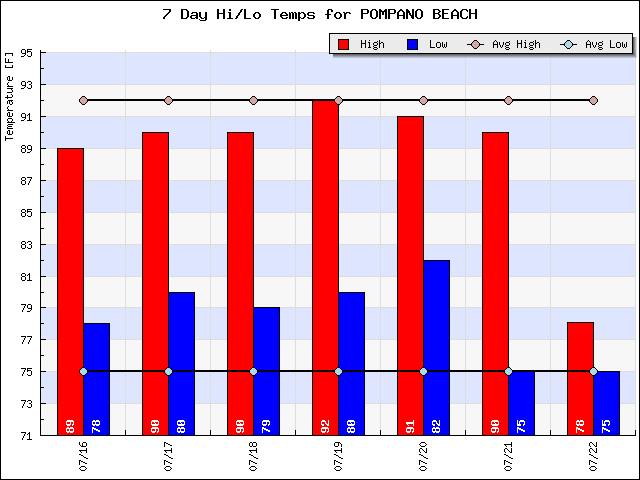
After some stronger storms on Friday we are starting the day at a nice, “cool” 75F without the offshore shower activity we have seen the last few mornings. Showers are expected by late morning/early afternoon though mostly focused on the interior and west coast. High today will be 90F. As mentioned last week, and the trend continued this week, our highs have been at or just below normal. The last two days have seen our lows near normal.
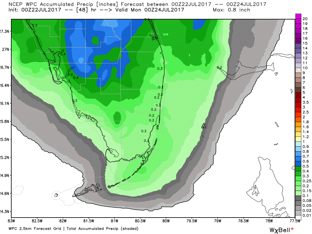
Though rain cannot be rules out today, Sunday should be drier overall and looking at the WPC rainfall forecast through tomorrow evening all areas will see under one inch of rain. Though is there are heavier showers or thunderstorms we could see some higher amounts.
Weather threats today from the latest HWO from Miami:
THUNDERSTORMS EXPECTED ACROSS SOUTH FLORIDA TODAY…
…POOR DRAINAGE FLOODING POSSIBLE WITH HEAVIER RAINFALL…
…WATERSPOUTS POSSIBLE OVER LOCAL WATERS..
Go out and enjoy the day, but remember if thunder roars – go indoors!

What about in the lion country safari area?
LikeLike
For LCS this afternoon we will see showers and thunderstorms in the area with a high of 93F. Showers will be slow moving so rainfall amounts could be close to one-half inch. Thunderstorms will likely have strong, gusty winds. When thunder roars, move indoors.
Thank you for reading and for your question.
LikeLike