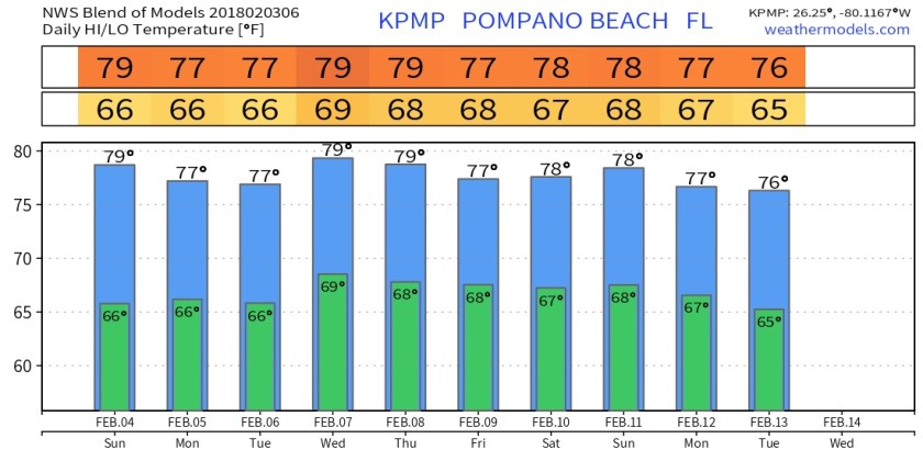
In Pompano we are at 58F this morning as we enjoy our second “cooler” morning. Though our temps are only slightly below normal with the warmer February we had I think all of our enjoying this change.
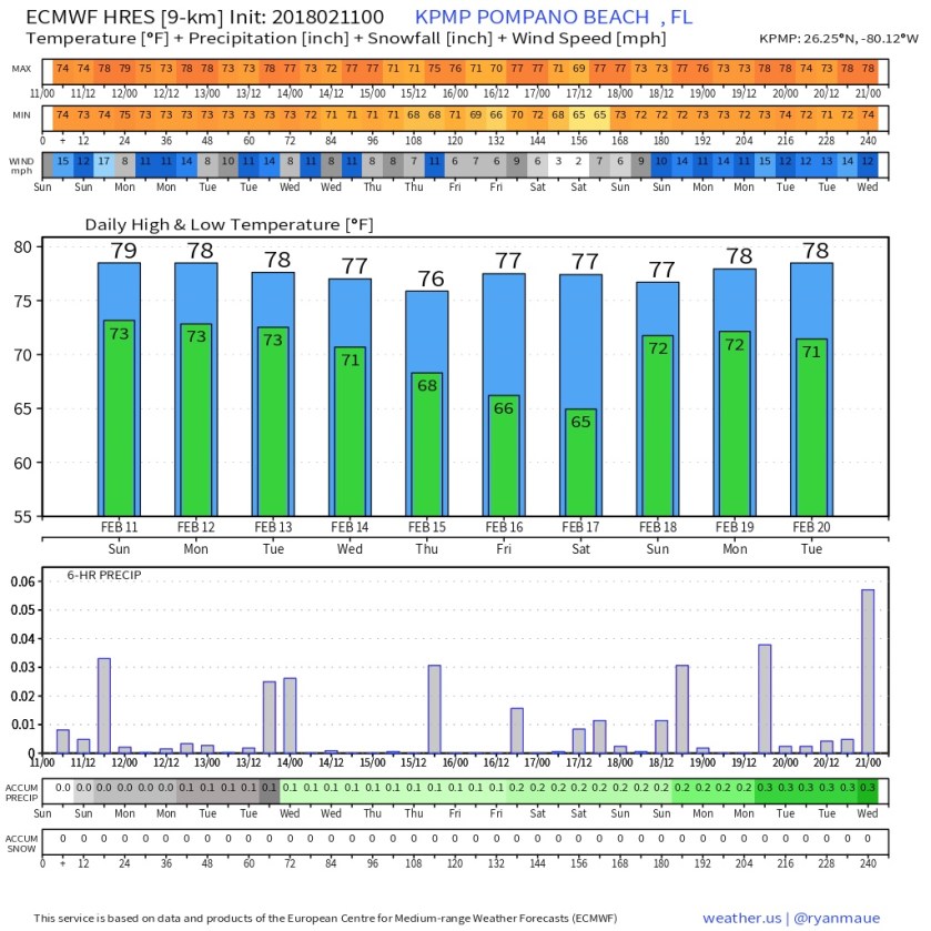
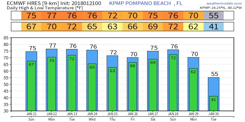
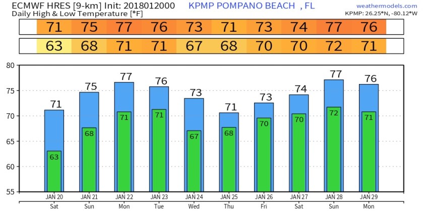
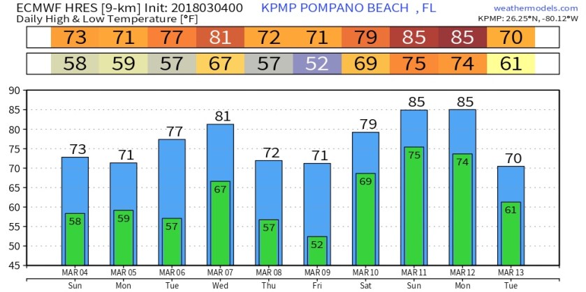
We will see a high of 77F today with mostly clear skies, no rain chances. Our next chance of rain does not come in until late Wednesday and into Thursday with the approach and passing of our next cold front. This will again dry out our air and bring us to near normal temps again late in the week and Saturday. This is the latest Euro showing our temperature roller coaster.
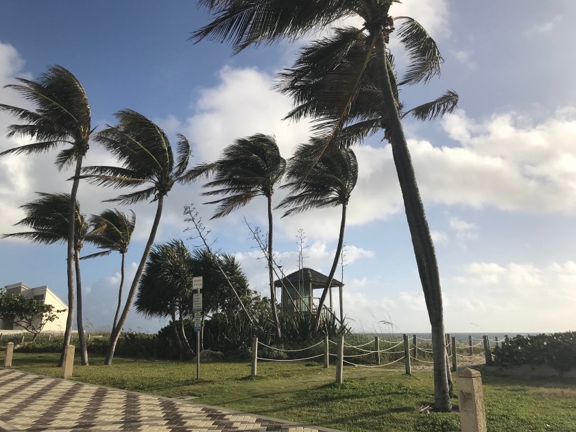
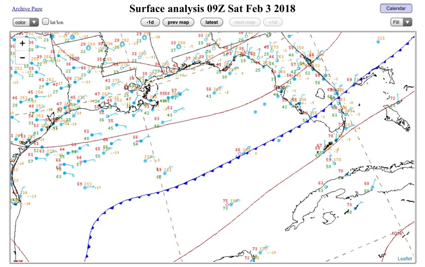
The only weather threat today will be surf conditions becoming very rough due to waves generated from the nor’easter that is now well offshore the NE coast.
Go out to the many festivals in the area (Renaissance Festival, St. Coleman’s Carnival) and enjoy our early Match weather.