
NWS has issued a Special Weather Statement for Coastal Broward County & Metro Broward County Counties until 01:00 PM
Author: Howard
Love talking about the weather, technology, and family (and not in that order).
Special Weather Statement
NWS has issued a Special Weather Statement for Metro Broward County & Metro Palm Beach County Counties until 09:15 AM
NYE 2016 – Warmer and Mostly Dry
As we end 2016 our cool spell will end as well. Starting the day with the coolest temps in about 10 months of 54F. We will warm up rather quickly with the 70s by about noon and topping off around 76F. Here are the highs from the latest HRRR:

Only the very slightest chance of a shower today and tonight. If you are out tonight we will run about 12-15 degrees warmer with our over night low being 68F.
Thank you for being one of my readers in 2016 and looking forward to more in 2017. Have a safe and happy New Year’s!
Special Weather Statement
NWS has issued a Special Weather Statement for Coastal Broward County, Coastal Palm Beach County, Metro Broward County & Metro Palm Beach County Counties until 07:45 AM
Wednesday – More Sun, Less Wind
We had a bit more rain than expected yesterday with some areas of Pompano getting over an inch of rain. Pompano Airport had .52 inches ending at 7pm yesterday.
Some fog this morning with visibility in Pompano currently at 7 miles with a temp of 68F. Less clouds, wind, and rain today with a high of 82F.
Still looking at cooler weather starting Friday. Current forecast has the cold front south of us as depictied by WPC for 7am Friday.
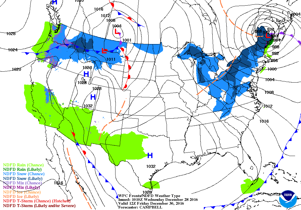
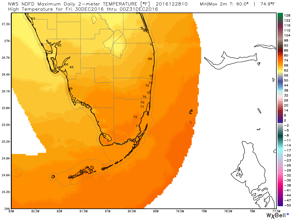
This will keep our highs on Friday much cooler than what we have. Current NWS forecast has our high at 70F and this might be too warm. The forecast is still evolving. Here are the highs per NWS:
Special Weather Statement
NWS has issued a Special Weather Statement for Coastal Broward County, Coastal Palm Beach County, Metro Broward County & Metro Palm Beach County Counties until 09:00 AM
Special Weather Statement
NWS has issued a Special Weather Statement for Coastal Broward County, Coastal Palm Beach County, Metro Broward County & Metro Palm Beach County Counties until 05:45 AM
Tuesday – Another Breezy, Nice Day with Cooler Weather on the Horizon
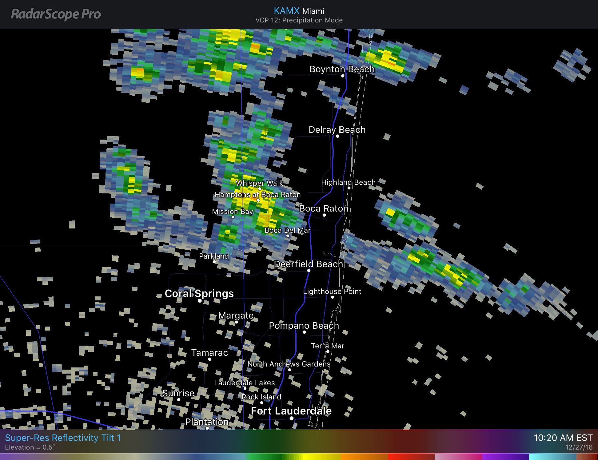
Our breezy, warm weather continues today with a few more showers possible today compared to the las few days. Current radar shows some activity west of Boca Raton and some scattered activit over the Atlantic waters moving towards the WNW.
For the remainder of the day we will see a high of 81F and for the most part précis totals under .1 inches. The latest HRRR for Pompano shows us peaking at 80F in the next couple of hours.
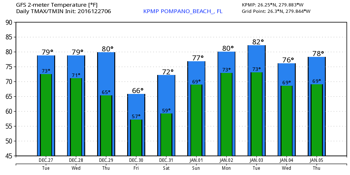
As mentioned yesterday, Friday we will get a shot of cooler weather that will not last long but will remind us it is winter. At this time I would not expect out high on Friday to break 70F. Here is the latest 10 day highs and lows per the GFS.

Do not let those showers out there keep you inside!
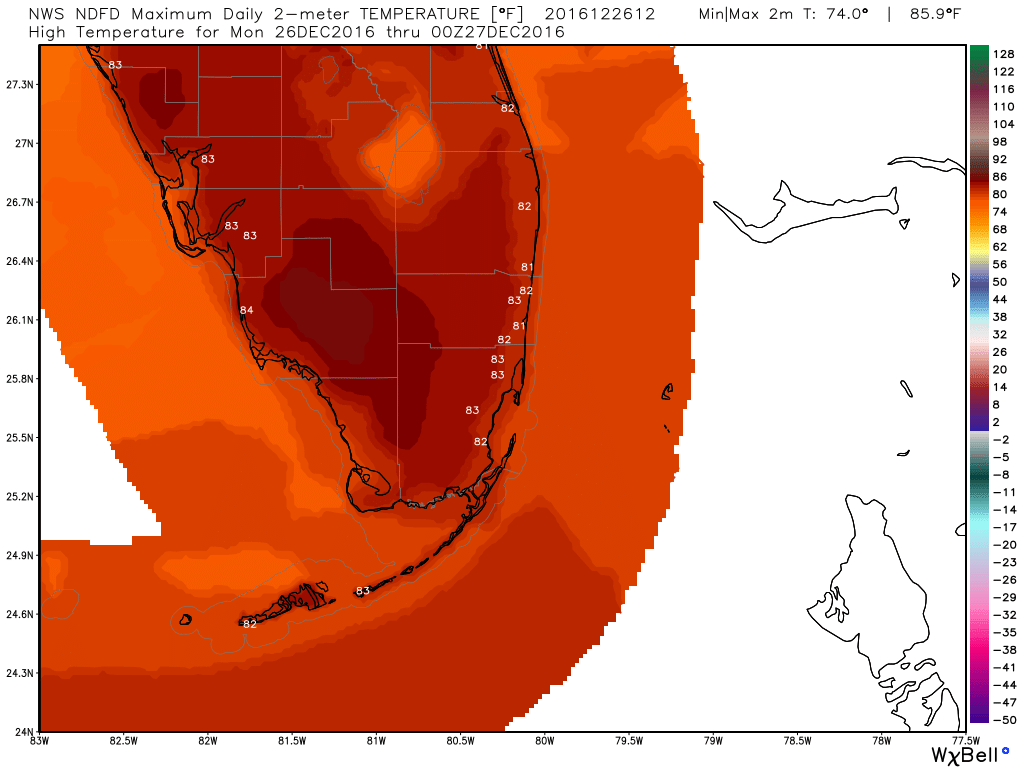
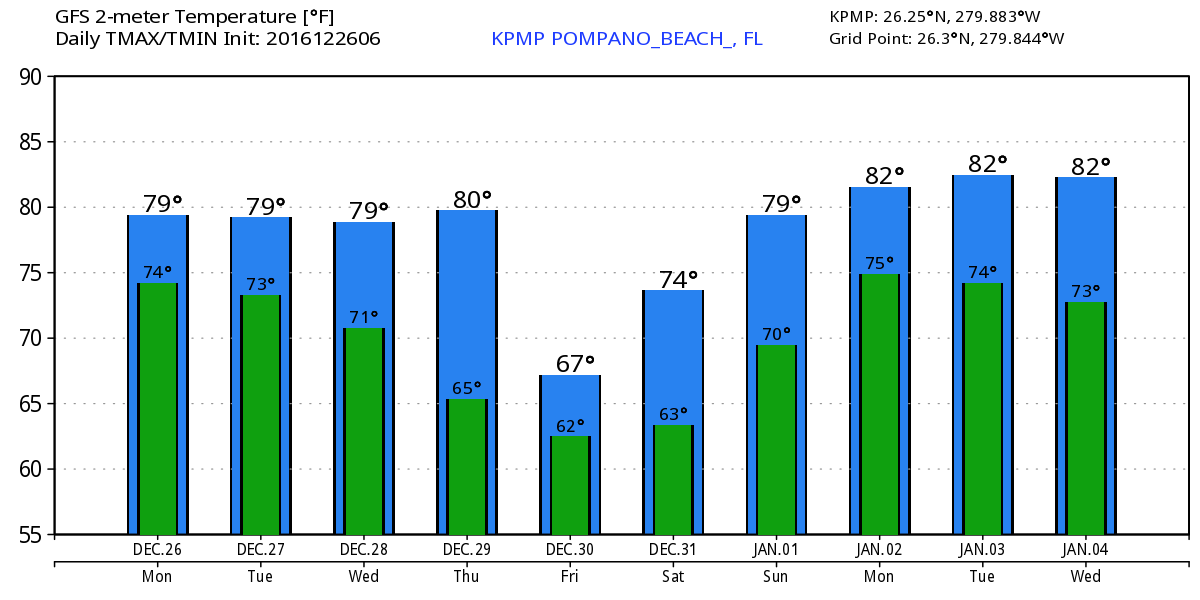
Monday – Continued Breezy and Warm
After a very warm Christmas Day our trend of above average temps will continue. We are at 77F this morning and will see a high of 82F. A possible shower with the strong breeze cannot be ruled out, but, as in recenent days will not be a long-lasting affair if you do see rain. Here are the NWS forecasted highs today.
Not much change to our weather until Friday where it looks like we may see some cooler weather to help end 2016. Latest GFS highs and lows for the week and into the weekend:
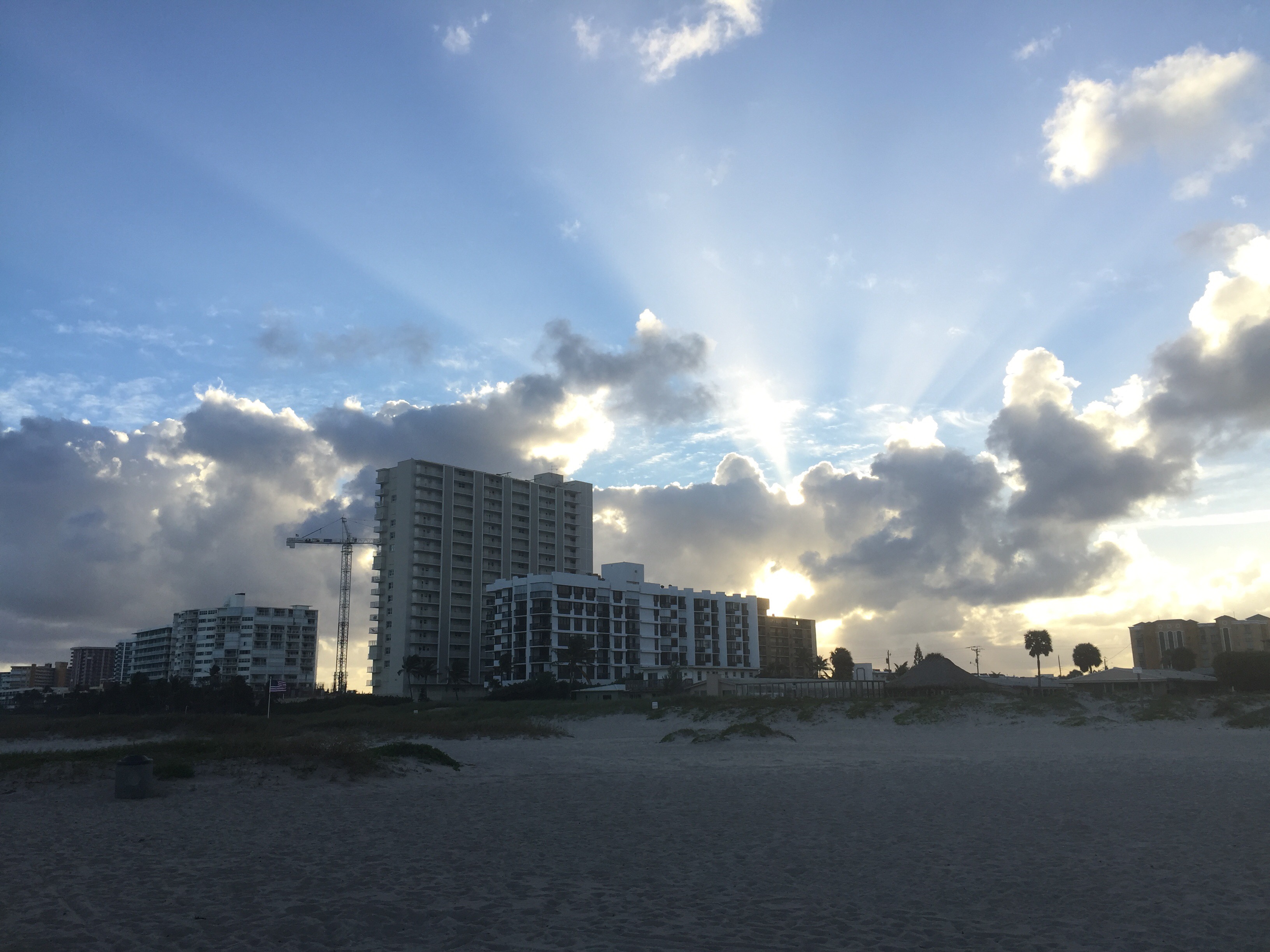
To finish off for now here is Pompano Beach from late yesterday afternoon. Have a great day!
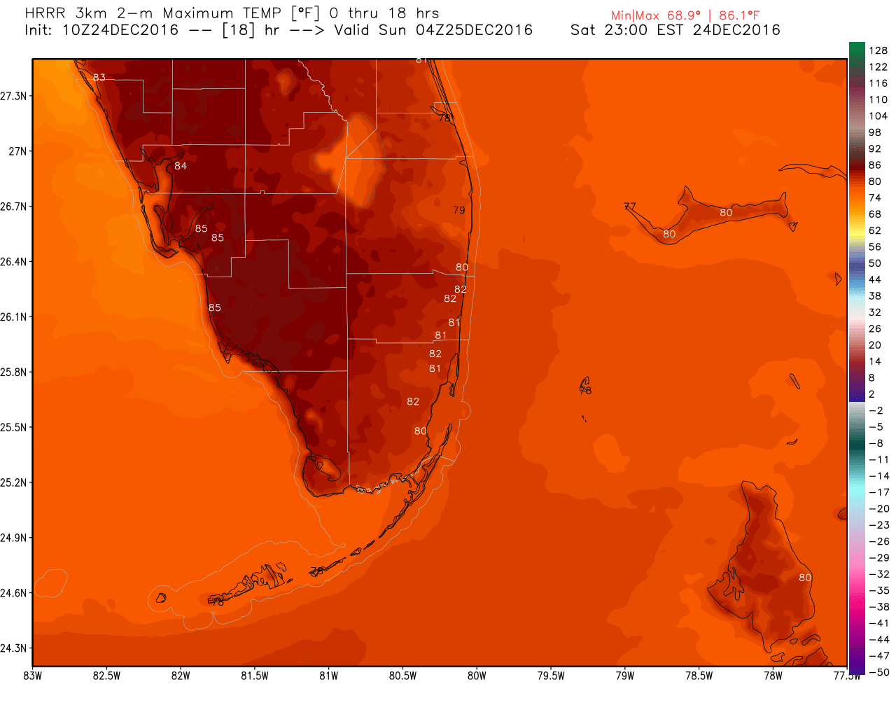
Christmas Weeeknd Will be Tropical
Starting our day at 76F with a few showers offshore moving towards the WNW off the ocean. This will continue through the day and not expecting anything prolonged or heavy.

This afternoon will be warm with a high of 83F. The latest HRRR highs are below.
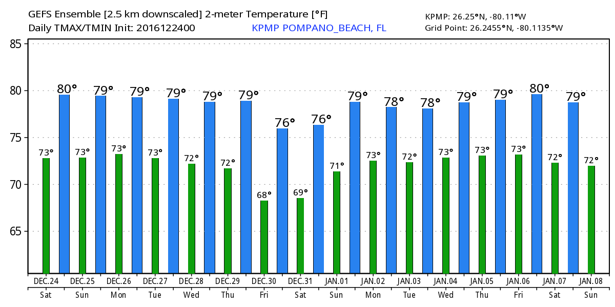
No real changes going into Christmas Day and our temps will continue warm through the coming week. Next weekend we could possibly have cooler weather but there is not real consensus on that yet. Here is the latest GEFS highs and lows for the next 16 days:
Santa forceat later today!
