
NWS has issued a Special Weather Statement for Coastal Palm Beach County & Metro Palm Beach County Counties until 06:30 PM
Category: Local Weather
Special Weather Statement
NWS has issued a Special Weather Statement for Metro Broward County & Metro Palm Beach County Counties until 11:45 AM
Climate Data from 5/28/17 – 100F High for FXE
Here are yesterday’s highs and this morning’s low for south Florida locations:
FLL : Fort Lauderdale Intl : 95 / 77 / 0.00
FXE : Fort Lauderdale Exec : 100 / 78 / 0.00
HST : Homestead AFB : 94 / 72 / 0.00
MIA : Miami : 98 / 78 / 0.00
APF : Naples : 88 / 75 / 0.00
OPF : Opa-locka : 97 / 77 / 0.00
HWO : Pembroke Pines : 97 / 76 / 0.00
PMP : Pompano Beach : 93 / M / 0.00
TMB : West Kendall-Tamiami : M / M / 0.00
PBI : West Palm Beach : 93 / 74 / 0.00
Special Weather Statement
NWS has issued a Special Weather Statement for Coastal Broward County & Metro Broward County Counties until 10:00 AM
5/29 – Memorial Day – Not as Hot, Afternoon Showers/T-storm Possible
Please take a moment to appreciate the freedom what we have and those who have given it to us.
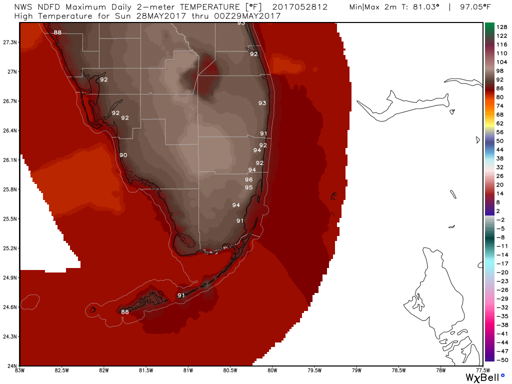
After a very hot day by south Florida standards we are sub-80 this morning at 78F. Miami set a monthly record high of 98F with most of the reporting sites in the mid 90s. I will post climate data from yesterday later.
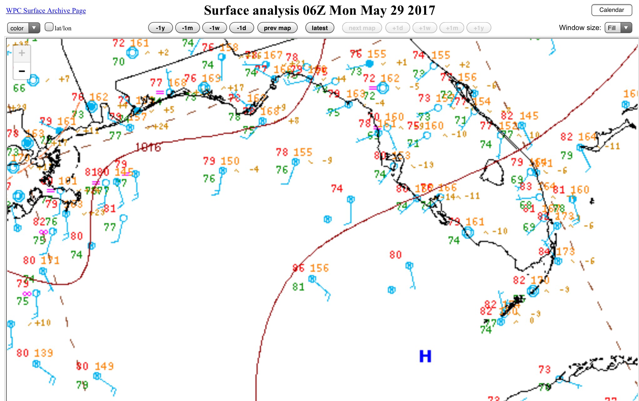
With high pressure to our southwest we should see the sea breeze push in earlier in the day keeping us at a high of 90F. This morning’s surface analysis looks like this as of 2am:
We could see some convention pop up this afternoon but at this point it is only worth mentioning and watch for, it will not be widespread if it develops.
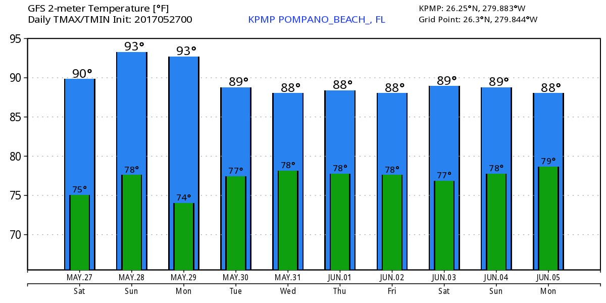
Latest GFS for high/lows do show our temps moderating into the work week.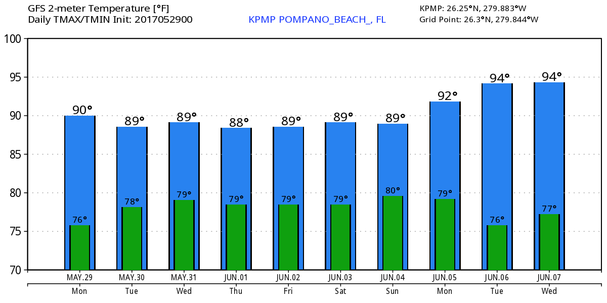
Enjoy your Day!
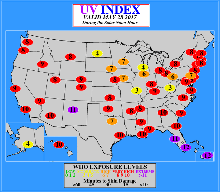
5/28 – Hot with Some Clouds, UV Index = 12
At 11am Pompano is already at 87F and climbing to a high of 92F. No weather concerns today but if you are going it be outside use plenty of sunscreen and drink water. We are in the extreme category for the UV index with a 12 today.
Here are the forecasted highs across south Florida:
With a light breeze today there are no rip current worries at the beaches.
Enjoy the day!
Special Weather Statement
NWS has issued a Special Weather Statement for Metro Broward County County until 09:15 AM
5/27 – Mostly Rain Free, Very Warm Holiday Weekend
We are at 79F this morning with almost calm winds across the area.

For today we will see a few clouds and an outside chance of a shower/Thunderstorm with a high of 89F. Tomorrow will be a touch warmer with a bit less moisture in the atmosphere so even less chance of a shower. Our humidity will be “low” and this will keep our heat indices on the double digits for the most part. Depending on tomorrow’s setup we could make a run for the 90s for highs Sunday and Monday. The GFS is showing this.
Enjoy the day!
Special Weather Statement
NWS has issued a Special Weather Statement for Coastal Broward County & Metro Broward County Counties until 03:15 PM
Special Weather Statement
NWS has issued a Special Weather Statement for Coastal Broward County, Coastal Palm Beach County, Metro Broward County & Metro Palm Beach County Counties until 02:30 PM
