
NWS has issued a Special Weather Statement for Coastal Palm Beach County & Metro Palm Beach County Counties until 09:30 AM
Category: Local Weather
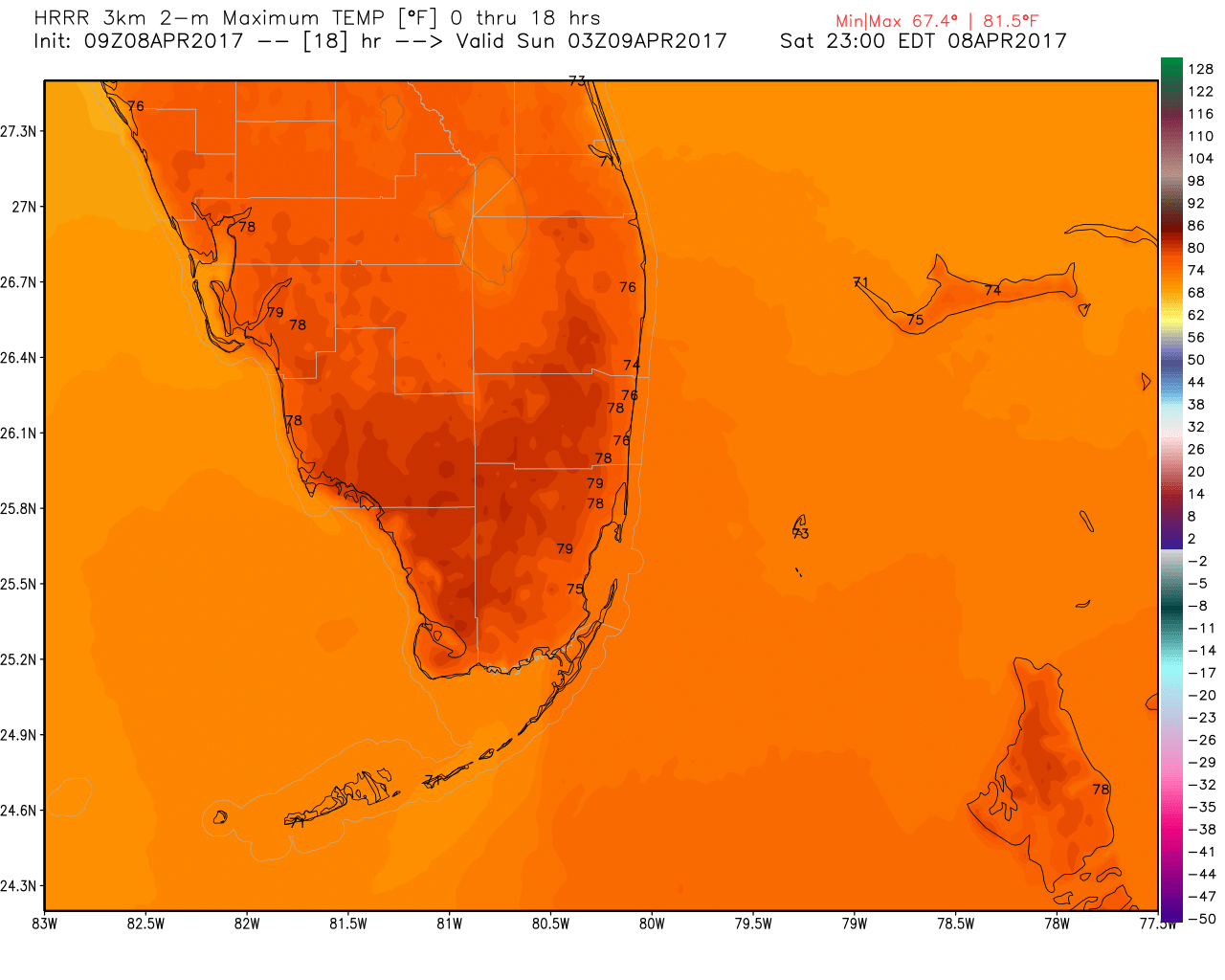
59F to Start this Saturday with, High of 76F
A very cool and comfortable start to this April morning. The mostly blue sky this morning will see a few clouds but no real weather hazards at all. There is a moderate chance of rip currents at the beaches and we could see some smoke blow in from the western Broward fire. High today will be 76F. Here are the area’s highs per the latest HRRR:
The last two mornings have been a beet cooler than normal after serveral days of above average temps. In the past seven days we have had a range of temps from 59F to 90F.

Enjoy the weather today and get outside.
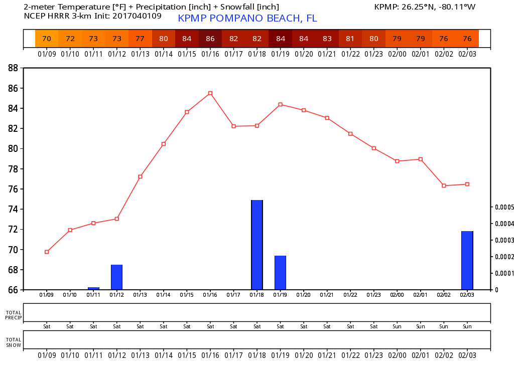
Saturday – A Few Clouds and Warm, High 85F
Not a reason not to get outside this weekend. Looking at a beautiful day with only the slightest of chances of rain along with a high of 85F. The latest HRRR shows a bit warmer:
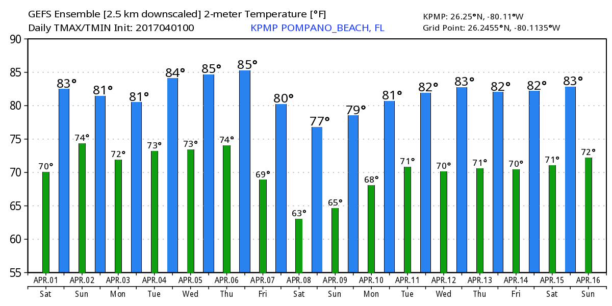
Not really seeing any impact weather heading our way at the moment. Temps will remain steady through the upcoming week but watching the trend of some “cooler” weather next weekend, but do not hold your breath yet. This is what the GEFS shows at the moment:
Get outside and enjoy!
Special Weather Statement
NWS has issued a Special Weather Statement for Metro Broward County & Metro Palm Beach County Counties until 07:00 PM
Special Weather Statement
NWS has issued a Special Weather Statement for Coastal Palm Beach County & Metro Palm Beach County Counties until 06:00 PM
Severe Weather Statement
NWS has issued a Severe Weather Statement for Broward & Palm Beach Counties until 04:21 PM
Severe Thunderstorm Warning
NWS has issued a Severe Thunderstorm Warning for Broward & Palm Beach Counties until 04:45 PM
Severe Thunderstorm Warning
NWS has issued a Severe Thunderstorm Warning for Palm Beach County until 04:15 PM
Special Weather Statement
NWS has issued a Special Weather Statement for Coastal Palm Beach County & Metro Palm Beach County Counties until 10:30 AM
Another Cool Start, Nice Day Ahead
We are at 59F this morning heading to a high of 75F with some clouds and more sun. There could be a very light coastal shower this morning but really not a concern.
We will have some drier air work it’s way into the area tonight which will keep the rain away tomorrow. A warmer day on Sunday will lead to a slight relapse of cooler weather Monday/Tuesday.
Looking beyond that gradual warming will start mid-week and about normal temps return for the balance of the work week.
Get out and enjoy the weather.

