
NWS has issued a Special Weather Statement for Coastal Palm Beach County & Metro Palm Beach County Counties until 01:00 AM
Category: Local Weather
Wind Advisory from Noon to 7pm, Possible Severe Weather Tonight
A tranquil Morning will yield to windy conditions this afternoon and leading up to some possible severe weather tonight.
We are warmer this morning compared to yesterday with 73F at Pompano at 7am. A “cold” front will sweep through the area during the overnight hours which will be preceded by a squall line. This line will have some strong to possible scattered severe weather between midnight and 5am for the Broward area.
Before the front gets here the winds will turn out of the southwest and become stronger as we go through the afternoon. Shower activity increase after sunset, but a shower this afternoon is not out of the question.
The NAM has a good depiction and timing of this activity, below is the simulated radar for 4am
Monday.

Keep your weather radio on tonight and check for updates as we go through this afternoon.
Nice Saturday, Stormy Late Sunday
Starting off with fog reducing visibilties and 64F in Pompano. Today we will have mostly sunny skies and a high of 83F with winds picking up later today.
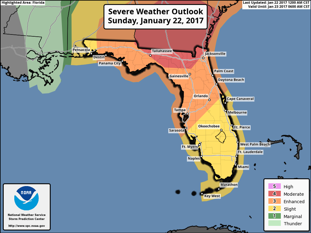
Tomorrow evening into the overnight hours we will see a squall line associated with a cold front sweep through the area. Thee is potential for gusty winds, small hail, lightning, and a possible tornado. I will have let on this later today. Currently the SPC has the entire south Florida area in a “slight” chance of severe weather.
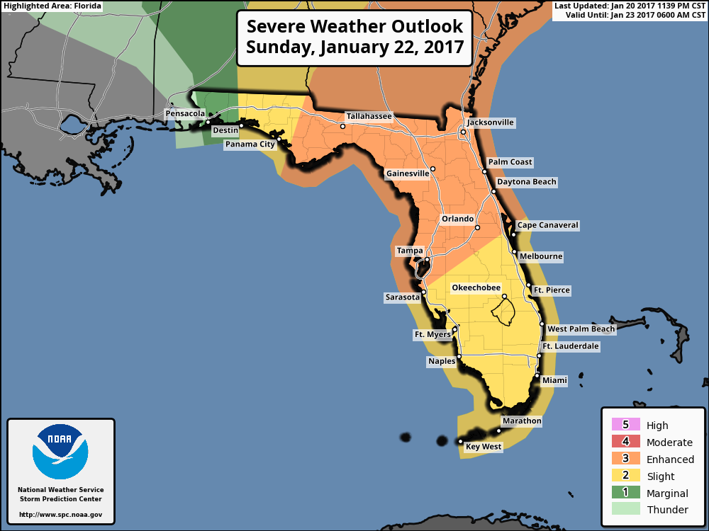 Get out and enjoy today and be weatherwise tomorrow ahead of the possible severe weather.
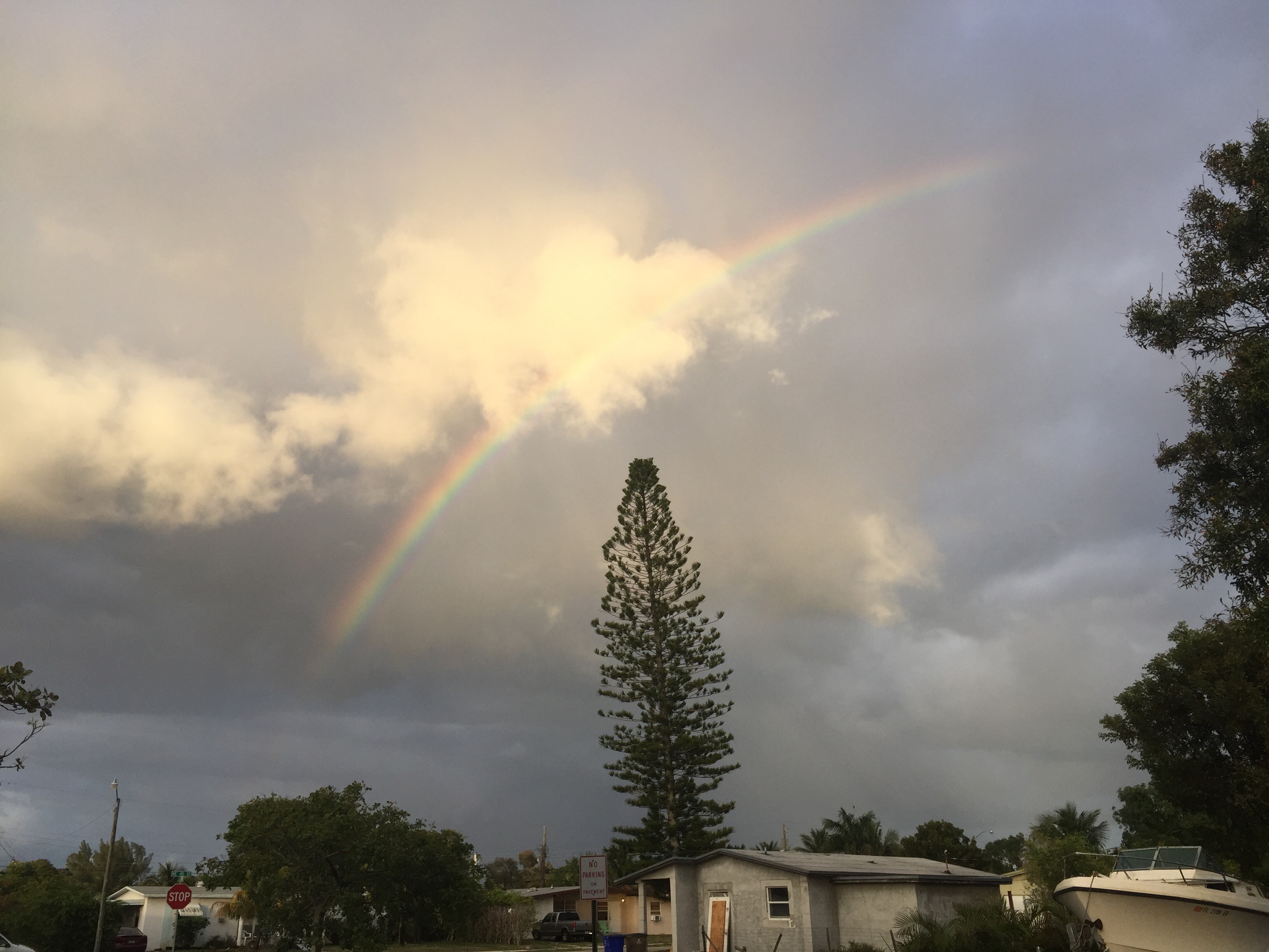
Rainbow Pictures from Deerfield Beach
A couple pictures of this afternoon’s rainbow from the passing showers as seen from Deerfield Beach, Florida on January 16, 2017.

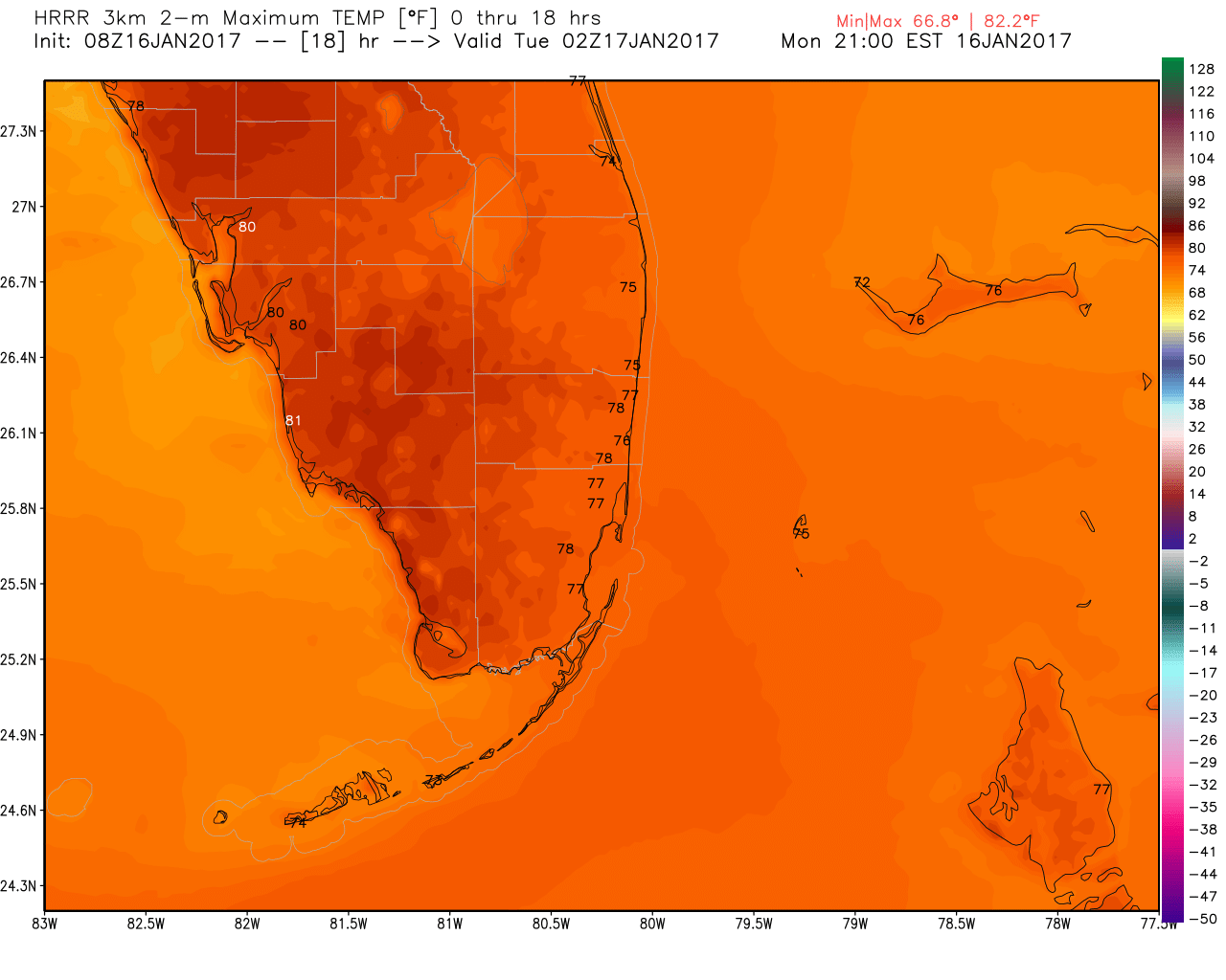
Monday Forecast – Mostly Nice, Shower Possible
Pompano is at 72F this MLK holiday morning with some showers now moving away towards the north that brought some light rain to the area.
Additional showers possible through the day but nothing that should interfere with today’s observances and parades as we head to a high of 78F. Here are the area’s highs today’s according to the latest HRRR.
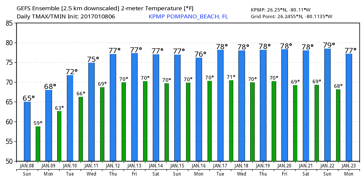
We are in a stagnet weather pattern with no real changes exepeced until late weekend or early next week. Highs and lows with the latest GEFS:
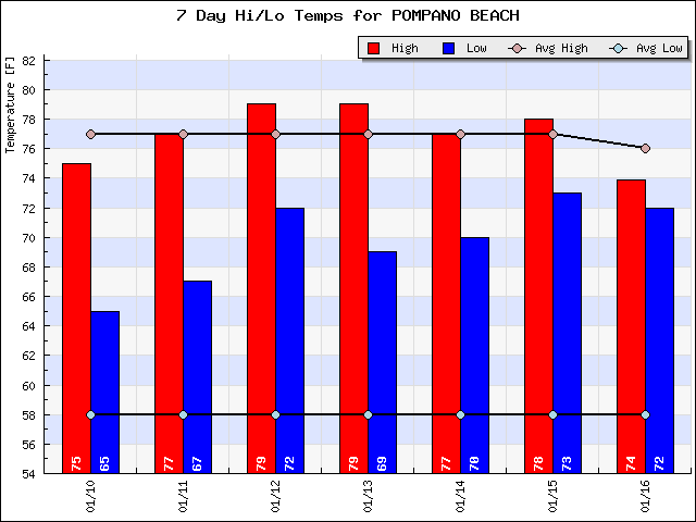
 Our lows are well above the normal of 59F and looking back this past week our highs have been slightly above normal.
Enjoy the day and do take some time to remember MLK and his contributions to our country.
Breezy, Cool Sunday
Cold front has passes and we have been left with clear skies and a Florida, winter breeze. Clouds will build this afternoon and even a chance of a passing shower but still a great outdoors day – with a jacket.
High today will be 67F and we will warm up as we go through this week leveling off about mid-week with no future cool downs in sight at this time as seen with the latest GEFS highs and lows.
Enjoy the Florida winter.
Special Weather Statement
NWS has issued a Special Weather Statement for Coastal Broward County, Coastal Palm Beach County, Metro Broward County & Metro Palm Beach County Counties until 02:30 PM
Special Weather Statement
NWS has issued a Special Weather Statement for Coastal Broward County, Coastal Palm Beach County, Metro Broward County & Metro Palm Beach County Counties until 01:00 PM
Severe Weather Statement
NWS has issued a Severe Weather Statement for Palm Beach County until 12:15 PM
Special Weather Statement
NWS has issued a Special Weather Statement for Coastal Broward County, Coastal Palm Beach County, Metro Broward County & Metro Palm Beach County Counties until 12:30 PM
