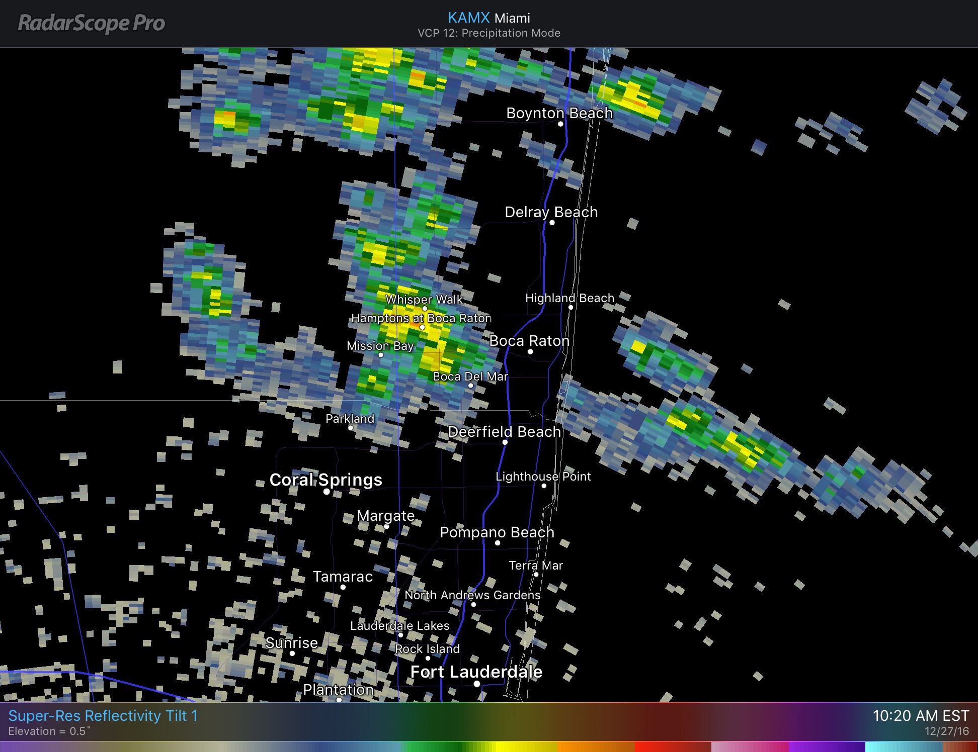
We had a bit more rain than expected yesterday with some areas of Pompano getting over an inch of rain. Pompano Airport had .52 inches ending at 7pm yesterday.
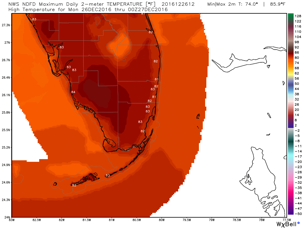
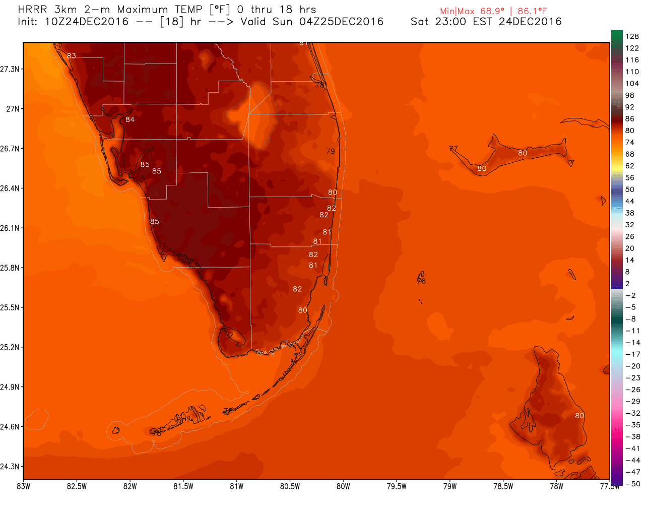
Some fog this morning with visibility in Pompano currently at 7 miles with a temp of 68F. Less clouds, wind, and rain today with a high of 82F.
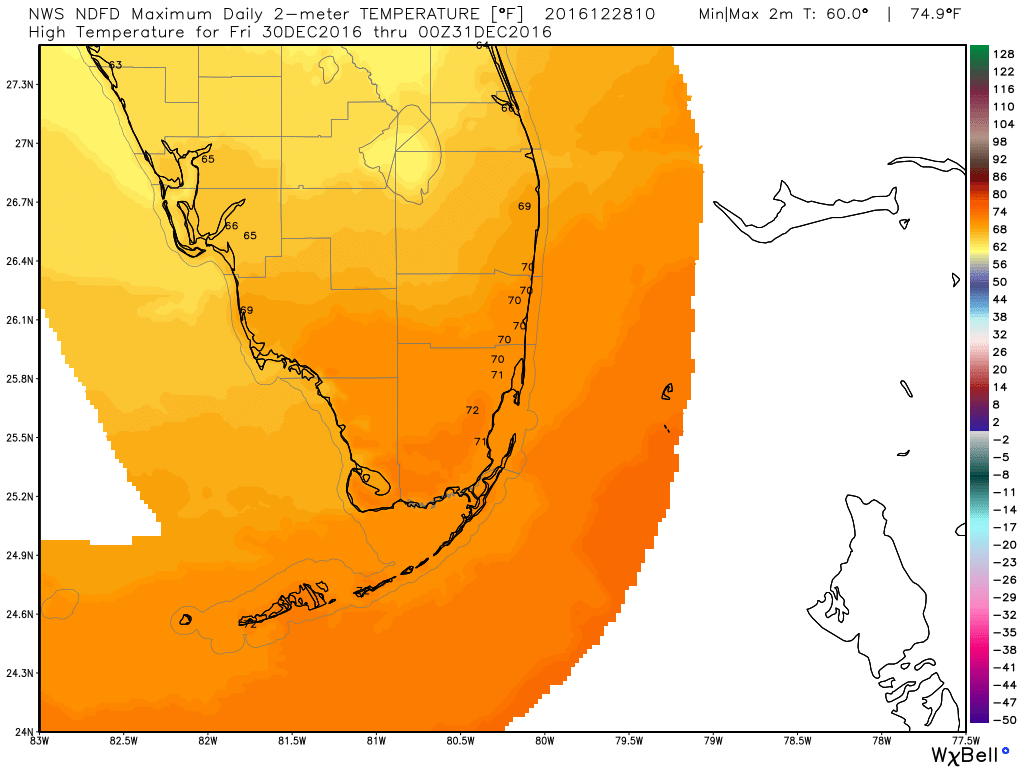
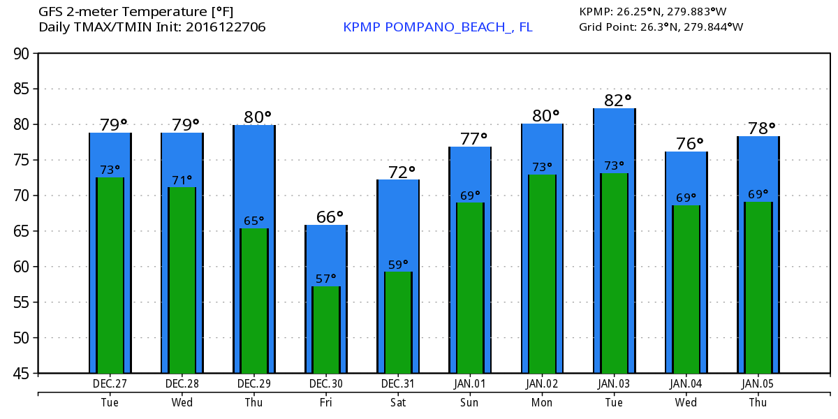
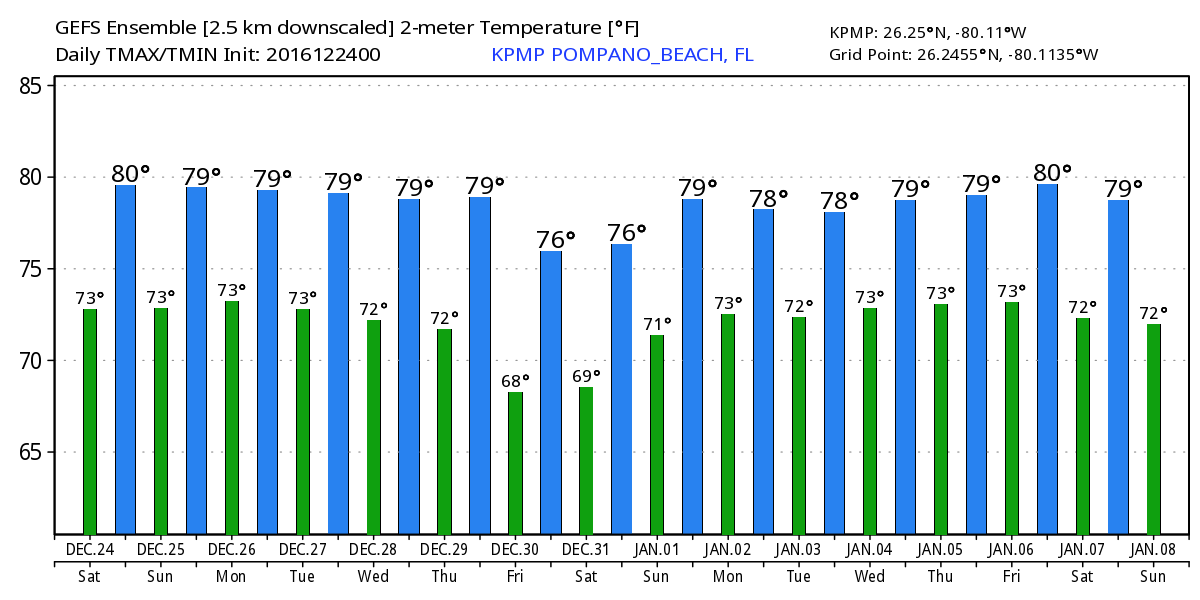
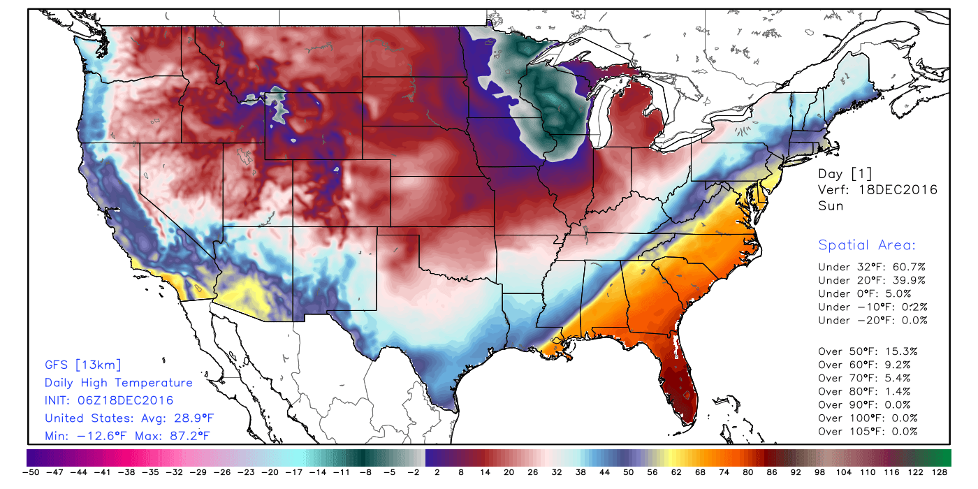
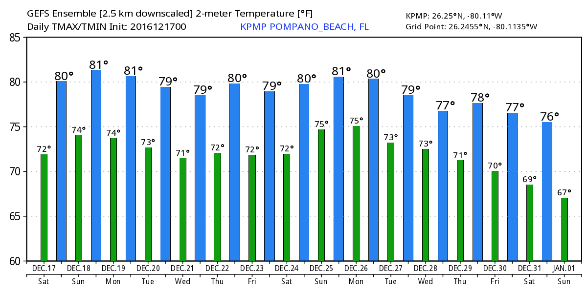
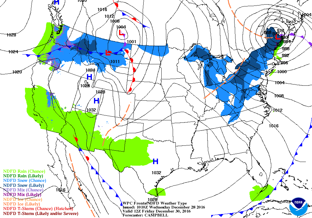
Still looking at cooler weather starting Friday. Current forecast has the cold front south of us as depictied by WPC for 7am Friday.
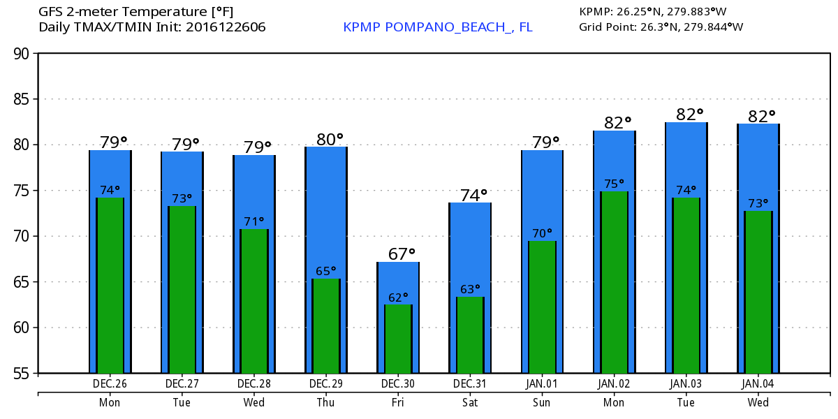
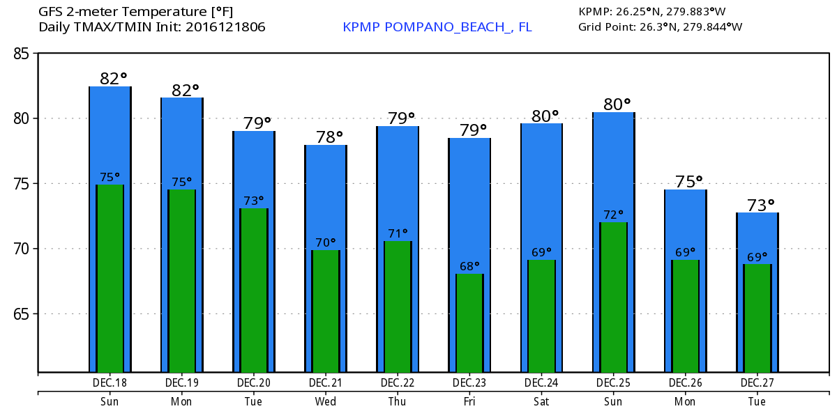
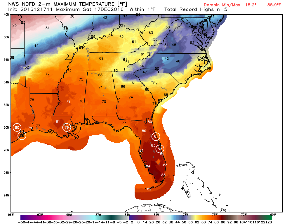
This will keep our highs on Friday much cooler than what we have. Current NWS forecast has our high at 70F and this might be too warm. The forecast is still evolving. Here are the highs per NWS: