Nice Weekend Weather Ahead, Updates on TS Julia and Karl

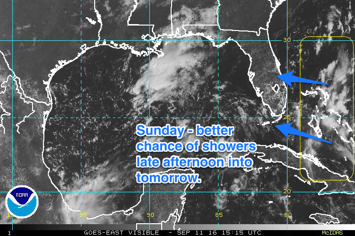
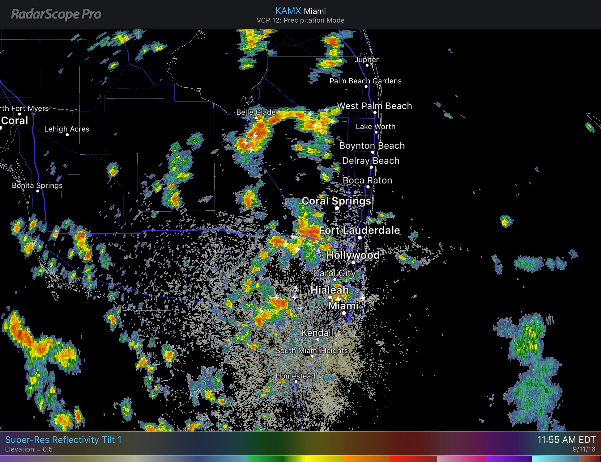
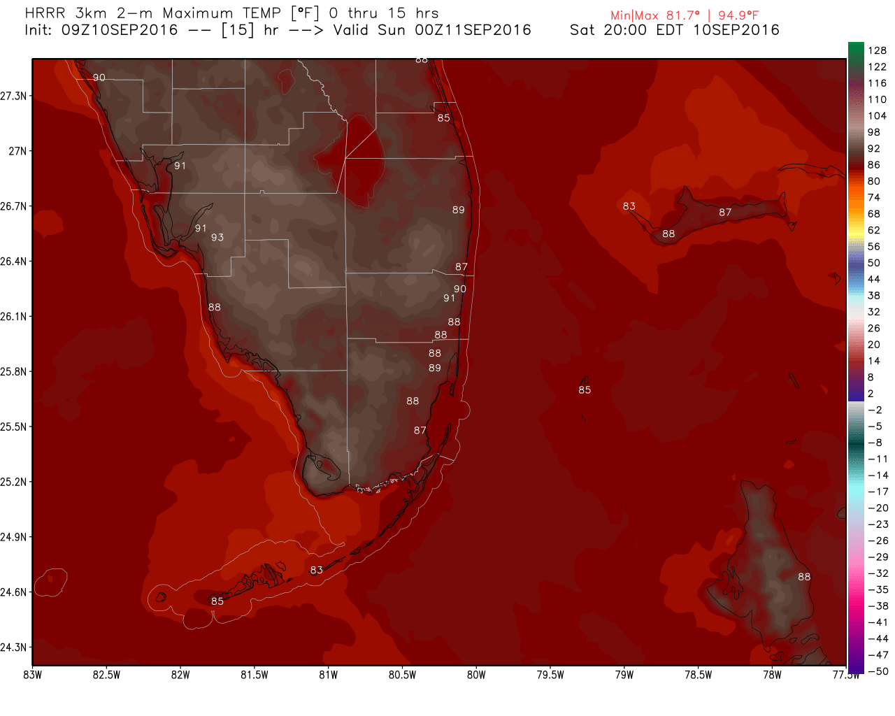
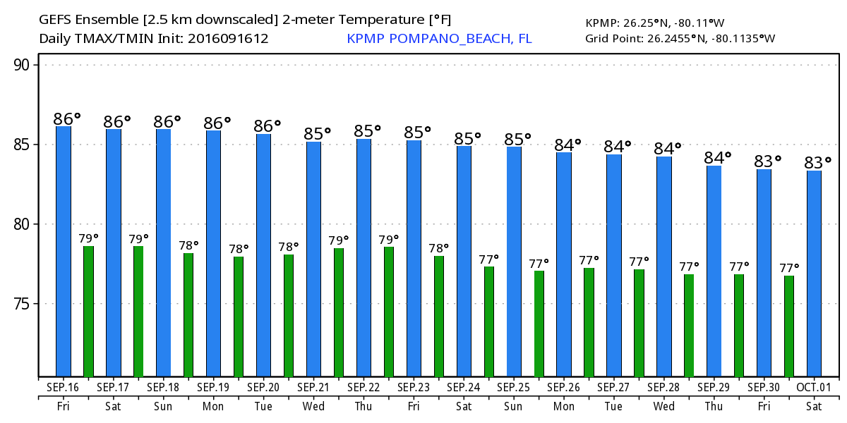
A fairly typical mid-September weather weekend ahead.  Mostly dry, but, cannot rule out a shower of thunderstorm with highs both days 88F.  Rain chances will ramp up early in the work week and the back to mostly dry mid-week.  Longer term not looking at and significant warmth or cooling over the next couple weeks.


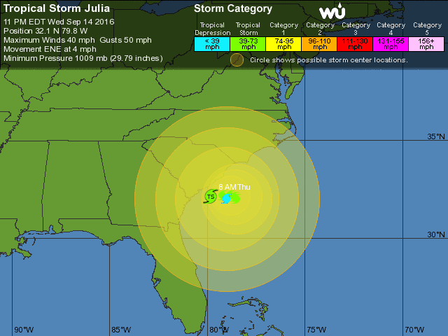
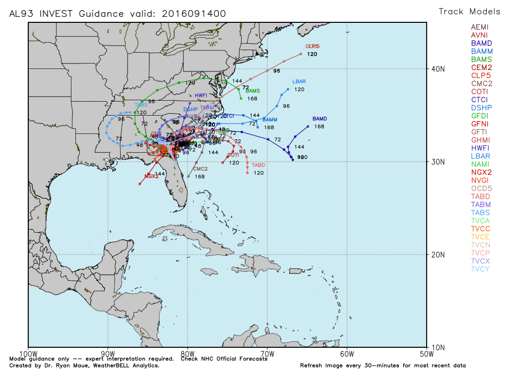
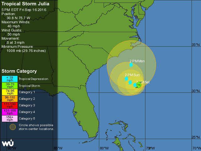
Tropical Storm Julia continues to meander off the SE US coast but towards late in the weekend we should see the storm moving away.  There are a couple models that want to bring the system back to the SW and over north Florida but I am not seeing that at this time.  Latest NHC forecast is here:


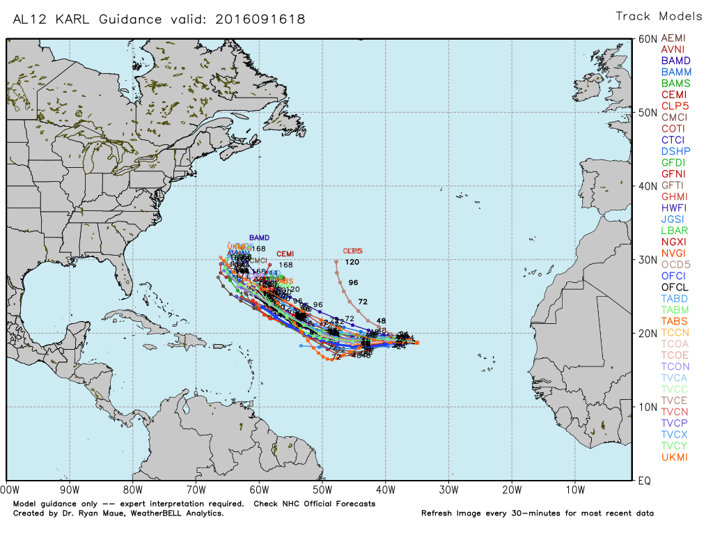
Finally, for now, Tropical Storm Karl is not under the best environmental conditions for strengthening but will be watched for the longer term.  Current model solutions are mostly in the school of calling this a “fish storm” and keeping it out to sea.  Too early to disregard it though.

Advertisement

Flood Statement

FLC011-086-152315-
/O.NEW.KMFL.FA.Y.0066.160915T2222Z-160915T2315Z/
/00000.N.ER.000000T0000Z.000000T0000Z.000000T0000Z.OO/
BROWARD FL-MIAMI-DADE FL-
622 PM EDT THU SEP 15 2016

THE NATIONAL WEATHER SERVICE IN MIAMI HAS ISSUED A

* URBAN AND SMALL STREAM FLOOD ADVISORY FOR…
SOUTHEASTERN BROWARD COUNTY IN SOUTHEASTERN FLORIDA…
NORTHEASTERN MIAMI-DADE COUNTY IN SOUTHEASTERN FLORIDA…

* UNTIL 715 PM EDT

* AT 621 PM EDT…DOPPLER RADAR INDICATED HEAVY RAIN DUE TO
THUNDERSTORMS. THIS WILL CAUSE URBAN AND SMALL STREAM FLOODING IN THE ADVISORY AREA. UP TO THREE INCHES OF RAIN HAVE ALREADY FALLEN IN THIS AREA AND AN ADDITIONAL 1 TO 2 INCHES ARE POSSIBLE.

* SOME LOCATIONS THAT WILL EXPERIENCE FLOODING INCLUDE…
MIRAMAR…MIAMI GARDENS…MIAMI LAKES…
MIRAMAR PARKWAY AND UNIVERSITY DRIVE AND COUNTRY CLUB.

PRECAUTIONARY/PREPAREDNESS ACTIONS…

EXCESSIVE RUNOFF FROM HEAVY RAINFALL WILL CAUSE FLOODING OF SMALL CREEKS AND STREAMS…URBAN AREAS…HIGHWAYS…STREETS AND
UNDERPASSES AS WELL AS OTHER DRAINAGE AREAS AND LOW LYING SPOTS.

&&

LAT…LON 2598 8024 2590 8028 2592 8033 2600 8030

$$

ALM

Tropical Wave Over Florida Could be Next Depression

NHC Has given a 70% chance of development for the system that is currently bringing rain across most of the state.  This syste will not impact SE Florida any more than it already has but could be a persistent rainmaker for much of the state through Saturday.


The system currently designated as 93L is tracking slowly towards the north.


Models are tightly clustered for the system, again the rain is likely across much of the SE US.

Sunday – Better chance of showers through mid-week

A weak tropical wave will increase moisture over our area bringing a better chance of showers over south Florida starting this afternoon.  Wave can been seen on visible satellite.


Latest radar shows the scattered showers over the peninsula now.


Latest weather hazards:

SCATTERED THUNDERSTORMS MAINLY INTERIOR AND GULF COAST…

…MODERATE RISK OF RIP CURRENTS ATLANTIC BEACHES…

We are nearing the high today of 88F at this noon hour in Pompano, currently 87F.

Nice, Warm Weekend Ahead – Showers Possible

Saturday should be warm as usual with a high of 90F.  Here are today’s highs per the latest HRRR:


There will be some showers this weekend and the latest rainfall amounts through Sunday evening:


Keeping an eye on the tropics, nothing immediately concerning but always need to be watched this time of the year.  Area to the south of Florida may develop as it moves into the western Gulf of Mexico.  The area to our east has a lot of shear to overcome before it can organize.


Enjoy the day!

Severe Weather Statement

FLC011-051805-
/O.CAN.KMFL.SV.W.0053.000000T0000Z-160905T1815Z/
BROWARD FL-
156 PM EDT MON SEP 5 2016

…THE SEVERE THUNDERSTORM WARNING FOR SOUTH CENTRAL BROWARD COUNTY IS CANCELLED…

THE STORM WHICH PROMPTED THE WARNING HAS WEAKENED BELOW SEVERE LIMITS…AND NO LONGER POSE AN IMMEDIATE THREAT TO LIFE OR PROPERTY. THEREFORE…THE WARNING HAS BEEN CANCELLED. HOWEVER GUSTY WINDS AND HEAVY RAIN ARE STILL POSSIBLE WITH THIS THUNDERSTORM.

LAT…LON 2596 8041 2596 8045 2606 8051 2611 8036
2603 8030
TIME…MOT…LOC 1754Z 055DEG 3KT 2603 8041

$$

ALM

Severe Weather Statement

FLC011-051815-
/O.CON.KMFL.SV.W.0053.000000T0000Z-160905T1815Z/
BROWARD FL-
143 PM EDT MON SEP 5 2016

…A SEVERE THUNDERSTORM WARNING REMAINS IN EFFECT UNTIL 215 PM EDT FOR SOUTH CENTRAL BROWARD COUNTY…

AT 143 PM EDT…A SEVERE THUNDERSTORM WAS LOCATED NEAR INTERSECTION I-75 AND GRIFFIN ROAD…OR NEAR PEMBROKE PINES…AND IS NEARLY STATIONARY.

HAZARD…60 MPH WIND GUSTS AND QUARTER SIZE HAIL.

SOURCE…RADAR INDICATED.

IMPACT…HAIL DAMAGE TO VEHICLES IS EXPECTED. EXPECT WIND DAMAGE TO ROOFS…SIDING…AND TREES.

LOCATIONS IMPACTED INCLUDE…
PEMBROKE PINES…MIRAMAR…DAVIE…SUNRISE AND WESTON.

PRECAUTIONARY/PREPAREDNESS ACTIONS…

FOR YOUR PROTECTION MOVE TO AN INTERIOR ROOM ON THE LOWEST FLOOR OF A BUILDING.

&&

LAT…LON 2596 8041 2596 8045 2606 8051 2611 8036
2603 8030
TIME…MOT…LOC 1743Z 055DEG 3KT 2604 8040

HAIL…1.00IN
WIND…60MPH

$$

ALM

Severe Thunderstorm Warning

THE NATIONAL WEATHER SERVICE IN MIAMI HAS ISSUED A

* SEVERE THUNDERSTORM WARNING FOR…
SOUTH CENTRAL BROWARD COUNTY IN SOUTHEASTERN FLORIDA…

* UNTIL 215 PM EDT

* AT 128 PM EDT…A SEVERE THUNDERSTORM WAS LOCATED OVER INTERSECTION I-75 AND GRIFFIN ROAD…OR NEAR PEMBROKE PINES…AND IS NEARLY STATIONARY.

HAZARD…60 MPH WIND GUSTS AND QUARTER SIZE HAIL.

SOURCE…RADAR INDICATED.

IMPACT…HAIL DAMAGE TO VEHICLES IS EXPECTED. EXPECT WIND DAMAGE TO ROOFS…SIDING…AND TREES.

* LOCATIONS IMPACTED INCLUDE…
PEMBROKE PINES…MIRAMAR…DAVIE…SUNRISE AND WESTON.

PRECAUTIONARY/PREPAREDNESS ACTIONS…

FOR YOUR PROTECTION MOVE TO AN INTERIOR ROOM ON THE LOWEST FLOOR OF A BUILDING.

&&

LAT…LON 2596 8041 2596 8045 2606 8051 2611 8036
2603 8030
TIME…MOT…LOC 1728Z 055DEG 3KT 2605 8039

HAIL…1.00IN
WIND…60MPH

$$

ALM

Special Weather Statement

FLZ071>073-051800-
INLAND MIAMI-DADE COUNTY FL-INLAND BROWARD COUNTY FL-
METRO BROWARD COUNTY FL-
116 PM EDT MON SEP 5 2016

…SIGNIFICANT WEATHER ADVISORY FOR 45 TO 55 MPH WINDS AND UP TO NICKEL SIZED HAIL FOR SOUTH CENTRAL BROWARD COUNTY UNTIL 200 PM EDT…

* AT 116 PM EDT…DOPPLER RADAR WAS TRACKING A STRONG THUNDERSTORM OVER BROADVIEW-POMPANO PARK…OR NEAR TAMARAC. THIS STORM WAS NEARLY STATIONARY.

* THE PRIMARY IMPACTS WILL BE UP TO NICKEL SIZED HAIL AND GUSTY WINDS OF 45 TO 55 MPH. THESE WINDS CAN DOWN SMALL TREE LIMBS AND
BRANCHES…AND BLOW AROUND UNSECURED SMALL OBJECTS. SEEK SHELTER IN A SAFE BUILDING UNTIL THE STORM PASSES.

* LOCATIONS IMPACTED INCLUDE…
PEMBROKE PINES…MIRAMAR…DAVIE…PLANTATION…SUNRISE…WESTON… COOPER CITY…SAWGRASS MILLS MALL…ROYAL PALM RANCHES…
INTERSECTION KROME AND U.S. 27…SUNSHINE ACRES…
INTERSECTION I-75 AND GRIFFIN ROAD AND MARKHAM PARK.

LAT…LON 2606 8051 2616 8031 2604 8027 2593 8044
TIME…MOT…LOC 1716Z 334DEG 1KT 2619 8022

$$

ALM