
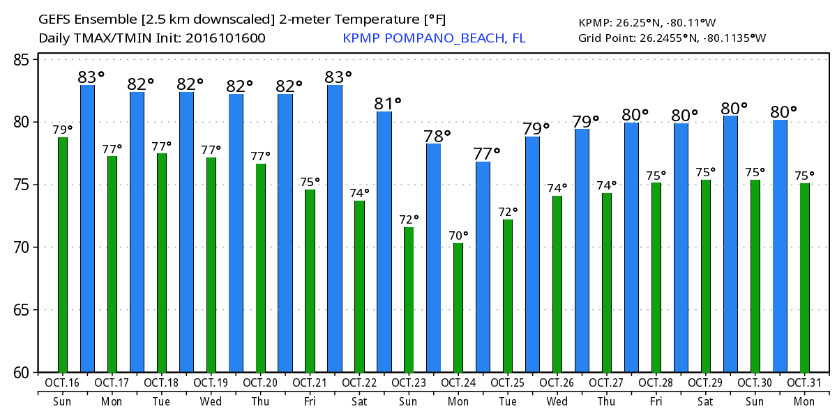
Similar to yesterday we will see some shower activity today with a slight chance of a thunderstorm with breezy conditions, high 86F. The cloud cover with the breeze we will have will make for a not too bad of a day to be outside, if you can miss the showers. Temperatures for the next week will continue mild with a chance of slightly cooler temps come next Sunday. Modeled highs and lows for the next 16 days show this:
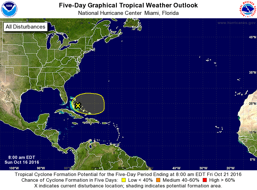
We have an area of disturbed weather over the Bahamas that is contributing to our slightly unsettled weather which the NHC is watching. Not likely anything will develop out of this but worth keeping an eye on.
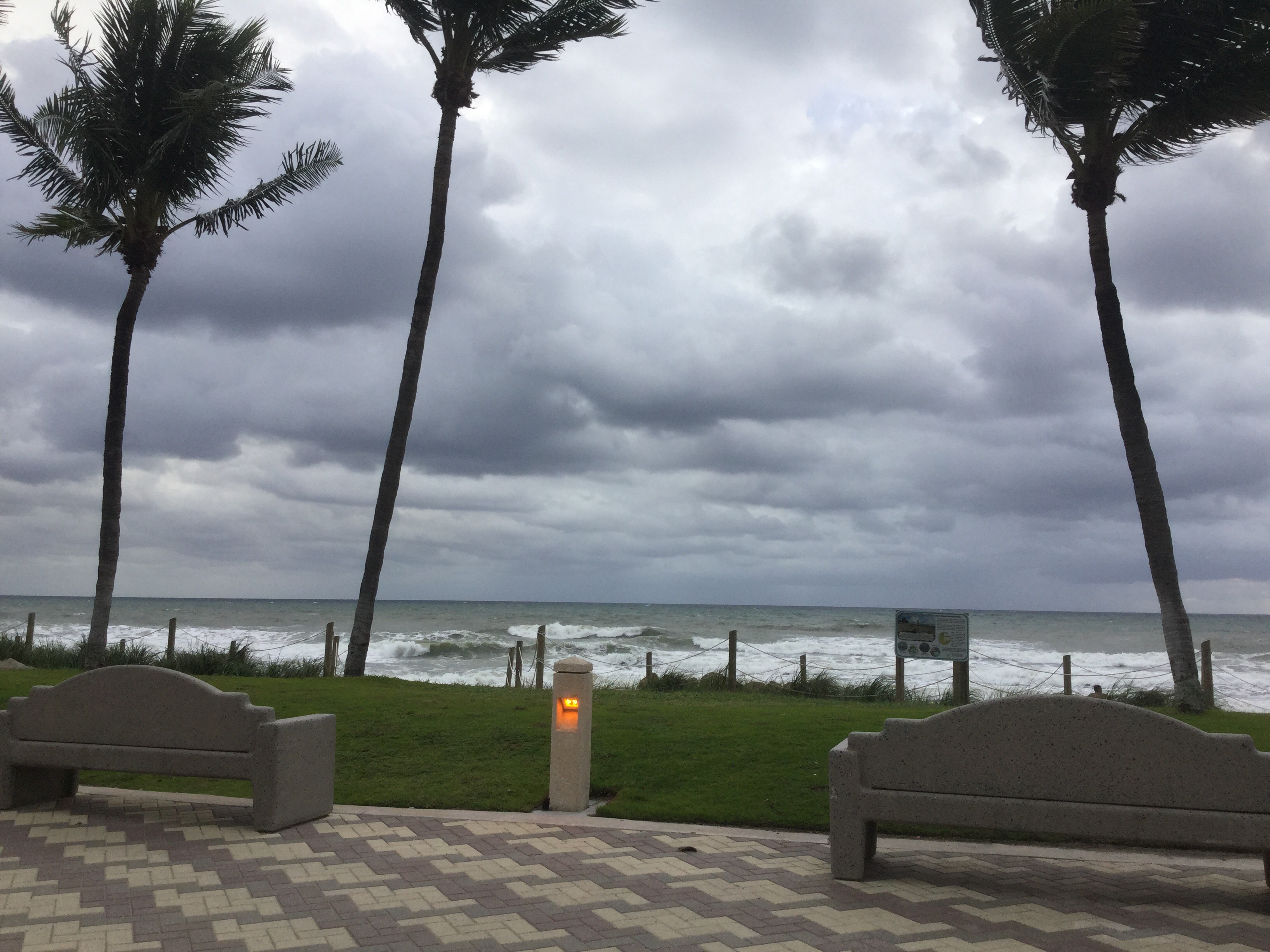
The weather hazards are a high risk of rip currents at the beaches and high astronomical tides due to the King Moon. You can see here it is not a day to be in the ocean.
That is it for now.
Discover more from Pompano Weather
Subscribe to get the latest posts sent to your email.
