
A cold front to our north pushing slowly down the state could trigger a shower or two today as we head to a high of 84F. Shower activity should be mostly along the coastal areas as seen in the precipitation forecast below.

There is a slight risk of waterspouts and rip currents today at the beaches.
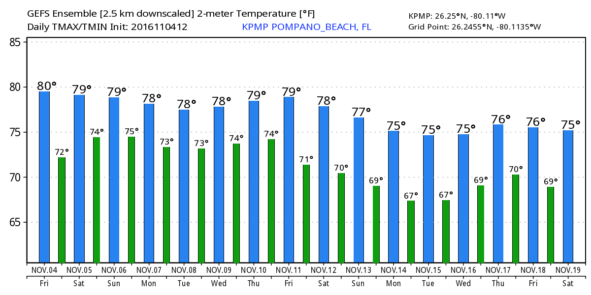
I do not see any notable weather for the next few days and we could see some cooler/colder weather as we get to mid month. Latest GEFS highs and lows:
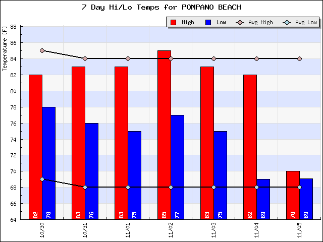
Looking at the past week our highs have been slightly below average and the lows above, but nothing significant.
Discover more from Pompano Weather
Subscribe to get the latest posts sent to your email.
