
Not departing from the pattern of the past week, we will see a slight chance of a shower but otherwise highs will be near normal, 90F, and lows above average 83F. If we see a decent shower or thunderstorm our low will like be sub-80F. Below you will see today’s forecasted highs from the NWS.

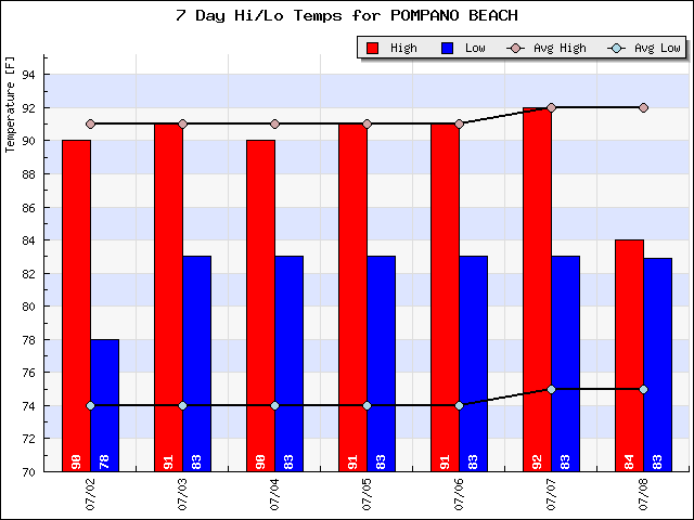
I did have a couple people ask this past week if we have been hotter than usual. Our highs have not been but out lows are above average as mentioned above. In fact, this past week Pompano has not been under 80F. This can be seen in the graph below showing our highs around 90F and lows above 80F, just like the forecast.
Later this coming work week we should see a change in the pattern as the remnants of TD4 moves in our general direction increasing moisture and shower activity.
Enjoy the day and I will have an update tomorrow.
Discover more from Pompano Weather
Subscribe to get the latest posts sent to your email.
