
Some of the coldest weather we have had in a couple years arrives today. Currently we are at 77F with a cold front now approaching the west coast of south Florida.
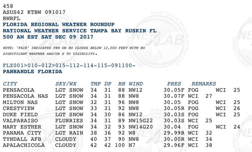
This front is currently producing snow in the panhandle area of the state. Here are the observations from the area.
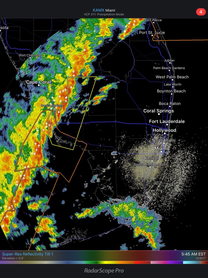
The front comes through the area today with rain and a few thunderstorms possible. Rainfall amounts are expected to be about a about a half-inch. Currently a Severe Thunderstorm Warning is in effect for the Naples area. The latest HRRR shows the peak rain around noon today with clearing by mid-afternoon. Temps drop quickly with the arrival of rain.
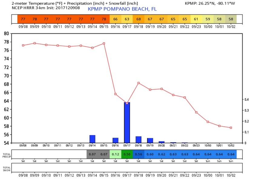
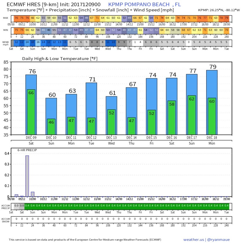
Once we dip below 70F today we will not see it again until possibly Tuesday before the next front comes through to reinforce this cooler weather. Sunday morning lows will be in the 40s throughout the area, latest NWS forecast shows this.

The latest Euro shows a cool/cold, dry week ahead with no rain after today.
Enjoy your day, find your jacket and I will have an update by tomorrow morning.
Discover more from Pompano Weather
Subscribe to get the latest posts sent to your email.
