
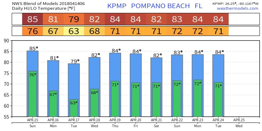
Winds are starting to veer from the southeast late this morning which will limit rainfall potential to near zero along the coast and a few showers inland. High today will be 87F.
This is ahead of a frontal system that will sweep the area the later part of tomorrow afternoon to the evening hours. There will be a squall line associated with this system which will bring the risk of gusty winds, brief heavy rainfall, and possible hail. Also cannot rule out a possible tornado at this time (remember this past Tuesday). The latest outlook keeps us in a Marginal risk.
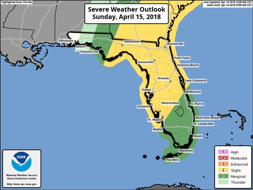
I will update this risk later tonight and into tomorrow.
Temps into next week will start off cooler than average with the passing of the front with lows around 60F for Tuesday morning. As we go into next week temps will climb back into the average/slightly above average area.
Follow the Twitter feed for quick updates and more here later for Sunday’s severe weather threat.
Discover more from Pompano Weather
Subscribe to get the latest posts sent to your email.
