
Rain has been the dominant weather of the day, granted it did not really kick in until later morning. Hope all of the mothers are enjoying the day and thank you for all you do!
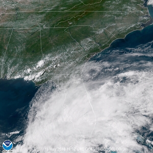
Current radar and satellite depict the abundant shower activity and cloud cover over the southern end of the peninsula. Some of this activity could produce lightning, gusty winds to 45mph, and funnel clouds are possible. Some of the heavier showers could cause localized, minor flooding.

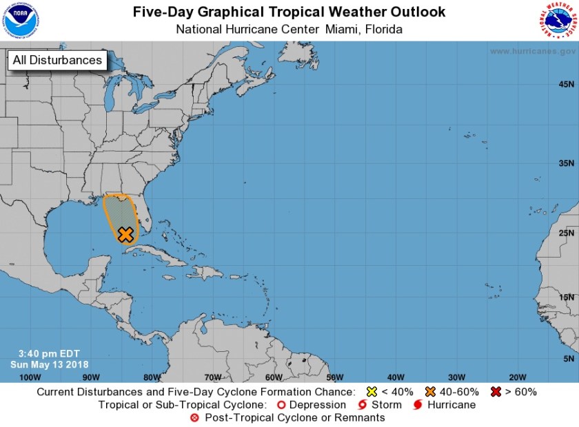
And just a short while ago the National Hurricane Center (NHC) issued a Special Tropical Weather Outlook regarding this system. Regardless of development our main concern will be some heavier showers for the next couple days.
Special Tropical Weather Outlook
NWS National Hurricane Center Miami FL
340 PM EDT Sun May 13 2018
For the North Atlantic…Caribbean Sea and the Gulf of Mexico:
A large area of cloudiness, showers, and thunderstorms extending
from western Cuba across the southeastern Gulf of Mexico, the
Florida Straits, and much of the Florida Peninsula is associated
with a broad surface low and trough interacting with an upper-level
low. This system could acquire some subtropical or tropical
characteristics while it moves slowly northward across the eastern
Gulf of Mexico during the next few days. Regardless of subtropical
or tropical cyclone formation, this system will enhance rainfall
across portions of Florida and the northeastern Gulf Coast during
the next few days. For more information on this system, please see
products issued by your local weather office. The next Special
Tropical Weather Outlook on this system will be issued by 11 AM EDT
Monday.
* Formation chance through 48 hours…low…30 percent.
* Formation chance through 5 days…medium…40 percent.
Enjoy the rest of your day!
Discover more from Pompano Weather
Subscribe to get the latest posts sent to your email.
