
Well, this is how we will start off the 2018 Hurricane Season. To be clear, this is not an Irma situation and will not see the widespread wind damage we had in September. At the same time we do need to be ready as we head into this season.
Wet weekend, yes. As wet as last weekend, probably not. But the potential is there for Flash Flooding and a Flood Watch will be in effect starting at 8am on Saturday. Current official NWS rainfall forecast through Monday at 8pm look like this.

Latest GFS and Euro do come in at 1.7 and 3.0 inches respectfully for the time frame. Today’s rain fall in the Pompano area amounted to between a half-inch to just under an inch.
In addition to the rain our weather threats this weekend include a moderate to high risk of rip currents and the potential for some strong to sever storms Saturday night into Sunday morning. I will wait until tomorrow to expand on this.
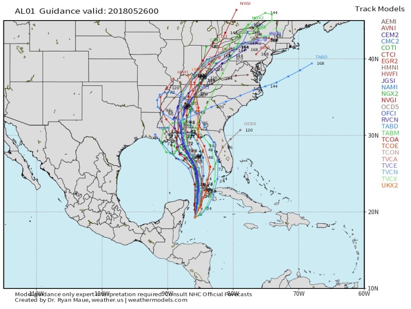
Model agreement is very good with the future track of Alberto taking the system into the north, central Gulf coast. No need to focus on the center of this storm, we are on the west side which is the wet, stormier side of tropical systems. Latest runs look like this.
To summarize, no need to panic but use caution if you are out and about this weekend and remember “turn around, don’t drown.” For your safety and your vehicle’s well being if you cannot determine how deep puddles are DO NOT drive through it.
Have a great night and watch for an update tomorrow.
Discover more from Pompano Weather
Subscribe to get the latest posts sent to your email.
