
The cold front mentioned yesterday will progress across the state today brining a chance of severe storms this afternoon to the area. Weather hazards today are:
HIGH RISK OF RIP CURRENTS ATLANTIC BEACHES…
…ISOLATED STRONG TO SEVERE STORMS POSSIBLE TODAY…
…ISOLATED WEAK TORNADOES POSSIBLE TODAY…
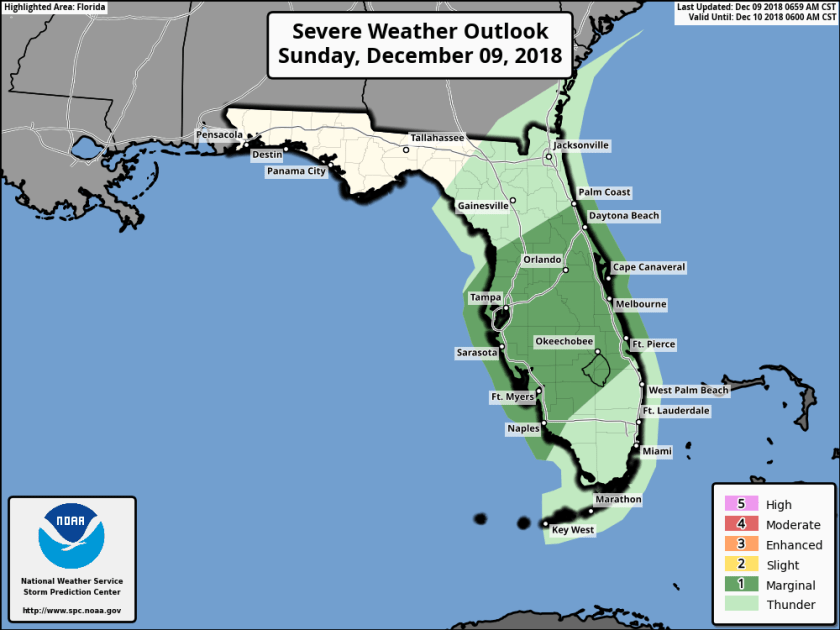
Current severe threat categories for Florida
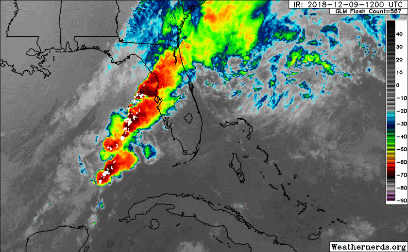
Current satellites image shows the front clearly over northern Florida
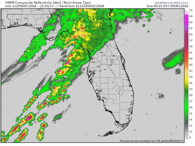
Looking at the latest HRRR you can see the cold front move through as we progress through the day.
Showers are possible anytime today but the focus and the more likely time for any of the strong to severe storms will be between 4pm and 7pm in the SE Florida area.
Rainfall amounts are not likely to be high with most areas not exceeding .15 inches around Pompano.
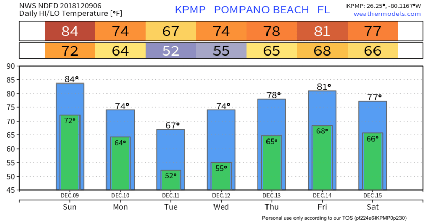
Will be cooler tonight but our coldest morning will be Tuesday and Wednesday so have the jacket ready. NWS highs and lows for the next week:
Discover more from Pompano Weather
Subscribe to get the latest posts sent to your email.
