
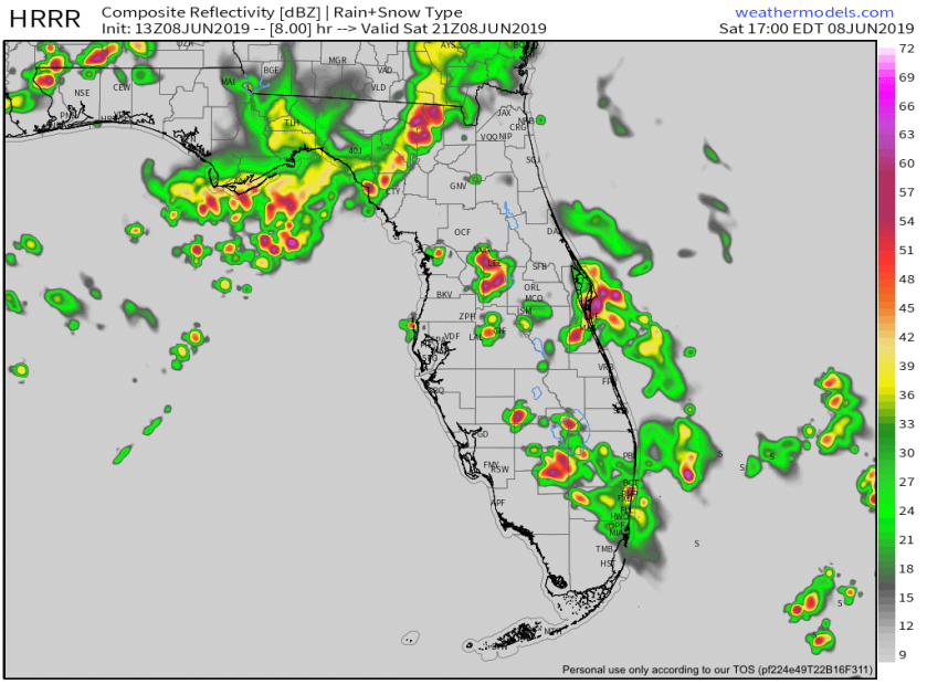
Like yesterday we will be warm and should see widespread shower activity as we get into the mid afternoon. Today we could get up to 93° before the showers and thunderstorms set in. Best time for the rain will be between 3pm and 7pm. Predictive radar for 5pm shows plenty of rain around the SE part of the state.
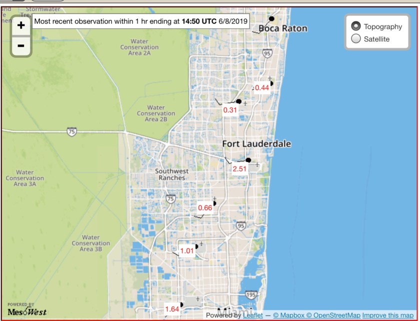
Rainfall forecast today appear we will see around an inch all along the coastal areas.

The heavier amounts will be be spotty, again like yesterday, where Pompano Airport (PMP) had .44 inches versus 2.51 at Ft. Lauderdale International Airport (FLL).
Weather threats today will be possible lightning, heat indices between 105° and 108°, wind gusts to 45mph in the stronger storms today. In additional to drinking plenty of water be ready to take shelter if you hear thunder.
Tomorrow looks to be about the same as we start to clear up Monday and beyond. By then the upper level low that is causing our unsettled weather will be away from the area.
Enjoy the day and try to stay dry.
Discover more from Pompano Weather
Subscribe to get the latest posts sent to your email.
