
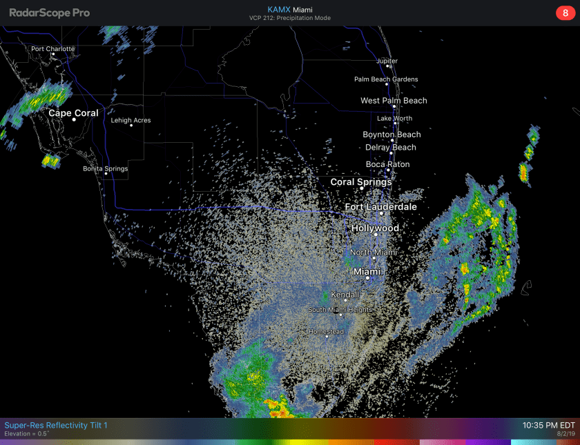
Similar to last evening the widespread rains that have been advertised have diminished during the night time hours. Currently the radar is fairly quiet over land.
As we go into tomorrow and again Sunday activity could flare up and local street flooding is possible in areas where the showers focus on. Latest rain total forecast for the area show one to two inches for the weekend.

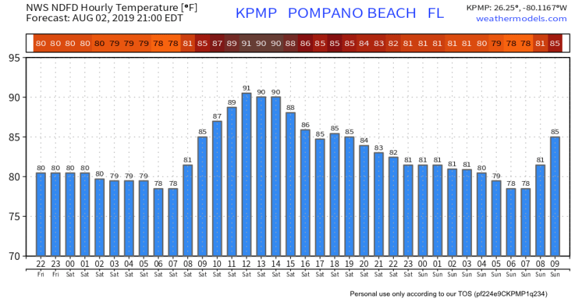
Since the rain and cloud cover will not be constant temperatures will still reach or go above 90° on Saturday. Here is the forecasted temps for the next 36 hours.
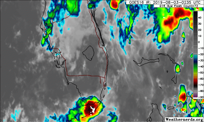
Again, rain will not be an all day/all night event but some areas could see much more than others. Satellite shows that the activity is not concentrated but rather scattered with areas of heavy rain over east=central Florida and around the Keys.
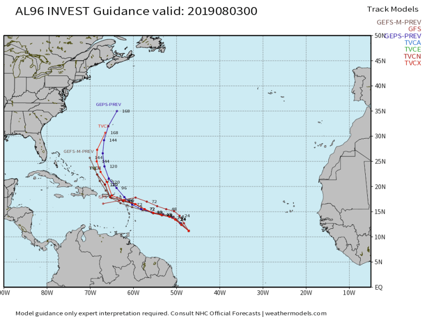
Also watching an area of disturbed weather that has a 40% chance of development over the next five days but the environment ahead of the wave is not very conducive for development. Latest model runs keep the Center well to the east of Florida and that is with the models that develop it.
I will post an updated rain forecast in the morning.
Discover more from Pompano Weather
Subscribe to get the latest posts sent to your email.
