
The saga of where Tropical Storm Karen will go has been fascinating, especially the consistent forecast of some kind of “loop” or sharp southwest turn the system may make in response to a ridge over the eastern US.
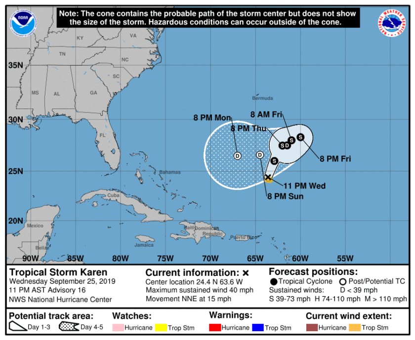
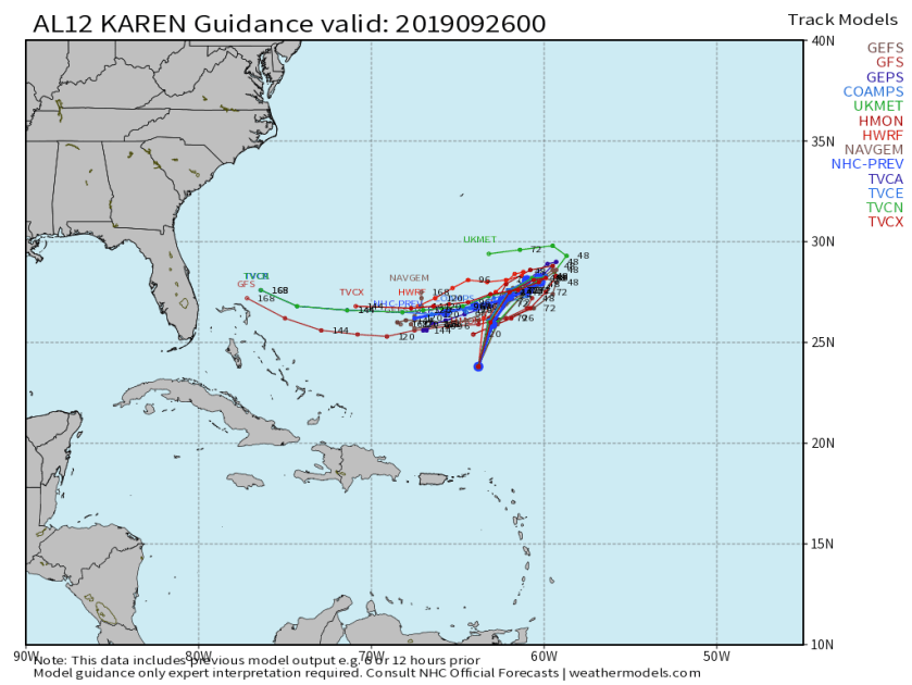
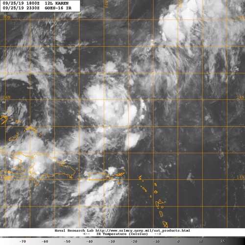
The latest official forecast and model output above shows the next five days of possible motion. What is not shown is the intensity of Karen IF the cyclone can maintain its structure for that long. There are some inhibiting factors such as dry air and shear that will have some effects on the storm. Even tonight TS Karen does not look well structured.
At this time it is too early to say if Karen will maintain tropical characteristics and where it will go. With the 11pm advisory Karen is barely a tropical Storm with winds of 40mph. At this point we need to continue to watch Karen and see if it strengthens and where it will go.
I will post an update tomorrow evening along with the weekend forecast.
Discover more from Pompano Weather
Subscribe to get the latest posts sent to your email.
