
Current Pompano is 90° with a dew point of 75° with a very nice wind from the east at 14mph. There are a few spotty showers on radar.

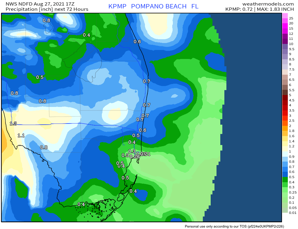
For today and Saturday we will remain breezy with highs around 90°. The scattered showers should be quick moving but we may see some gusty winds associated with them. At this time the main weather threat will be lightning. On Sunday we will see more shower and thunderstorm coverage with winds decreasing through the day. Rainfall amounts for the weekend are expected to be between one-half and three-quarters of an inch,
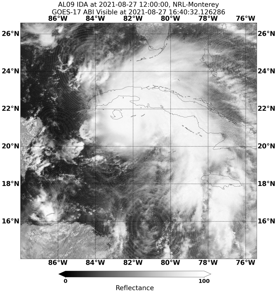
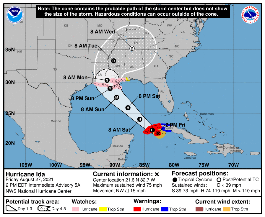
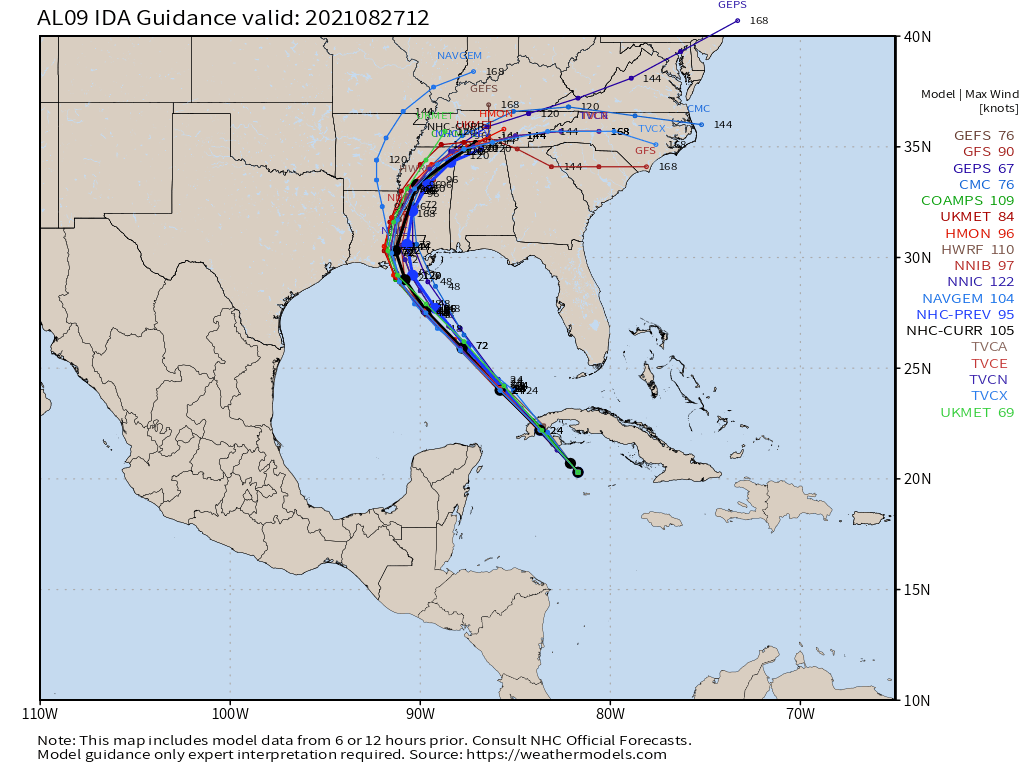
In the tropics, Ida was upgraded to a Hurricane this afternoon as recon found stringer winds just prior to making landfall in Cuba. Ida will not produce any direct impacts for south Florida but all those in the northern Gulf coast should continue to monitor the storm. Tropical watches and warnings are in effect for some areas.
Enjoy the rest of your day.
Discover more from Pompano Weather
Subscribe to get the latest posts sent to your email.
