
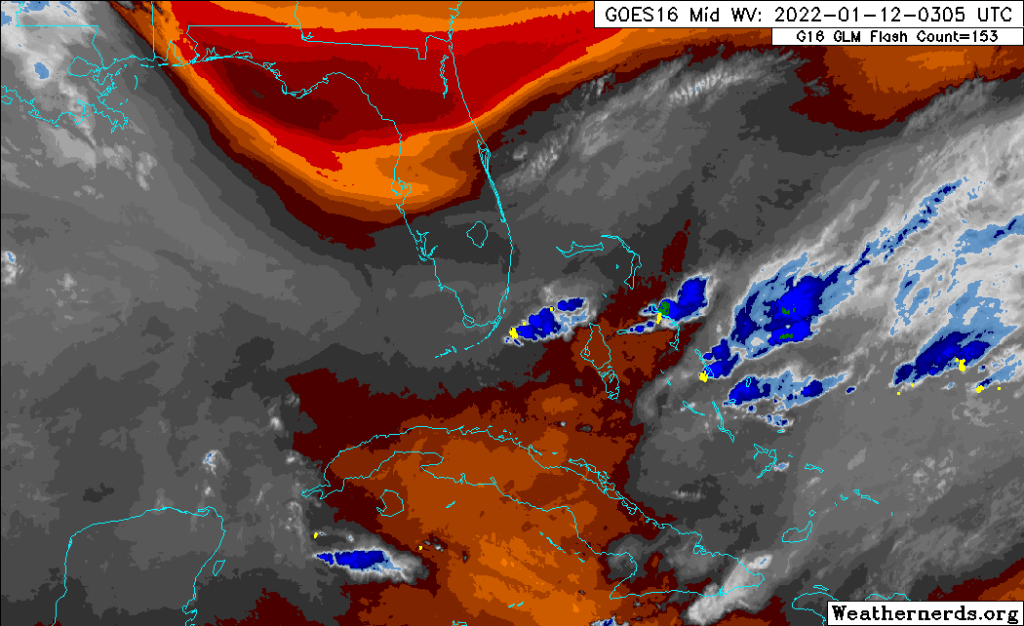
Certainly more rain around than we have see in awhile. As of 7pm tonight Pompano Airpark has received .71 inches of rain, with more to come. Latest satellite (water vapor) shows dry air well to our north with ample moisture in place over south Florida.
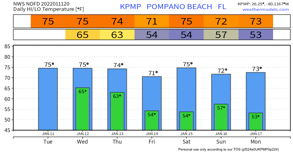
For the rest of the week, Wednesday into Thursday morning much of the same pattern we have seen today. This is ahead of a front that will clear our area on Thursday afternoon bringing the first of two shots of cooler are to the area. Friday and Saturday, clear and cooler. Starting Saturday night we will see an increase in showers ahead of the second front. This will clear our area on Sunday and in its wake give us more cooler and clearer weather. This should give us our coldest temps of the season so far, around 53°.

No severe weather is expected though we did have some flood advisories out earlier this evening. Rip currents are likely at the east coast beaches.
Besides the rain with the front on Sunday, the weekend outlook is clear and cool.
Discover more from Pompano Weather
Subscribe to get the latest posts sent to your email.
