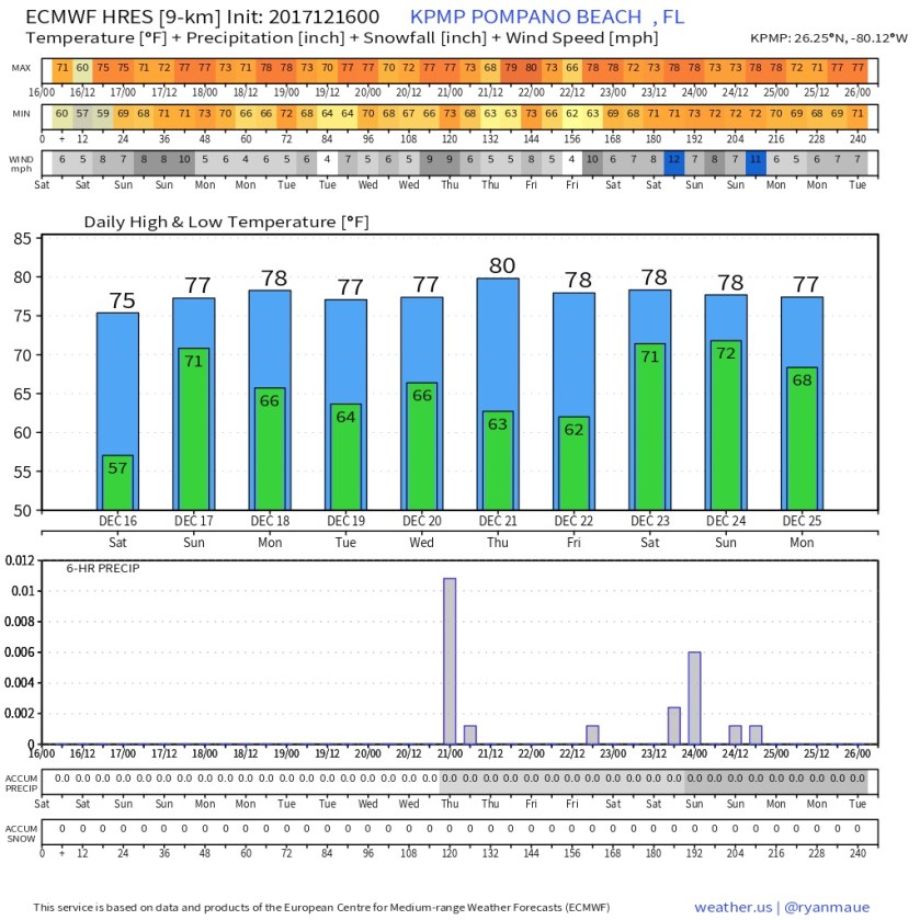
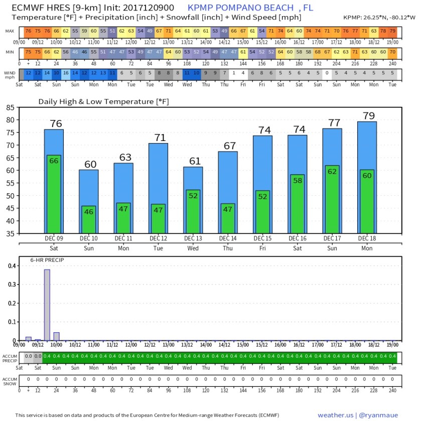
After a cold start to our new year our temps have been warming up over the past few days. That will continue today and we may actually get to a high of 70F this afternoon. Currently we are 53F with partly cloudy skies.
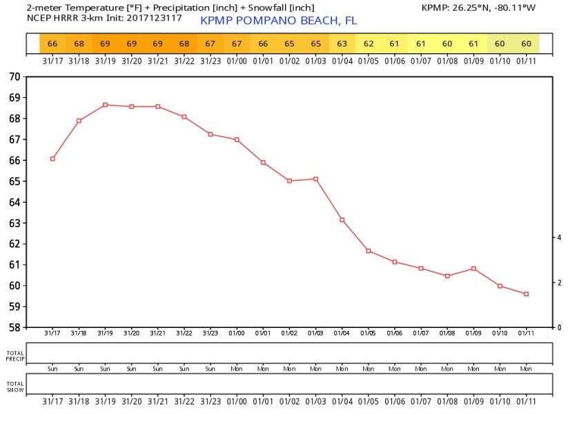
Along with this warming trend we could see some showers around, so we may not be as dry as we have been. The latest HRRR gives a hint of this but keeps us shy of 70F.
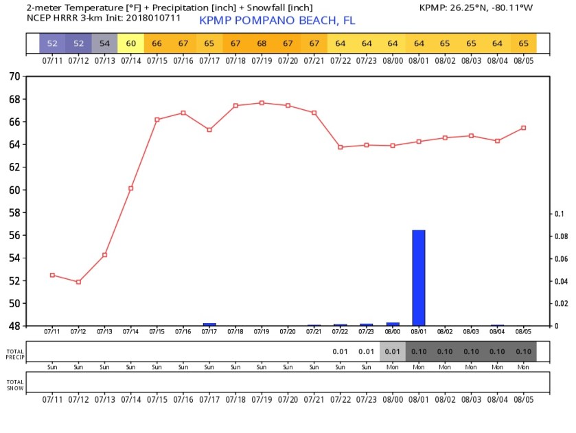
I am expecting to see some rain as we get to Tuesday/Wednesday of this week ahead of our next shot of cooler air which will not be as sharp as this past week.
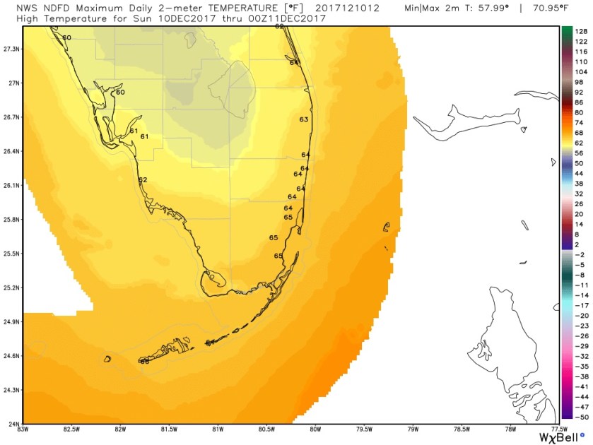
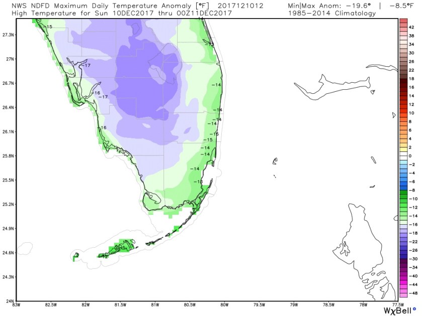
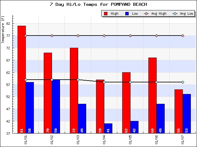
Looking back at the past week it has almost been fun to see how our highs have been near our normal lows for this time of the year.
Will update later with this temps we can look forward to this week.