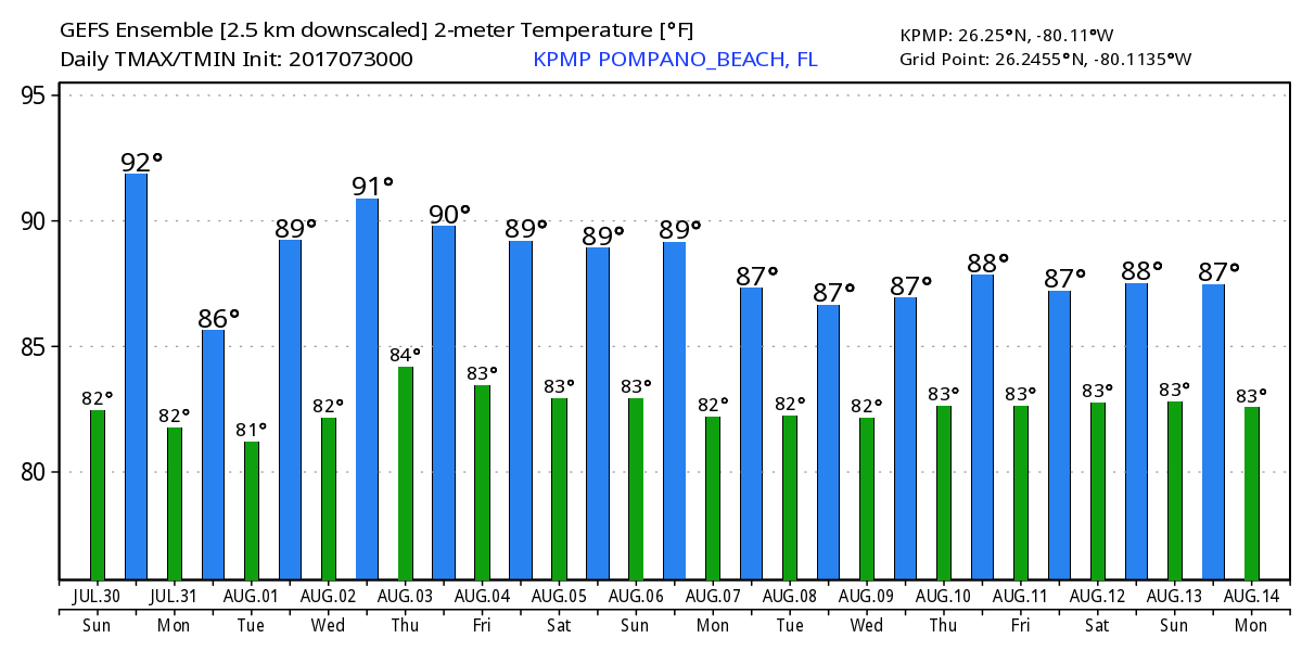
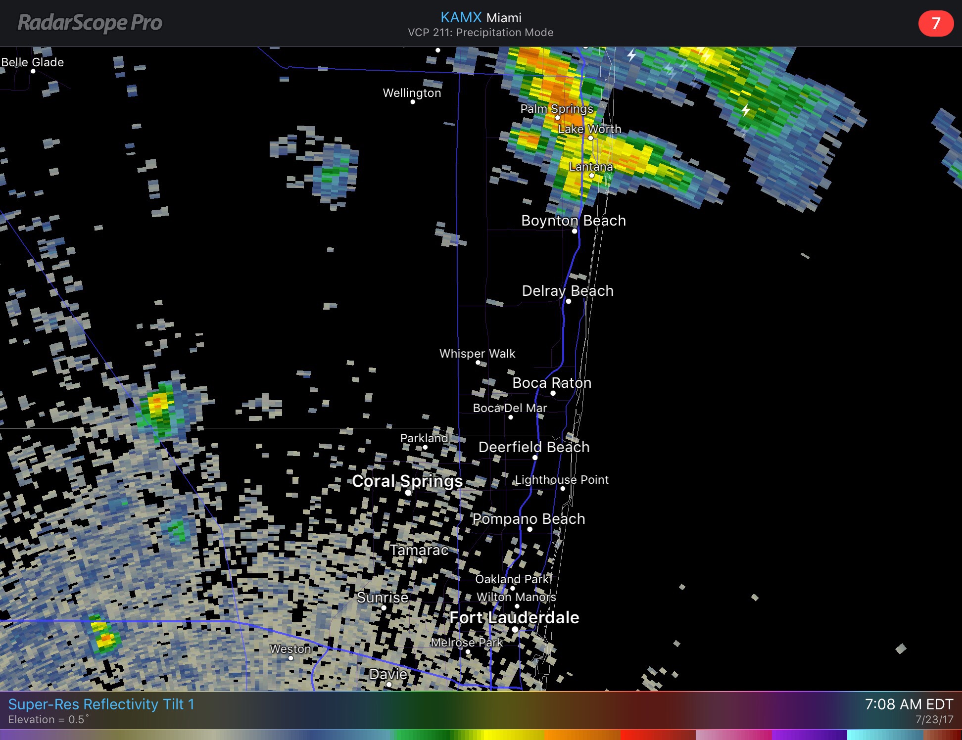
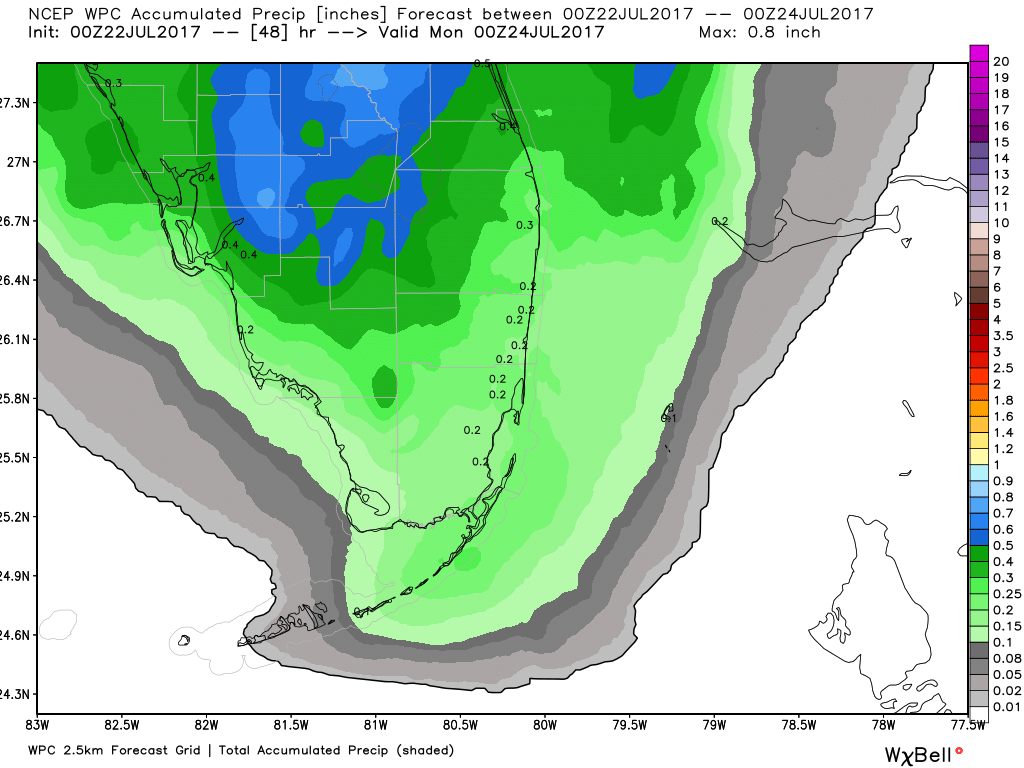
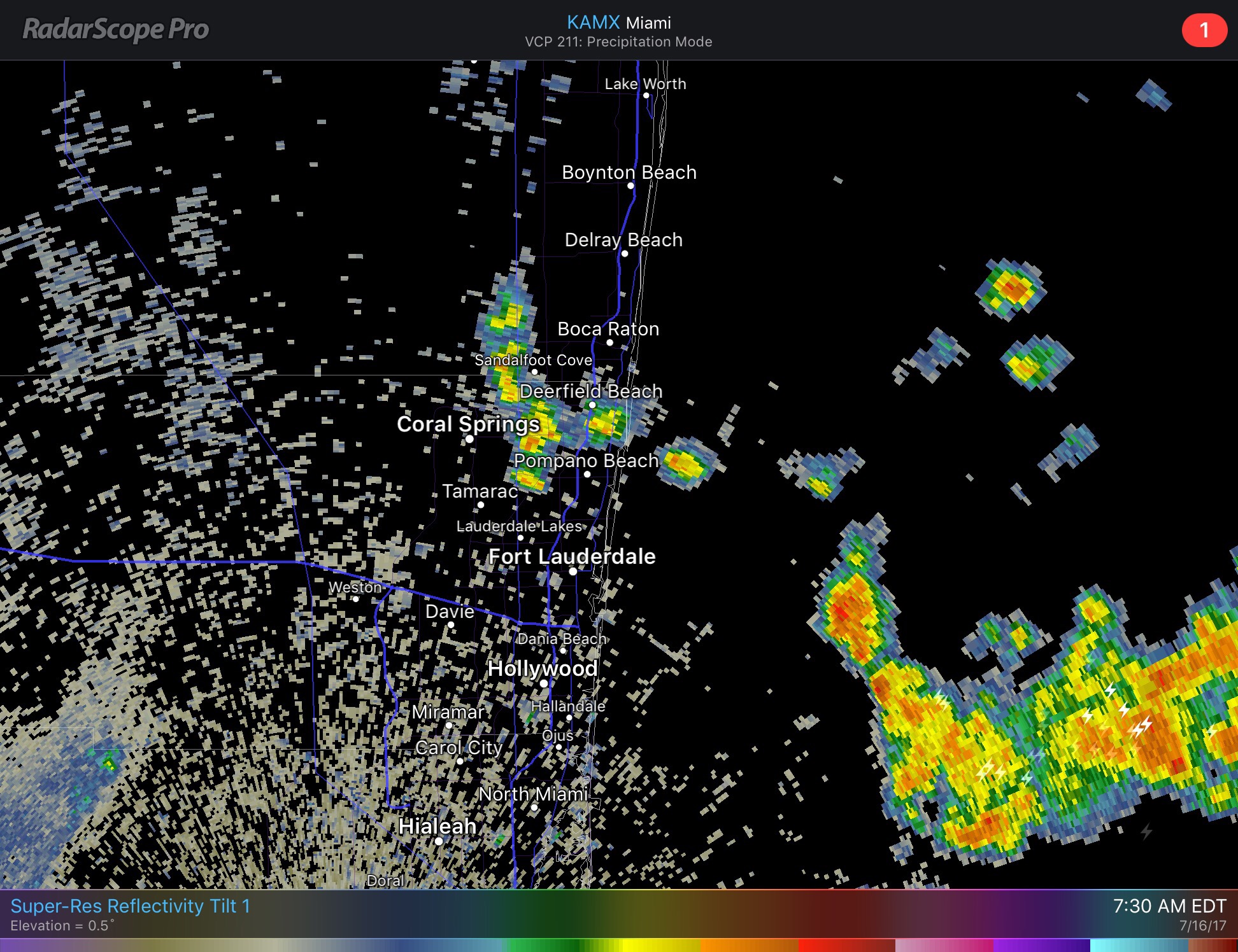
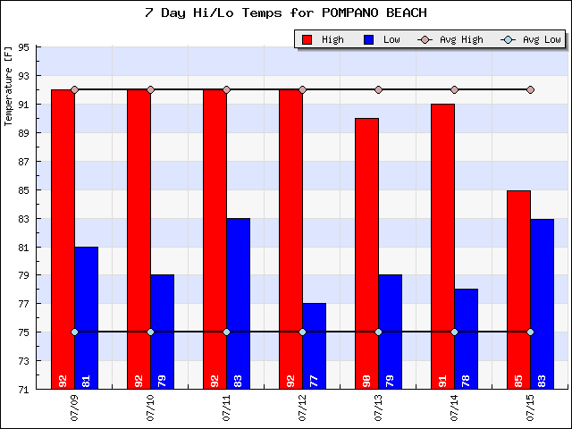
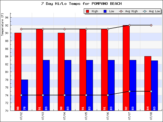
I think this is about as normal as a summer day can get for Pompano. Starting off at 82F with mostly clear skies our temp will climb to 90F as we have some showers and thunderstorms develop this afternoon. Nothing widespread but they will be around.
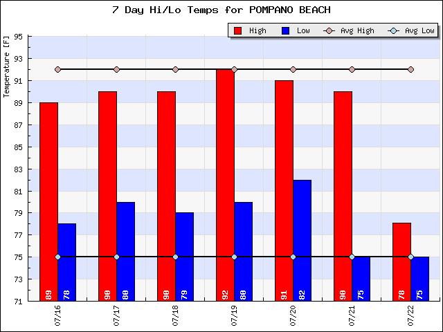
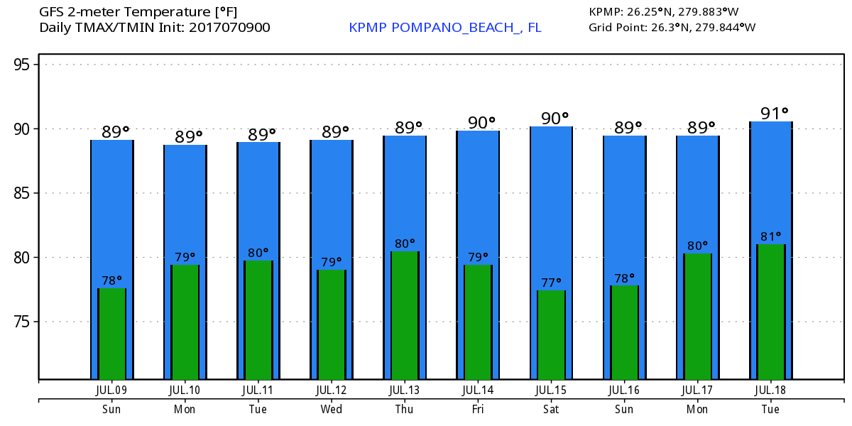
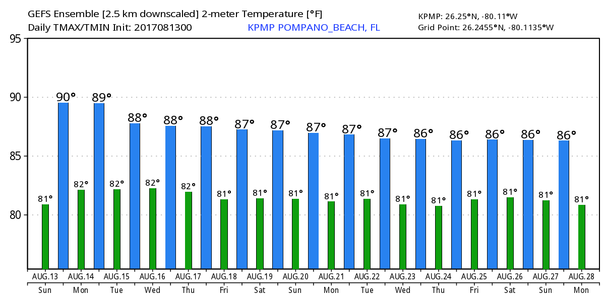
This pattern will continue for the next week with no exceptional chances of rain or temperature variation. As seen in the latest GEFS output temps looks very predicatiable,
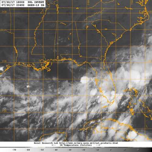
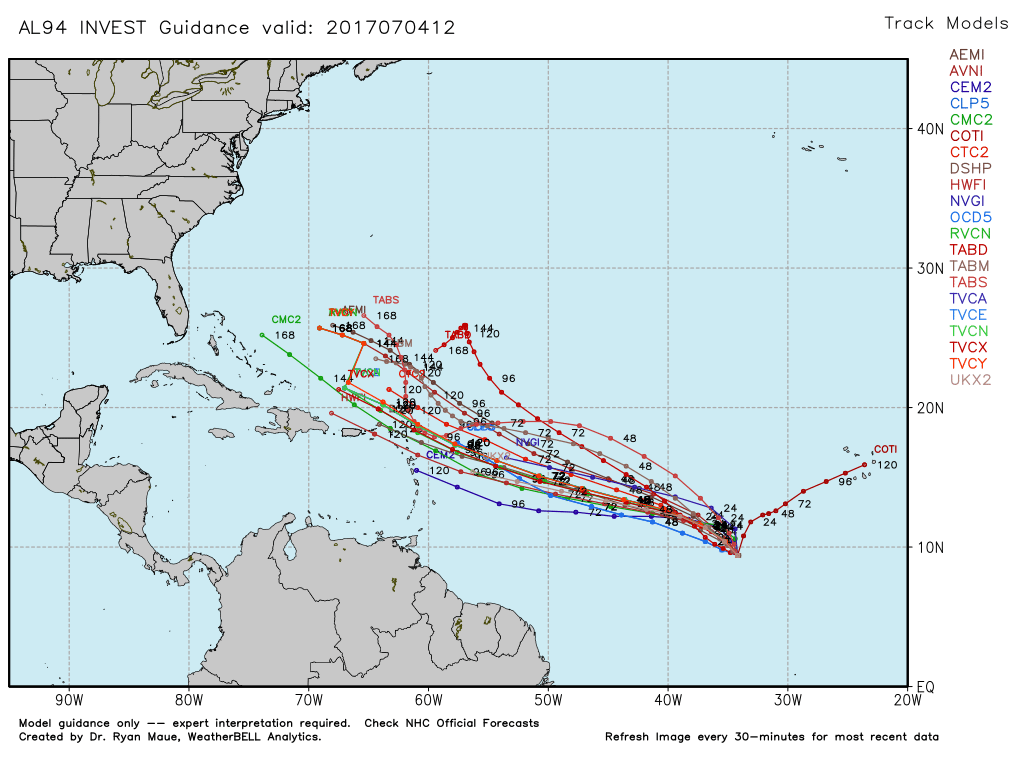
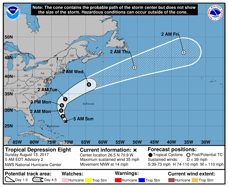
TD8 formed yesterday and is expected to strengthen. This system will pose no direct threat to Florida or at this time the east coast. The latest NHC forecast keeps the system well off the coast and away from any land areas.
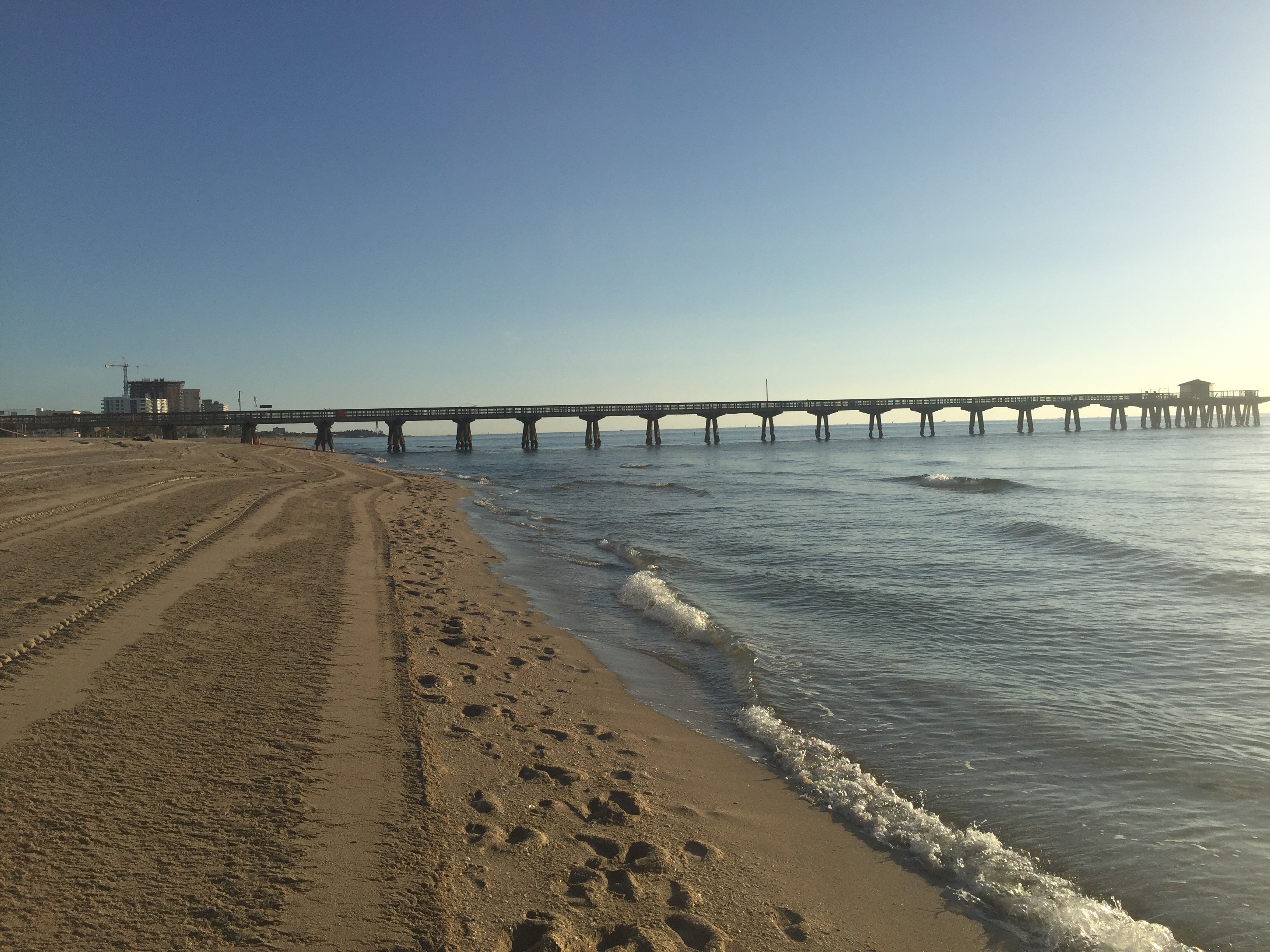
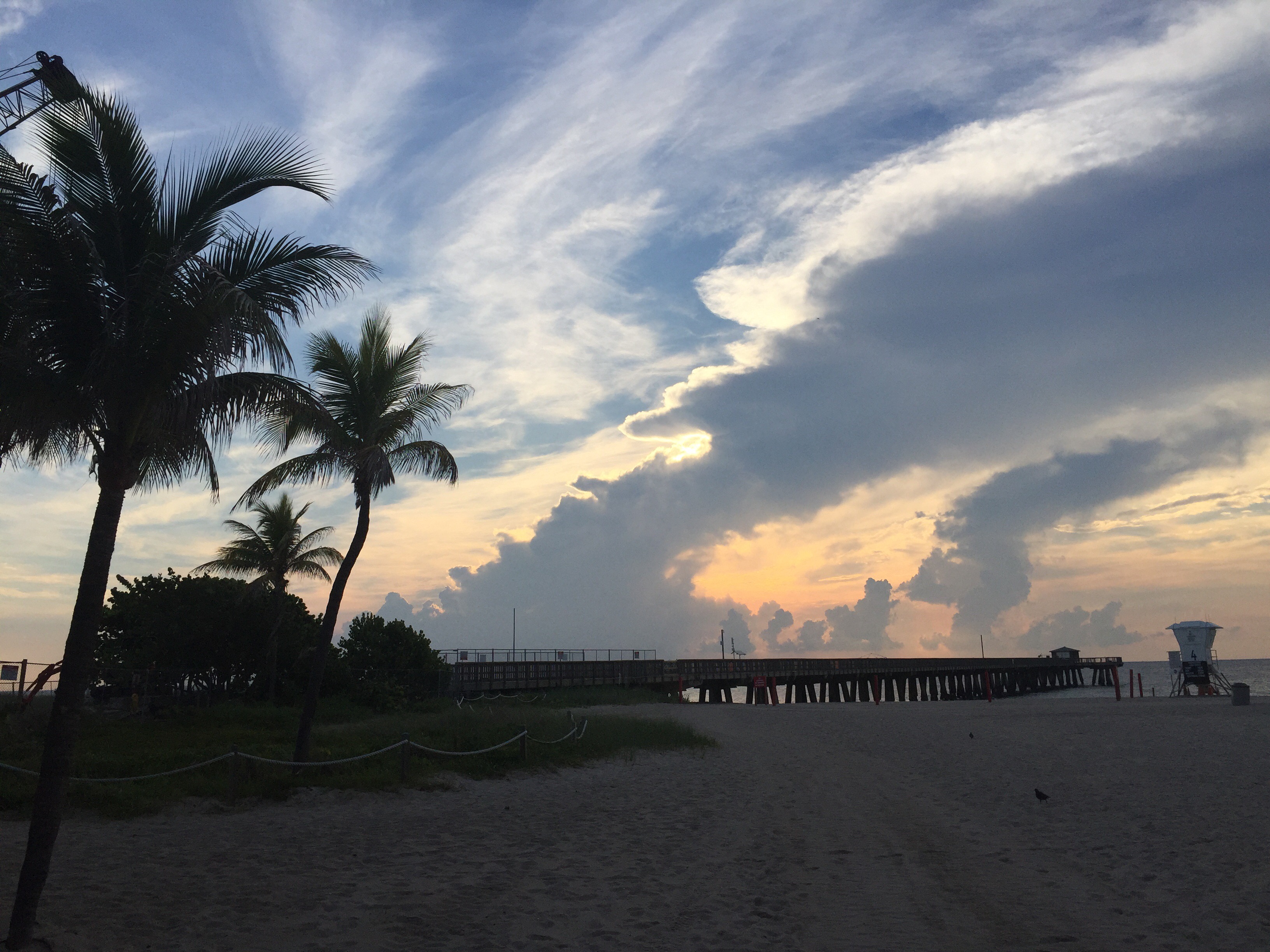
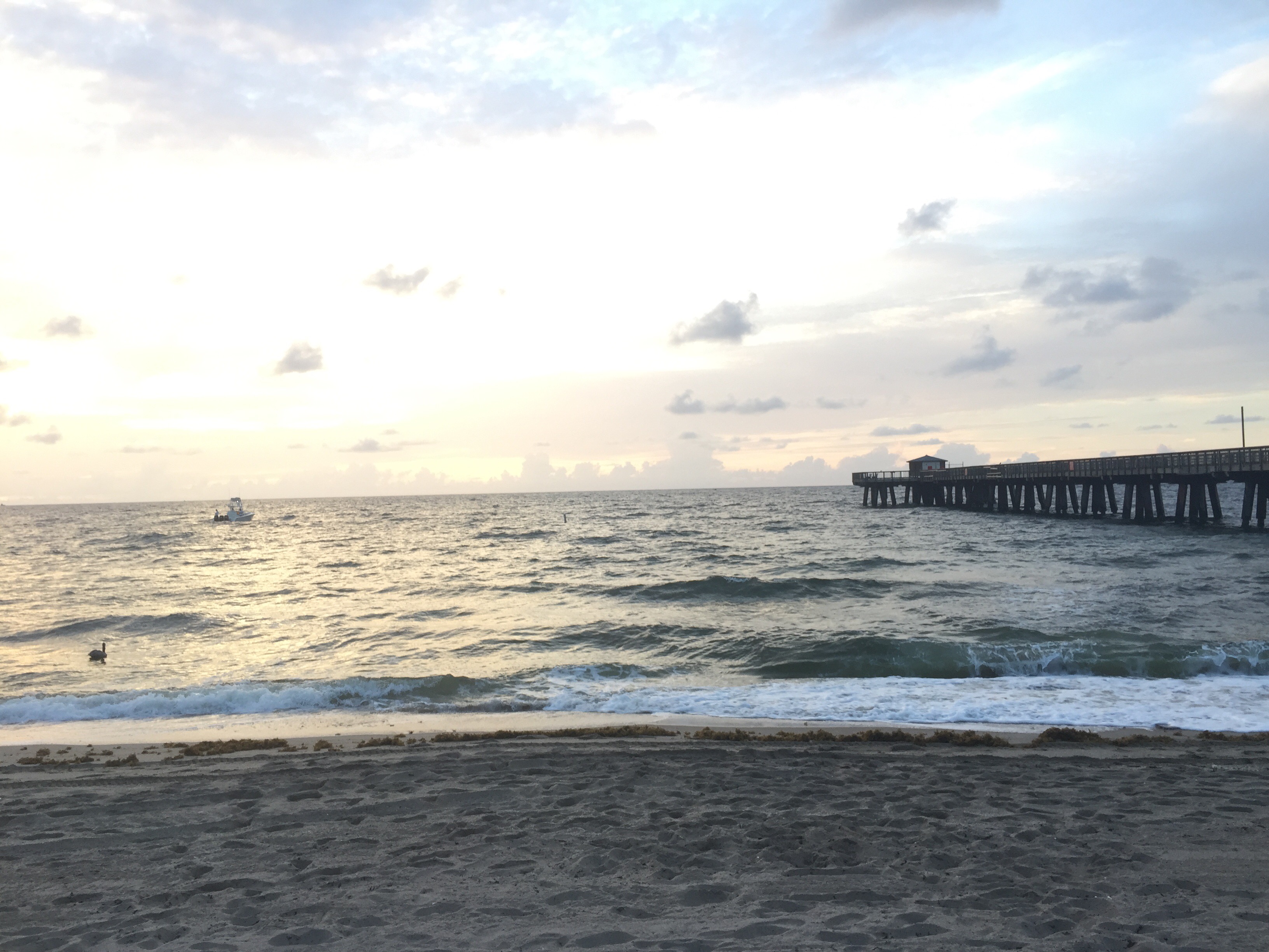
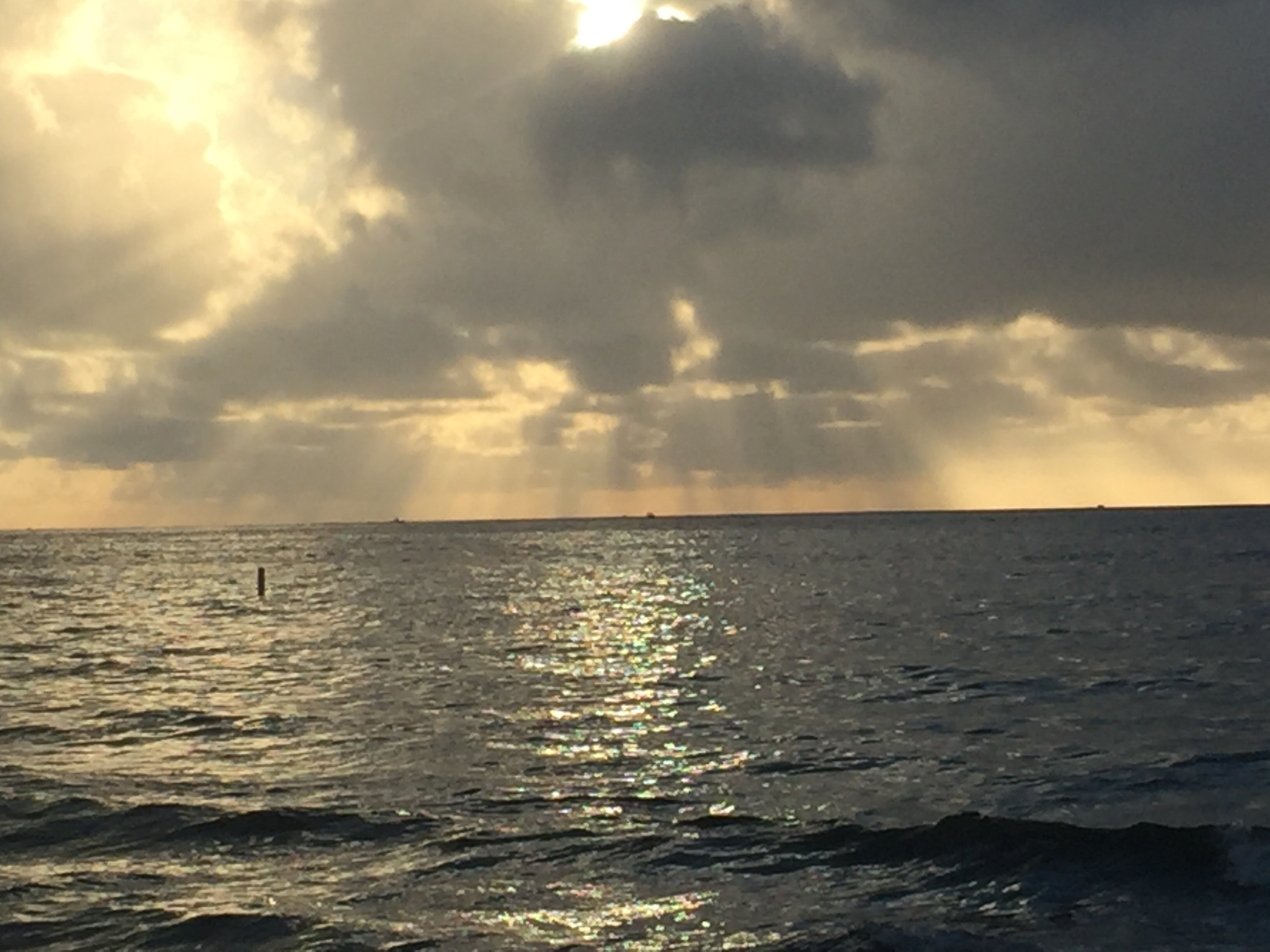
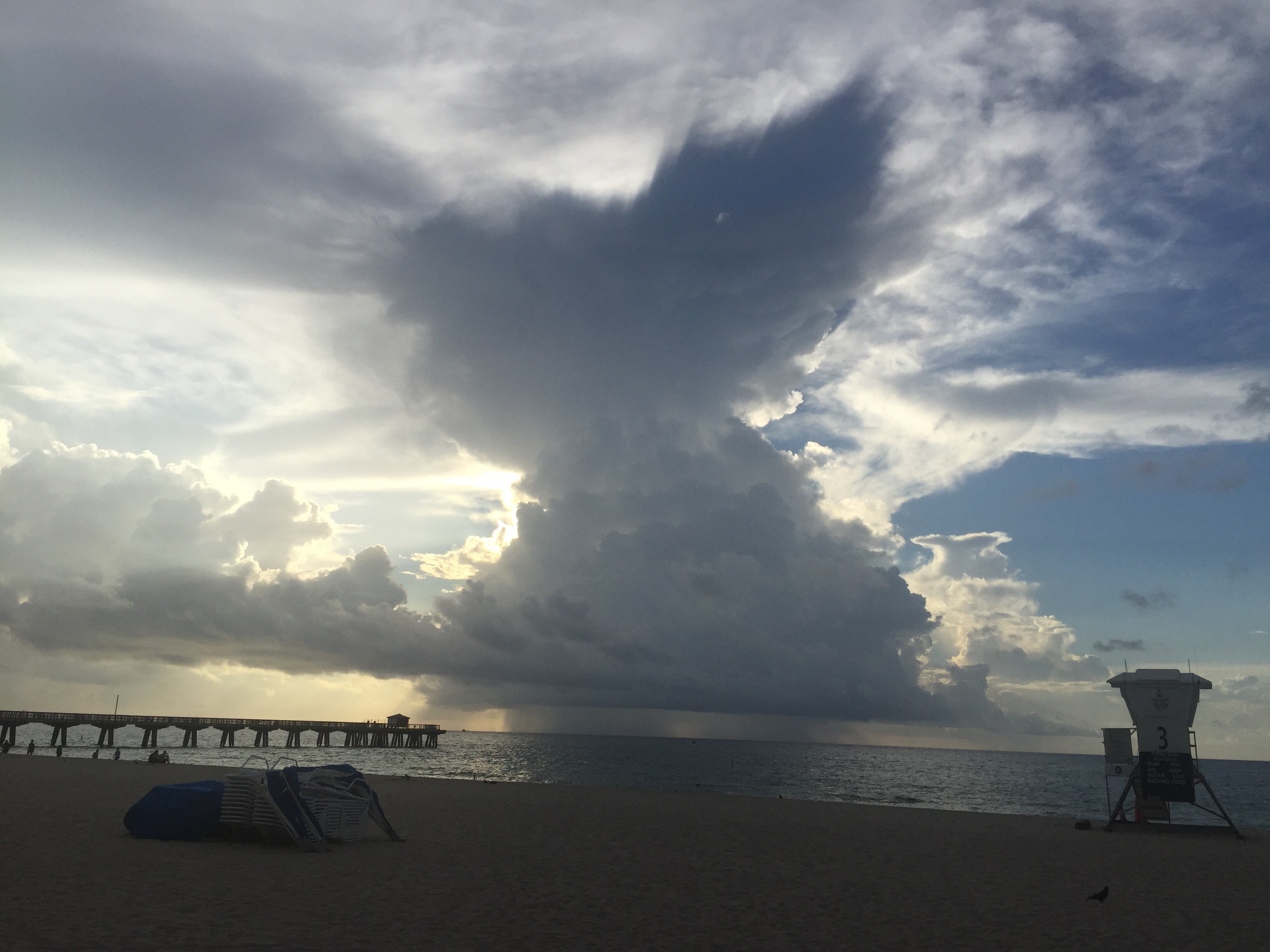
Get out and enjoy some of our south Florida weather today. Here are a couple of pictures from Pompano Beach this Sunday morning.