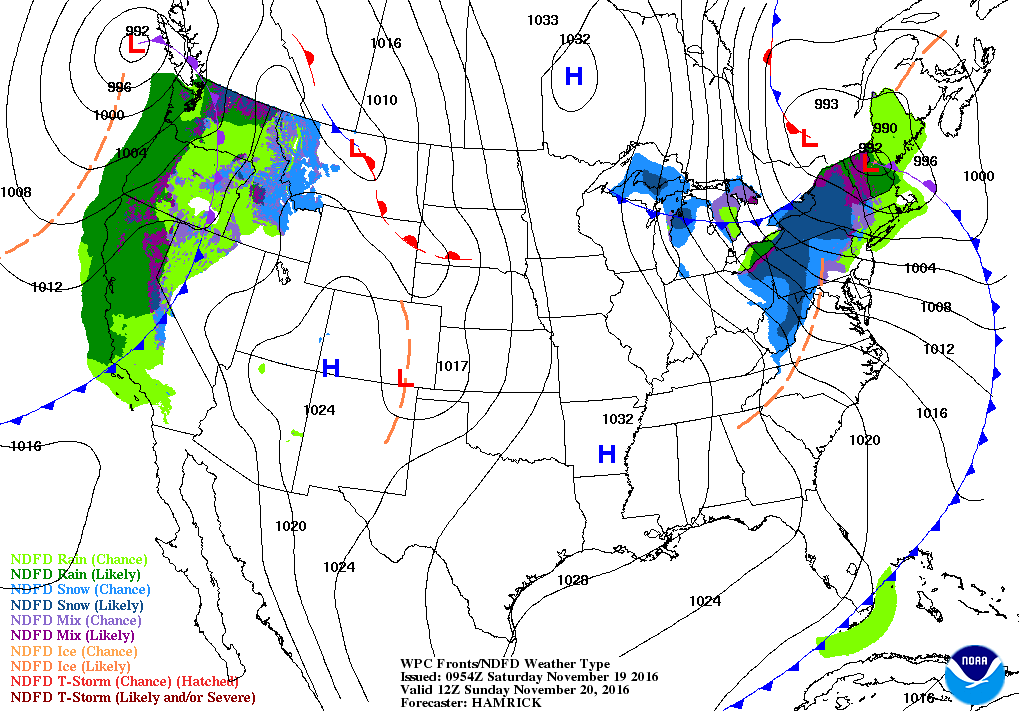
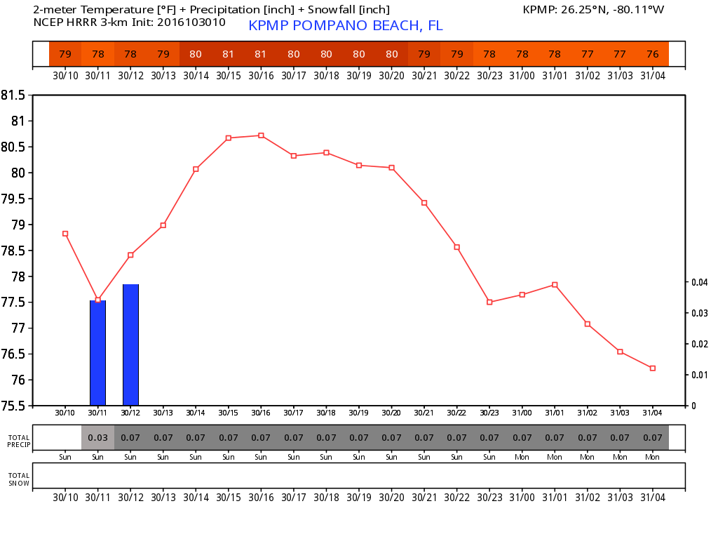
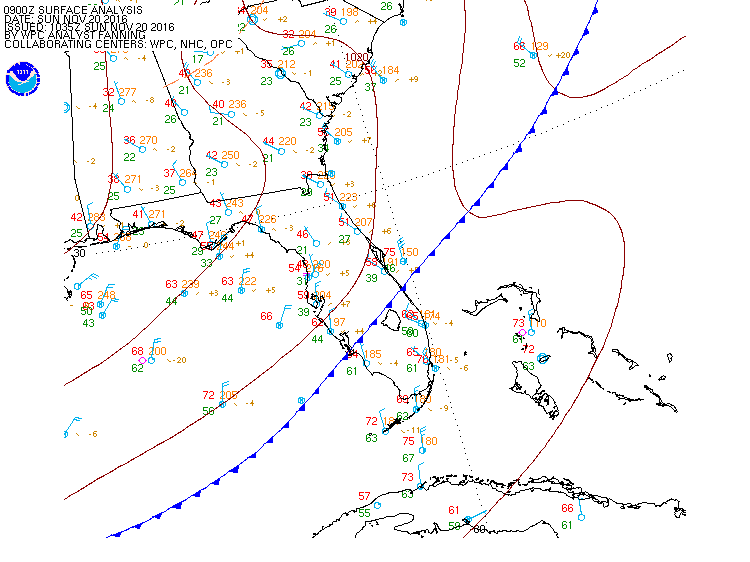
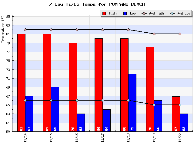
Another beautiful day ahead with temps just a little lower. This morning we are waking up to 63F in Pompano as a cold front recently moved through the area. The will usher in winds this morning from the north and becoming a bit gusty this afternoon, high 76F.
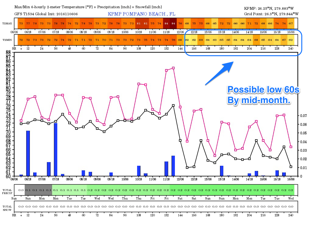
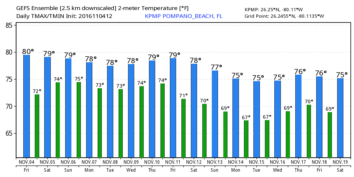
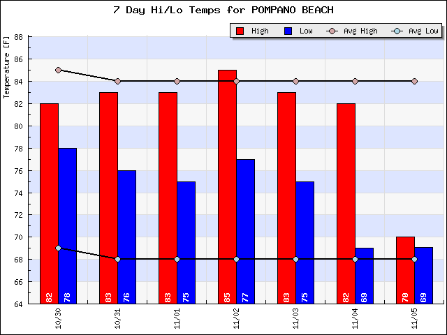
We have been a bit cooler than average and this trend will continue for the next few days.
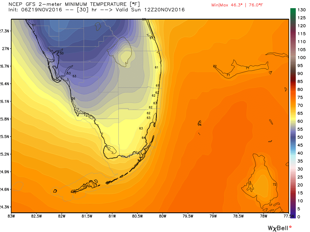
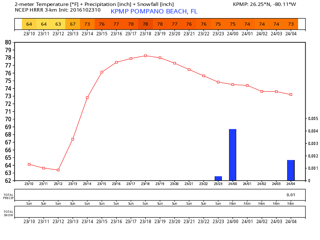
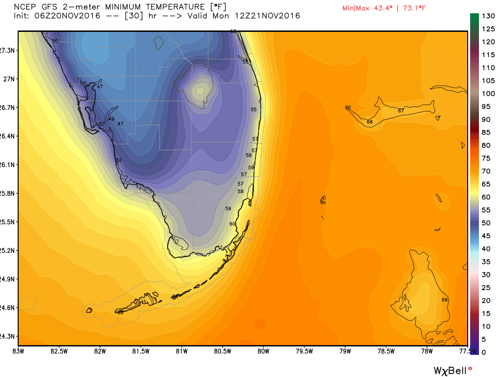
For tomorrow morning we will get down into the 50s around sunrise, here are the lows according to the latest GFS for south Florida.
I will have our Thanksgiving and Black Friday forecasts later today.