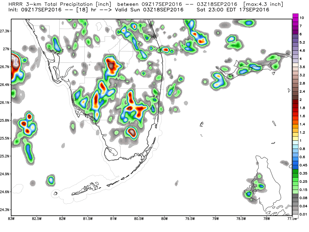
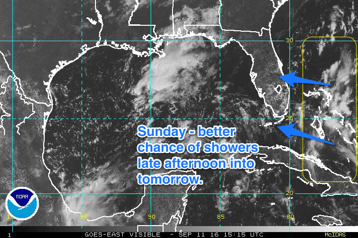
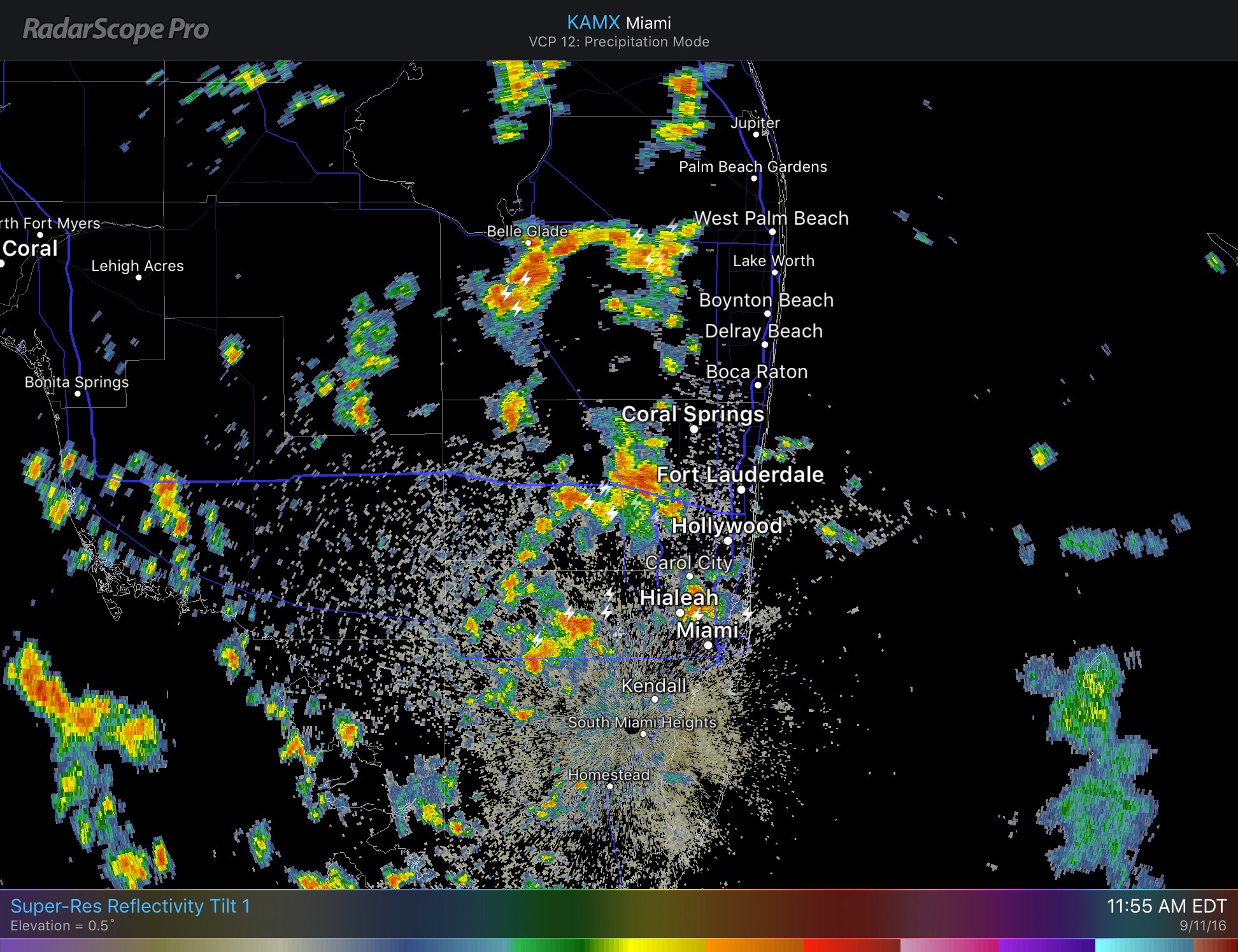
Much like yesterday we will be warm with some late afternoon showers and thunderstorms popping up as we head into this last Sunday of Summer 2016. Starting the day in the upper 70s in most areas.
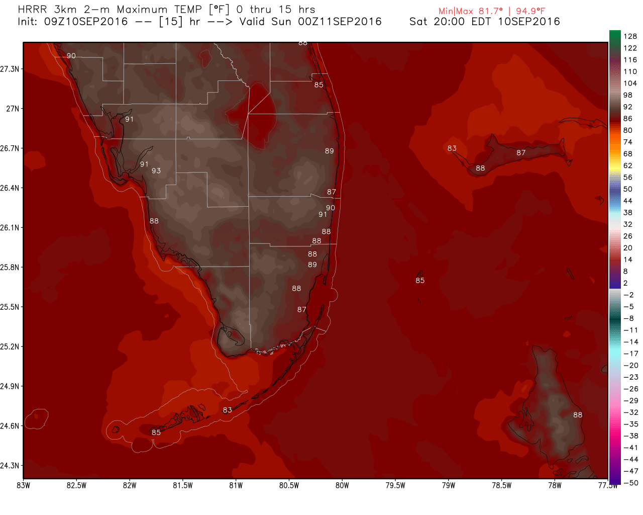
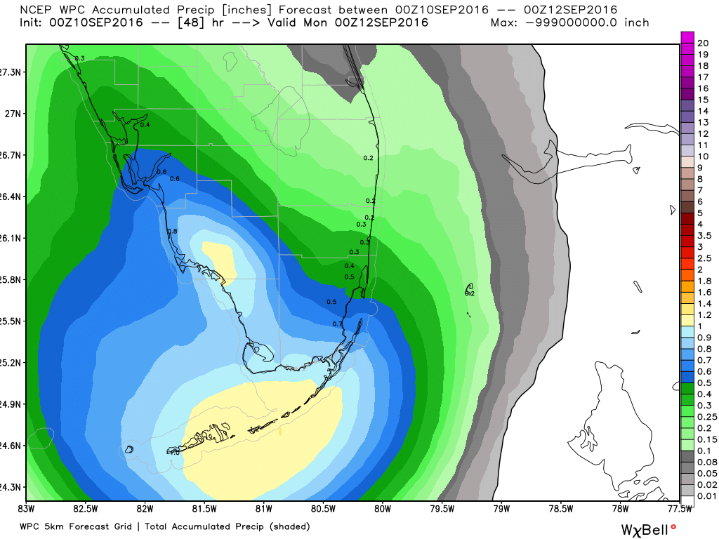
Today’s high will be 89F. As mentioned yesterday we will see a better chance for rain in most areas tomorrow through Wednesday.
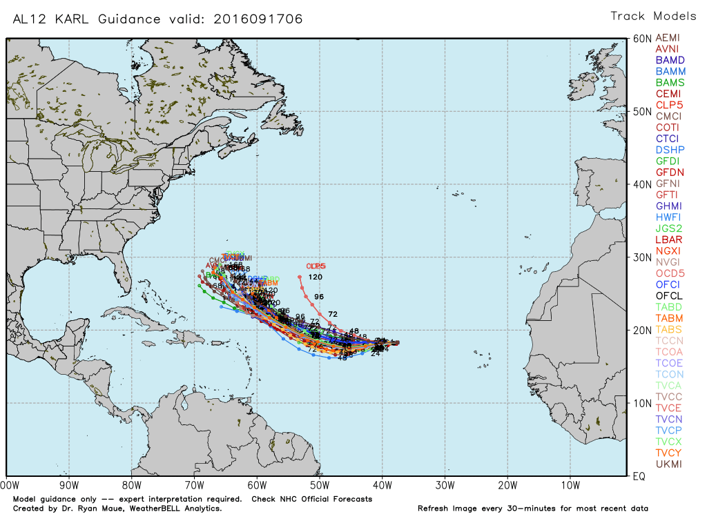
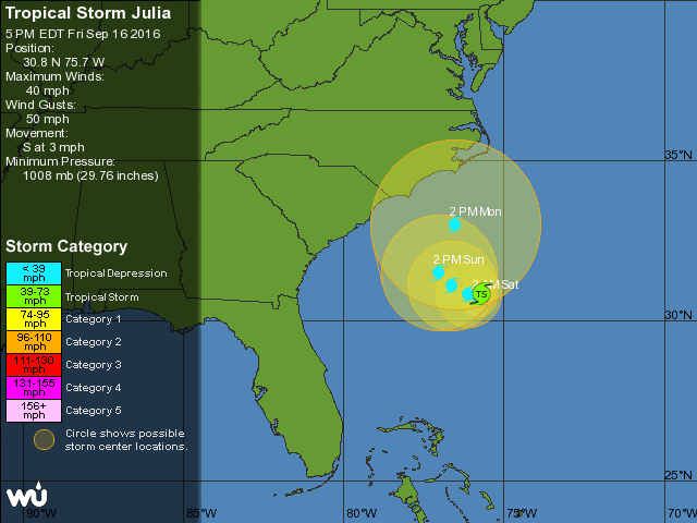
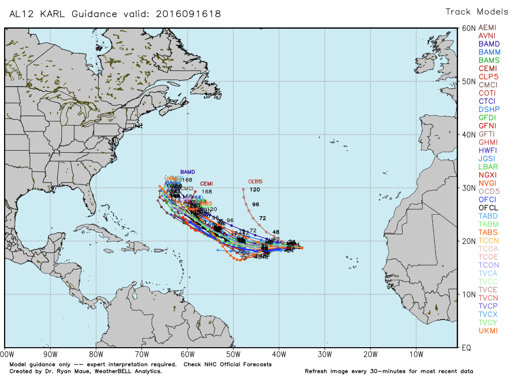
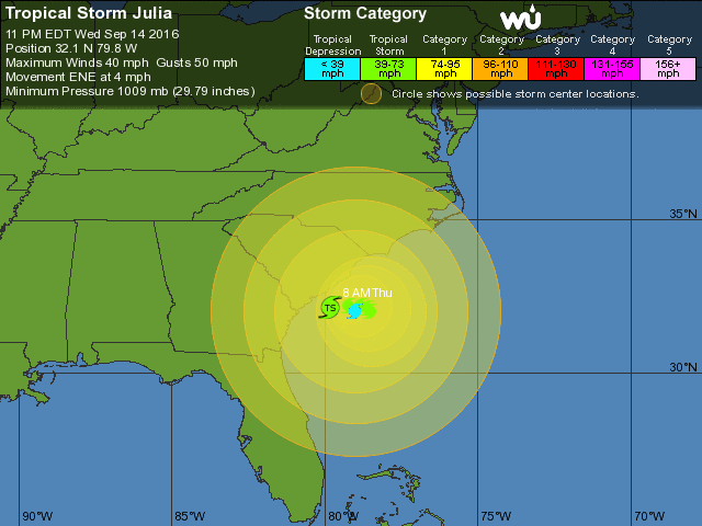
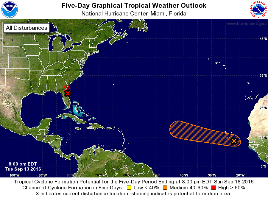
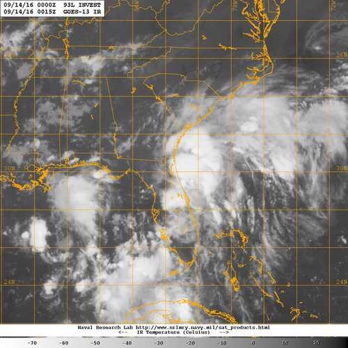
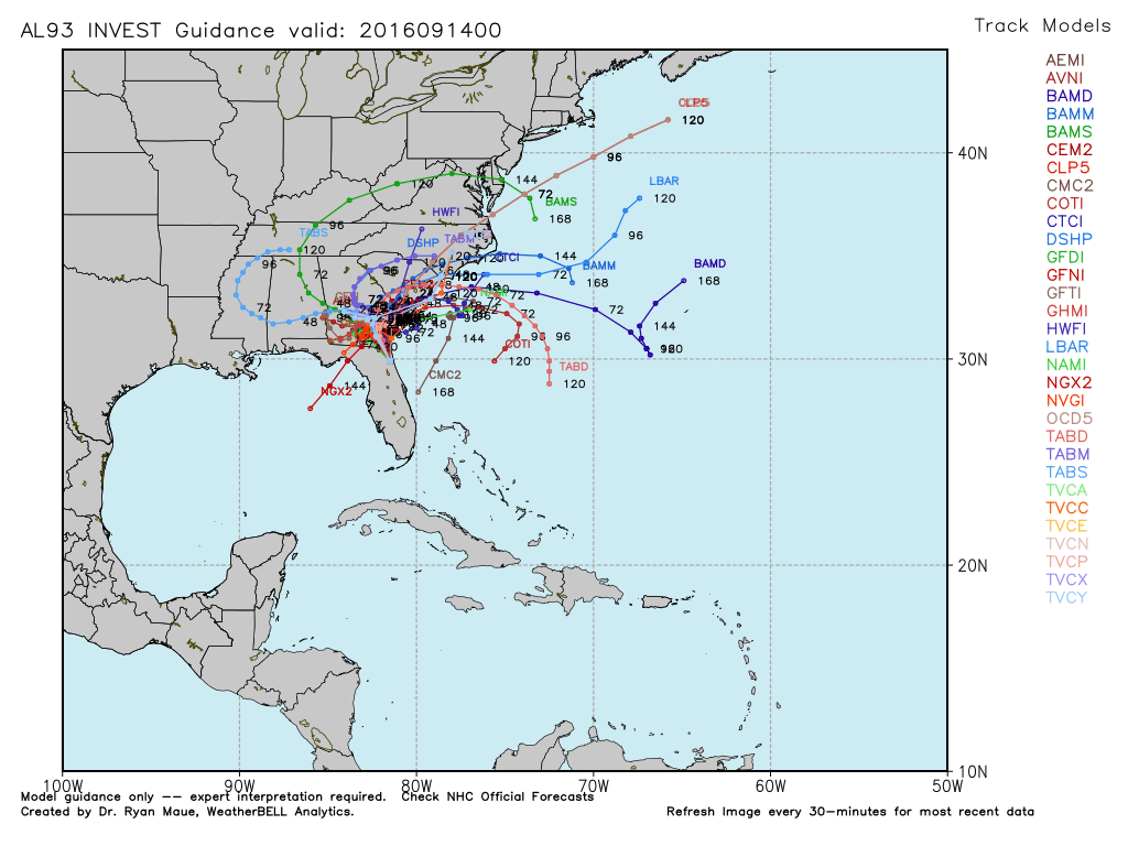
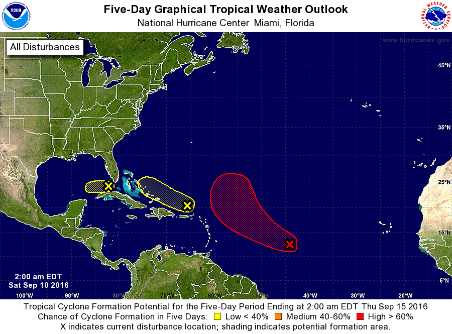
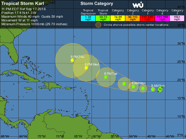
Tropics are still busy with Tropical Depressn Julia meandering off the SE US coast. Keeping an eye on Tropical Storm Karl who should start strengthening tomorrow and could be a hurricane per the latest NHC forecast by Wednesday.
Enjoy the day!