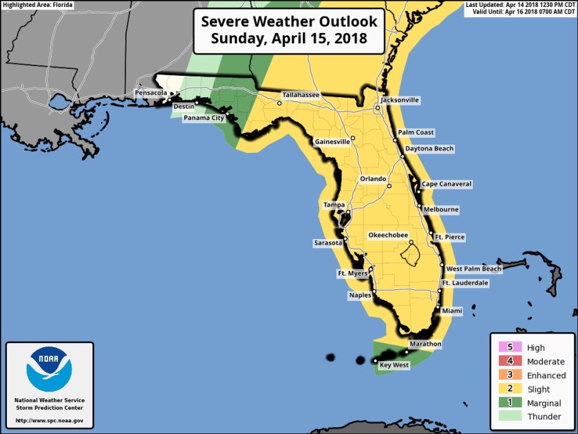
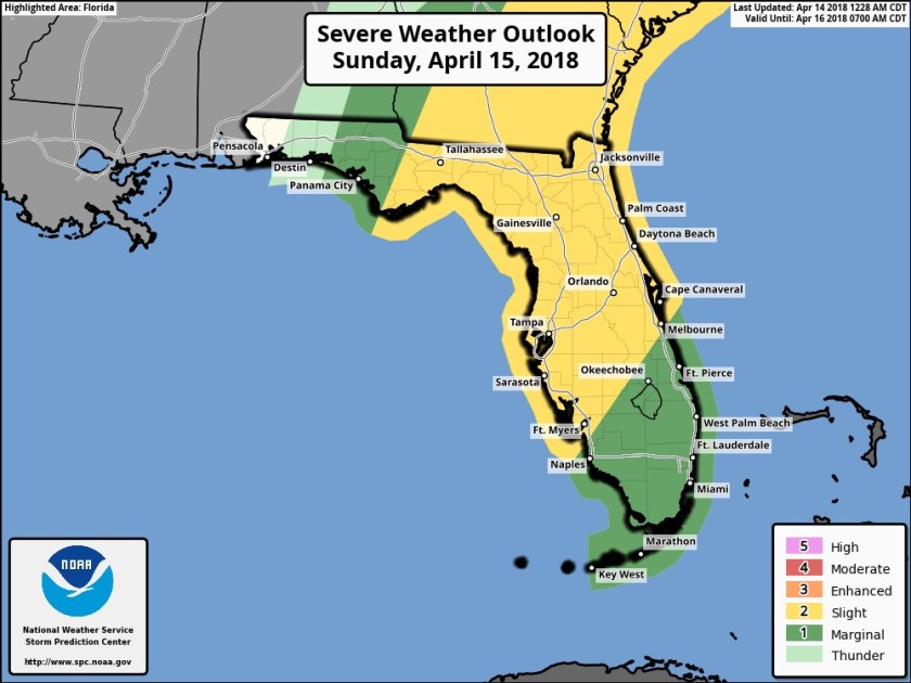
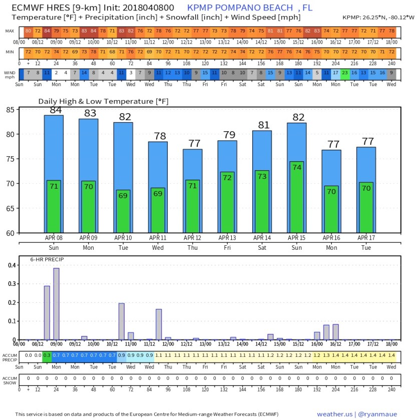
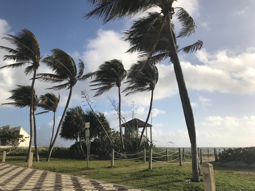
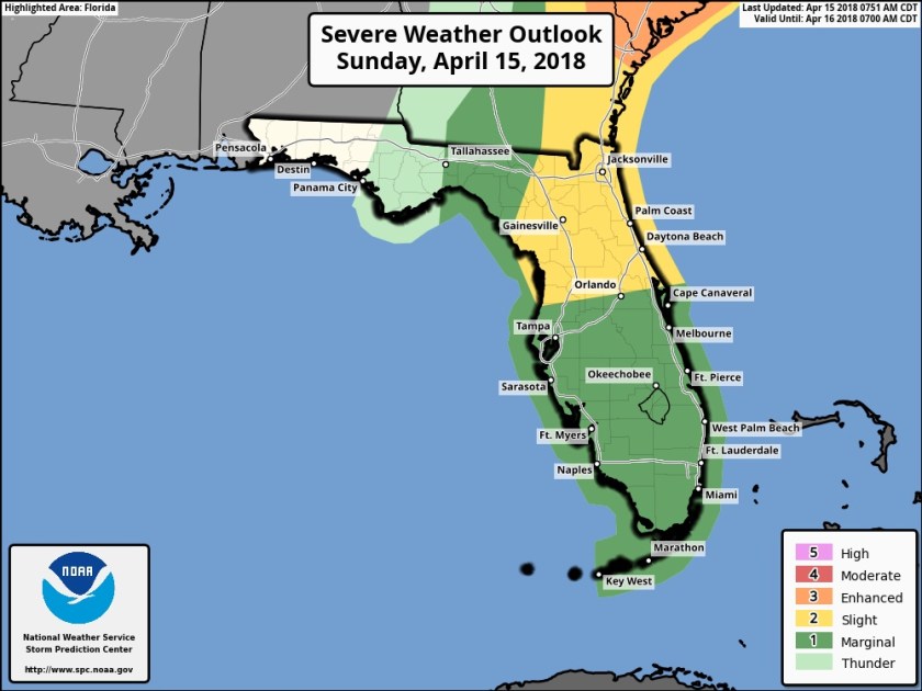
Appears we have an active weather day ahead. Though the overall probability of sever weather has decreased slightly (Slight to Marginal) these is still a notable chance and we need to be weather aware today.
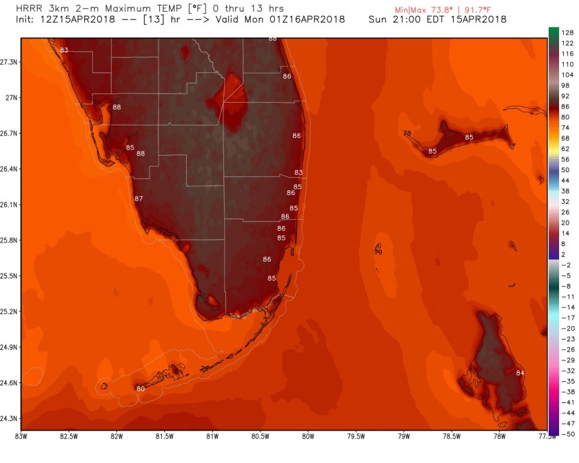
With highs today around 87F there will be ample energy in the atmosphere to fuel these strong to severe storms in two rounds.
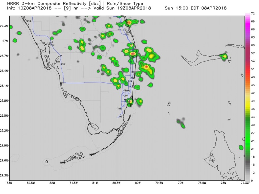
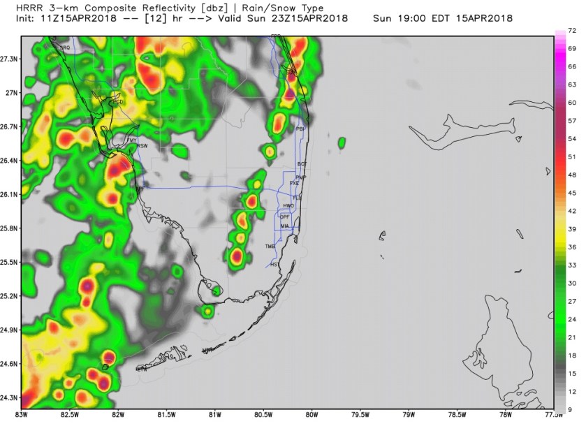
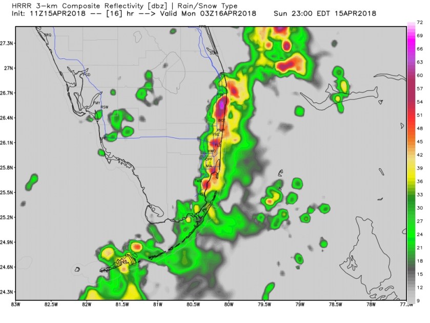
One this afternoon ahead of a squall line and with the squall line. Main threats will be gusty winds, hail, lightning, and even short-lived tornadoes are possible. Main time frame for the squall line will be between 6pm and midnight, but this could change with the actual speed of the front. Here is the latest HRRR showing the approach of the line around 7pm and the bulk of the activity over us at 11pm.
I will updated on Twitter as we go into the afternoon or sooner with any updates.
Be weather ready!