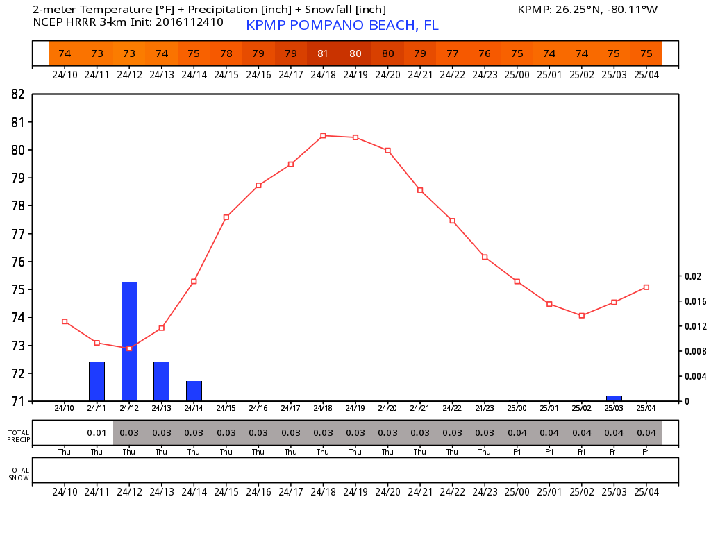
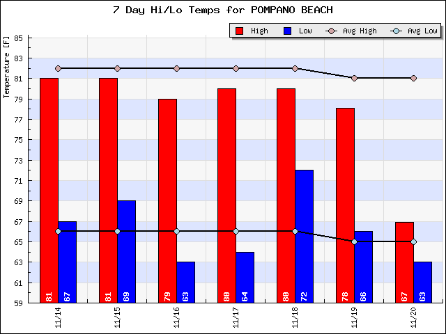
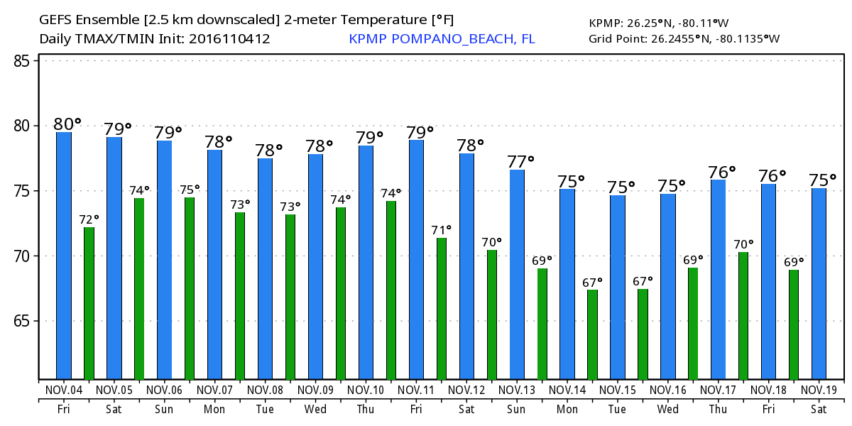
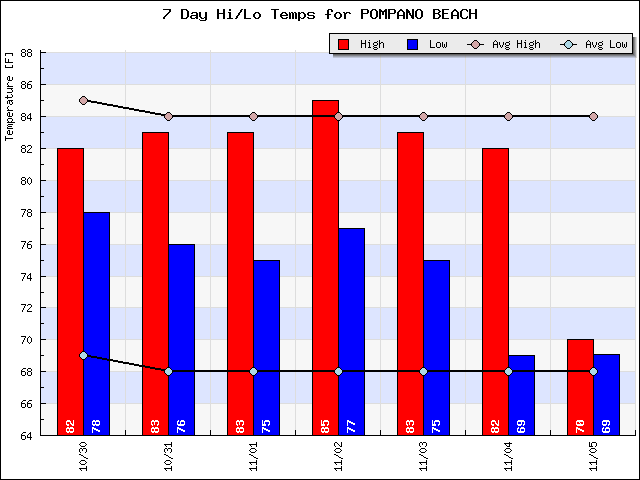
For our Sunday we will have overcast and breezy conditions with a few drops of rain here and there. At this point I do not see anything accumulating. High today 79F.
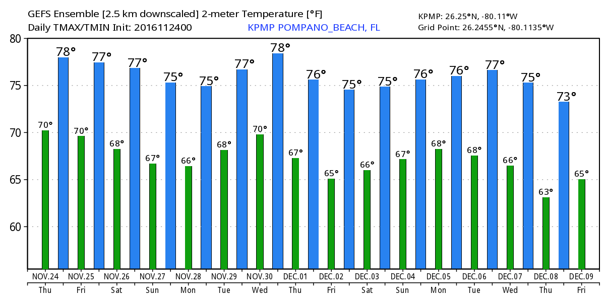
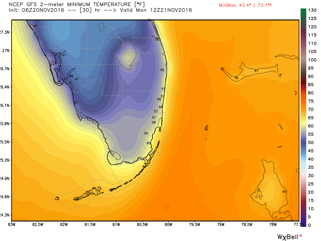
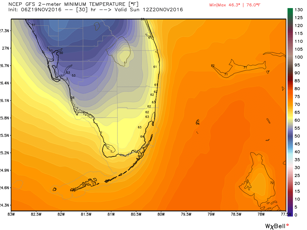
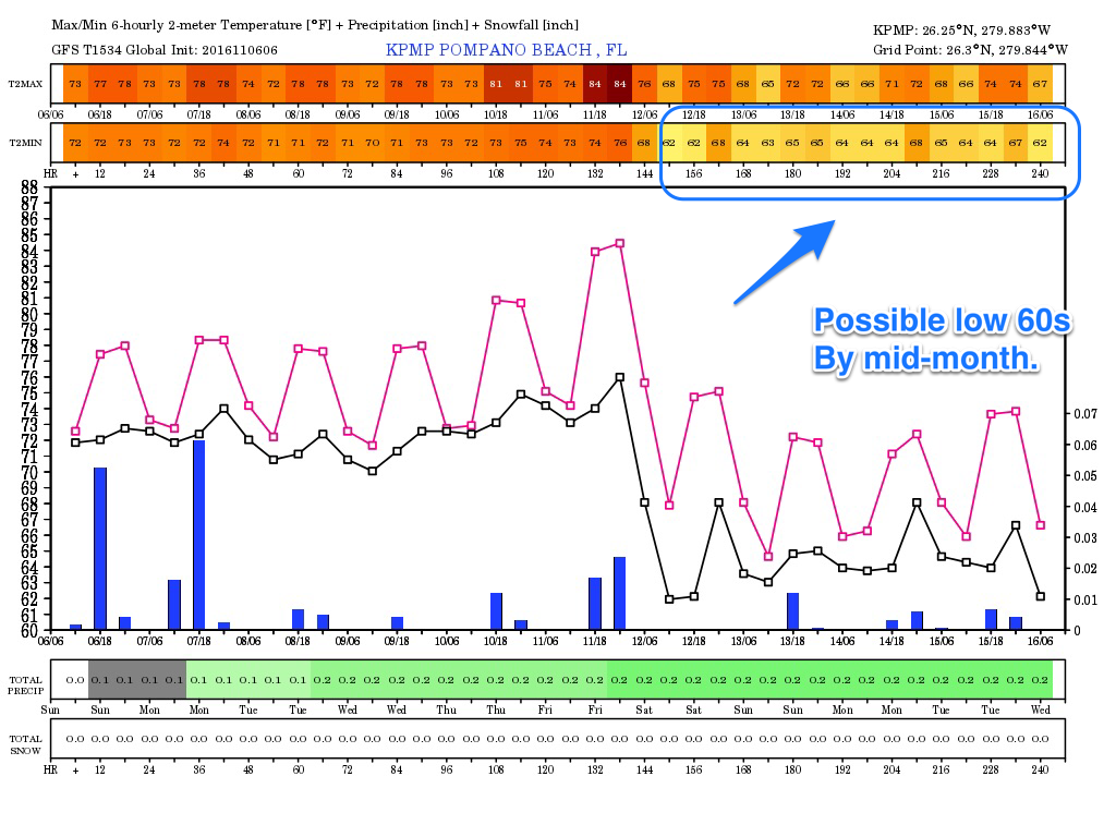
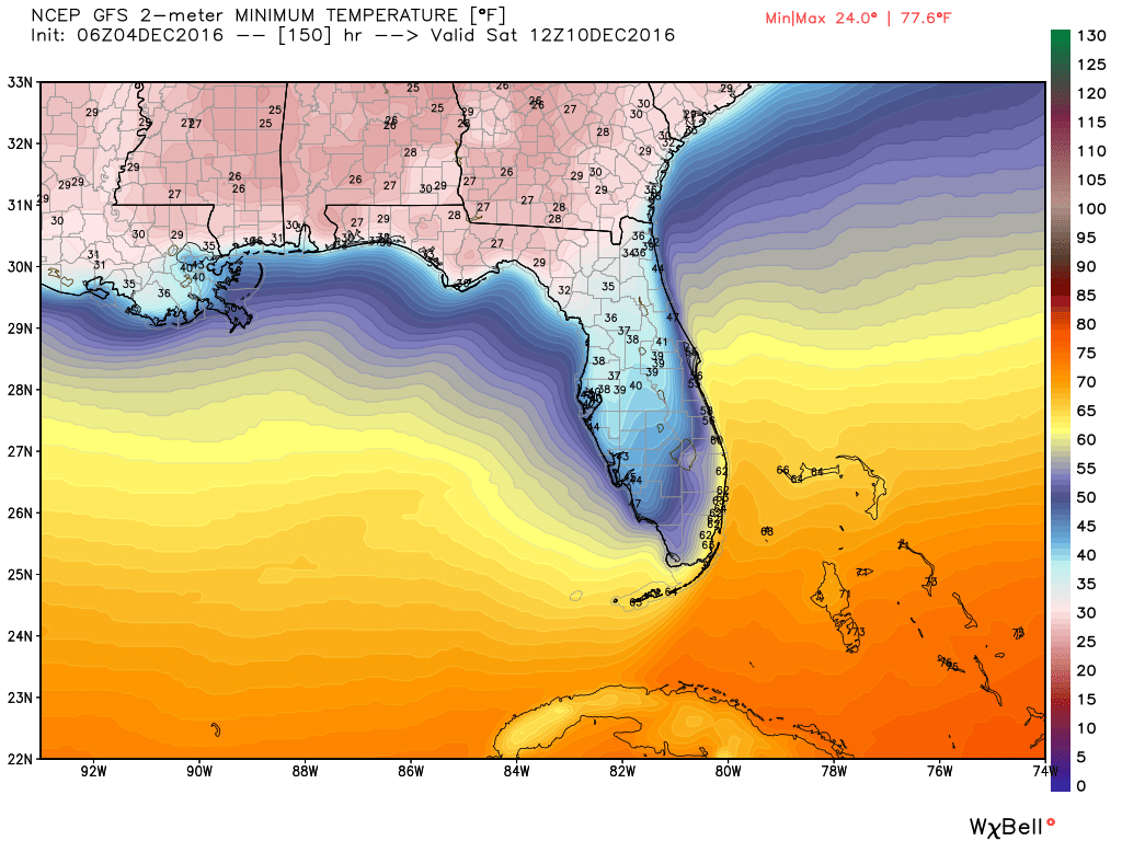
Still watching out for next weekend and the cooler air that will affect much of the eastern half of the country. We are still seeing about a 10F spread between the GFS and Euro for our Saturday lows, 60F vs 49F. It will be interesting to see which model is more correct this far out. Here are the state’s lows for next Saturday which should be the coldest of this air mass.
Will update later on the week ahead and the model progression for our lows next weekend.