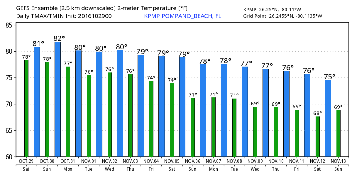
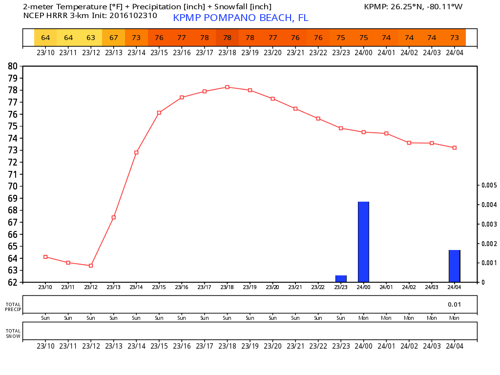
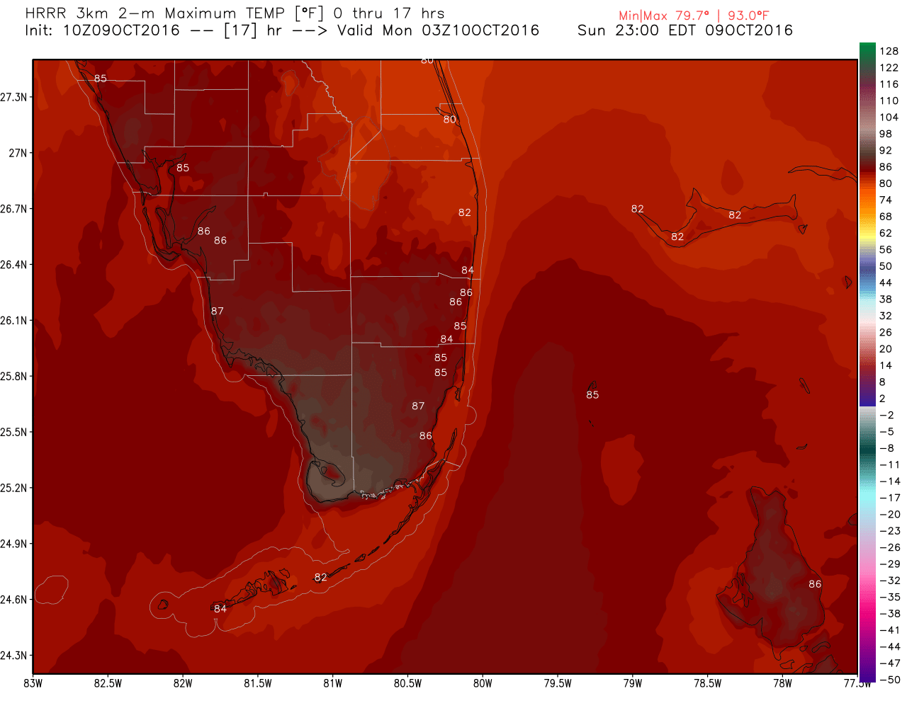
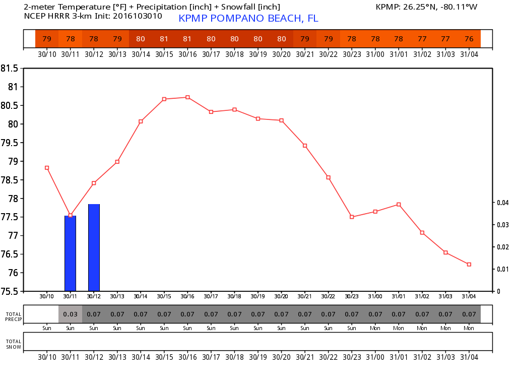
We have one more day of breezy, light showers as drier air works into the area this afternoon. High today will be 81F as clouds will again help keep our temps suppressed. The latest HRRR shows this:
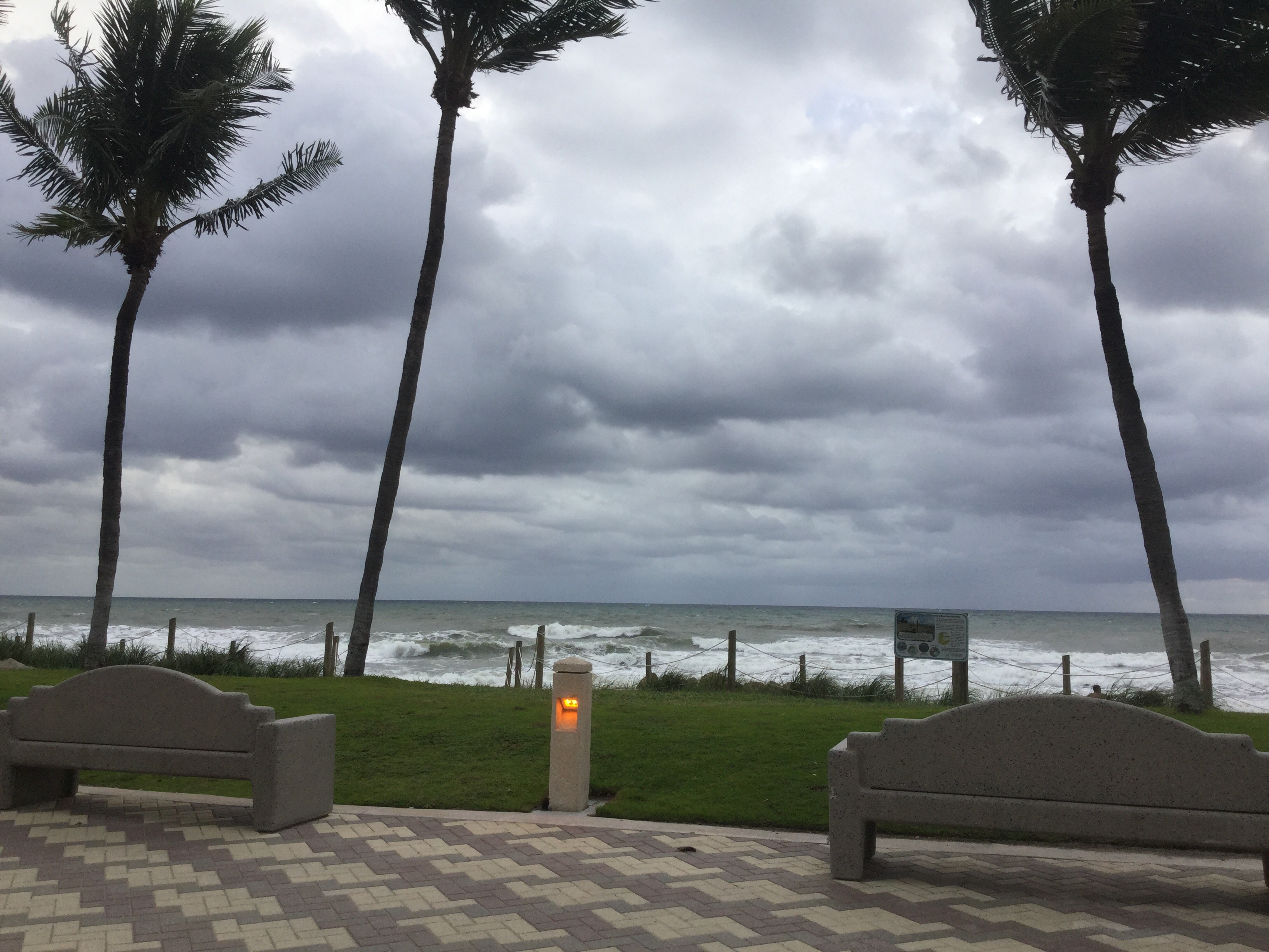
There is still a high risk of rip currents at the beaches since we will still have that stronger easterly wind affecting our area.
Halloween is still looking nice, more on that later today.