Not the Nicest Weekend, But We Will Take the Rain

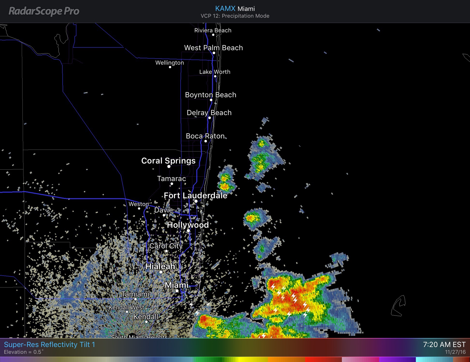
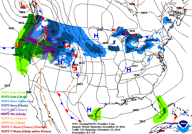
Starting the day with showers near and offshore.  This is a result of a stationary front to our south.


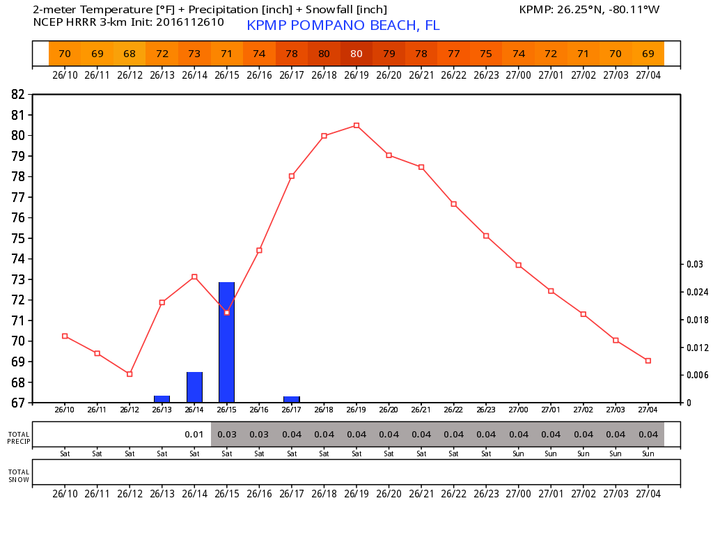
For today we are clocking and breezy and cloudy conditions with showers scattered around with a high of 77F.  A bit cooler than we have been due to the clouds and rain today.  Rain amounts will not be extreme but there be some ponding on the roads.

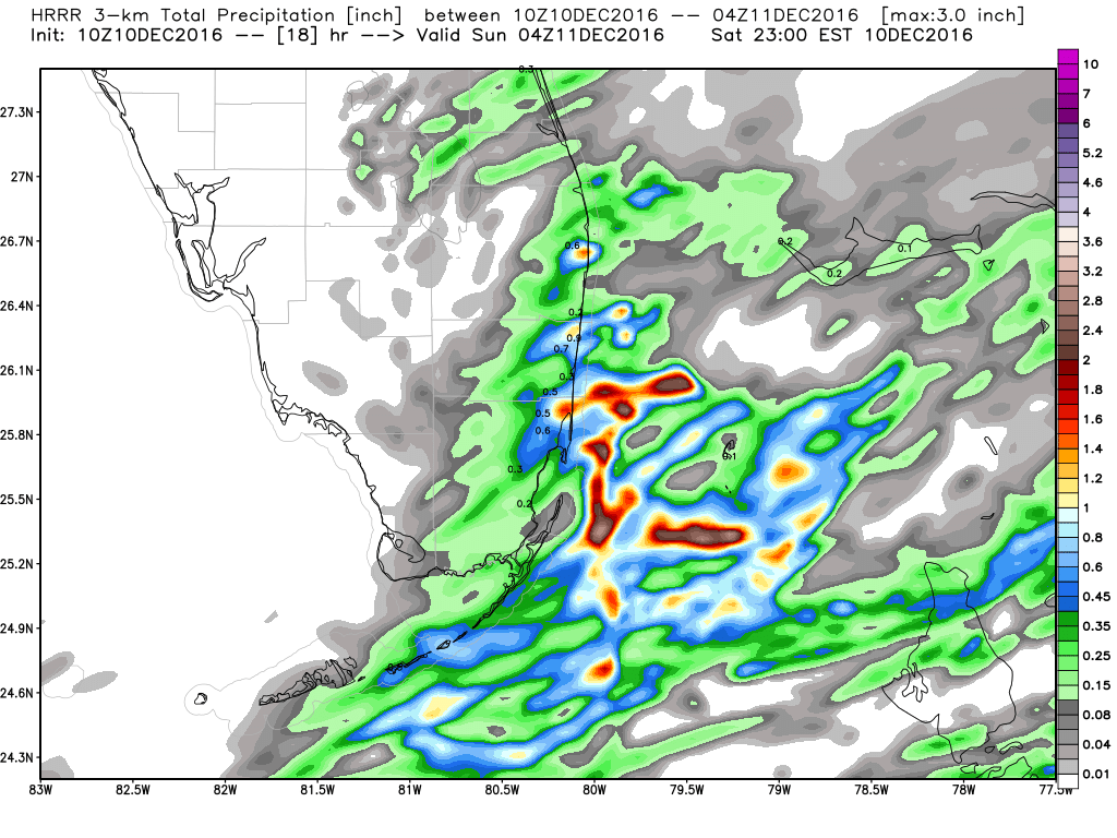
Rainfall totals through tonight according to the latest HRRR for our area:


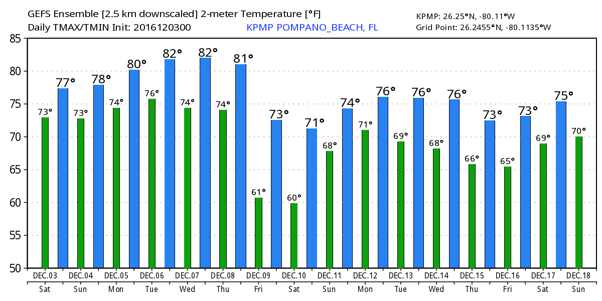
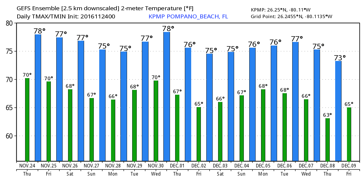
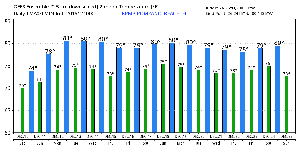
Looking ahead, with much of the nation under a much colder air mass we can expect very mild temperatures through Christmas Day according to the GEFS:


Have a great day!

Sunday – More Clouds and Breezy

For our Sunday we will have overcast and breezy conditions with a few drops of rain here and there.  At this point I do not see anything accumulating.  High today 79F.

Still watching out for next weekend and the cooler air that will affect much of the eastern half of the country.  We are still seeing about a 10F spread between the GFS and Euro for our Saturday lows, 60F vs 49F.  It will be interesting to see which model is more correct this far out.  Here are the state’s lows for next Saturday which should be the coldest of this air mass.


Will update later on the week ahead and the model progression for our lows next weekend.

Nice, Breezy Weekend – Cooler Next Weekend

We had a cold front move through the area overnight and is now nearly stationary through the Strights.  The morning clouds will break towards noon as we turn breezy and pleasant.  High today 79.  Here are the area highs with the latest HRRR:


Not much change to our weather as we go through the week until a cold front should sweep through the area around Friday giving us a fairly cool weekend.  How cool?  Well, maybe towards 50F but the models are still trying to get in come agreement with a 10 degree spread between the latest GEFS and Euro.  Here is the highs/lows with the latest GEFS:


More on this later.

Sunday – A bit Cooler and Drier

As we start today we have some scattered showers associated with a cold front that is currently moving trough the area.  The shower activity is just offshore  it could skim the coastal areas as we move through the morning.


Pompano is currently at a delightful 63F and cloudy.  With the cold front moving through I do not expect our high today above 80F and this is also shown with the latest HRRR:

Do not expect much cold out of this front as tomorrow morning’s lows will be around 70F.  The rest of the week does not look too bad with slightly warmer temps as we go through the week.  Here is the latest GEFS highs and lows:


Enjoy the outdoors today!

Happy Thanksgiving, Not a Turkey of a Forecast

Happy Thanksgiving to all of my readers and viewers.  I would like to wish all of you a bountiful feast with family and friends. 

For those of you in the Pompano area we have a very nice forecast.  We are starting this day with 75F (compared to 41F in New York for the parade) some clouds and breezy.  There will be a chance of rain through about noon and the cloudiness should break around then as well as we go to a high of 81F.  The latest HRRR shows that very well with the latest run.


For the rest of the weekend we will see much of the same as we hold onto the chance of a shower with not much of a change to our highs and lows.  This holds true for the foreseeable future with no wild changes expected to our temps.


One thing we will not have to contend with is Hurricane Otto which will affect Central America with its 105mph and more concerning flooding rains.


Enjoy your day!