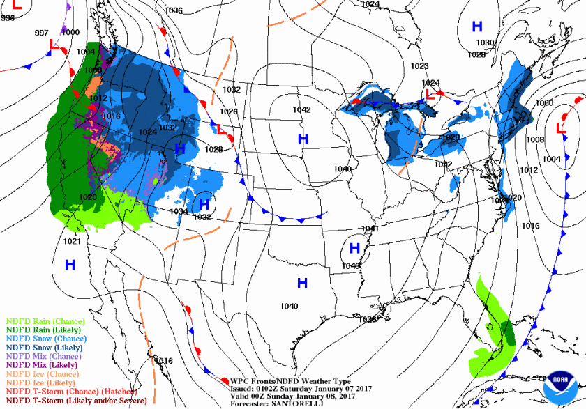
Quick update for the weekend – cooler weather is on its way as a front will sweep through the area late tomorrow afternoon and will be offshore by 7pm. This can be seen in the WPC forecast map for Saturday evening.

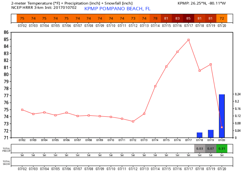
We will have a steep temp change with some showers as the front approaches then passes. Latest HRRR brings the front through early afternoon. The model gives us a high of 84 prior to the rain and in the hour after the frontal passage (FROPA) we have a nine degree drop.
 I will update the timing nad effect in the morning.
A couple notes from today’s weather, visibilities at Pompano Airport were .25 miles between 530 and 535am this morning. Also we reached a high of 80F.
Also our thoughts and prayers for those affected by the FLL violence this afternoon. Weird watching the coverage these evening for a place I know fairly well.
Discover more from Pompano Weather
Subscribe to get the latest posts sent to your email.
