
Not the driest forecast ahead today as Potential Tropical Cyclone 18 gets a bit more organized and expected to move southeast of us ahead of a cold front. The cold front will absorb the cyclone tomorrow quickly moving it out of our area leaving behind drier and cooler weather.
Currently 79F in Pompano with mostly clear skies. As we go through this Monring we will see rain moving in from the south and by late afternoon rain and thunderstorms will be widespread over south Florida. Latest HRRRR shows rain starting around 2pm and sticking around into the over night hours.

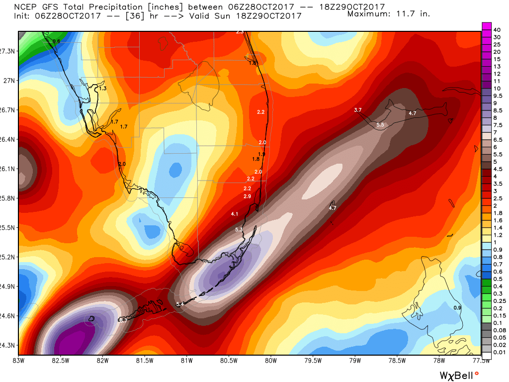
Main threats today will be heavy rain and gusty winds. Rainfall amounts could be two to four inches through tomorrow afternoon with isolated amounts of six inches. Latest GFS run shows rainfall amounts mostly in the two inch area.
And as I mentioned earlier cooler weather is on its way for Sunday. Highs and lows for the coming week according to the GEFS look very nice for this time of the year.

Enjoy the day and stay safe and dry!
Discover more from Pompano Weather
Subscribe to get the latest posts sent to your email.
