
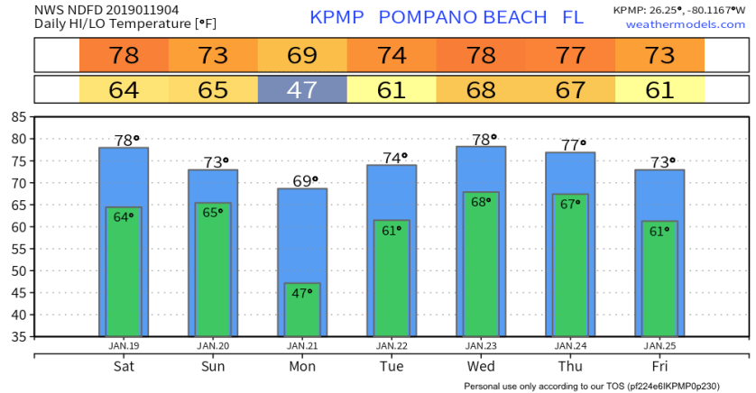
A bit of winter is on its way for Monday but before we get there we have a nice day ahead followed by some showers on Sunday. Starting today off at 62° with some clouds heading for a high of 79°.
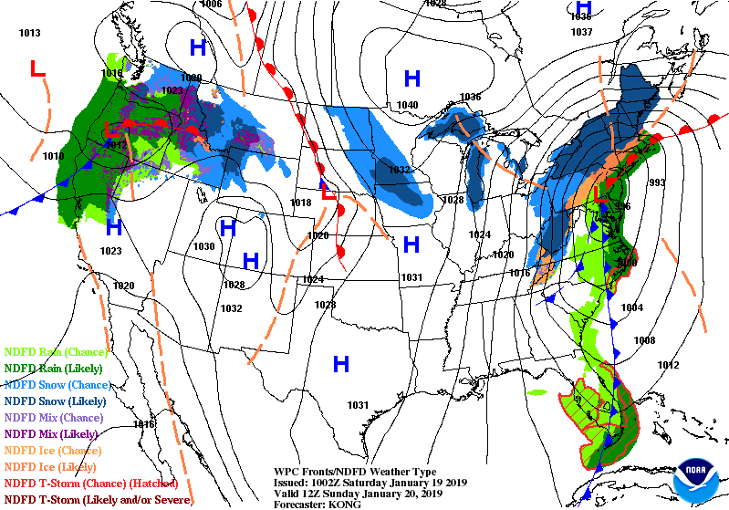
Overnight a cold front will approach the area and our rain chances will increase. Not expecting anything excessive with amounts around a quarter to a one-half inches. Once the front comes through tomorrow afternoon skies will clear and it will turn breezy and cooler. Coldest temps of the week will be Monday morning as we dip to just below 50°. We will warm up quickly starting Tuesday.
Forecast map for 8am shows the front and associated rain in the area.
Here are the highs and lows for the coming week.
Enjoy the day!
Discover more from Pompano Weather
Subscribe to get the latest posts sent to your email.
