
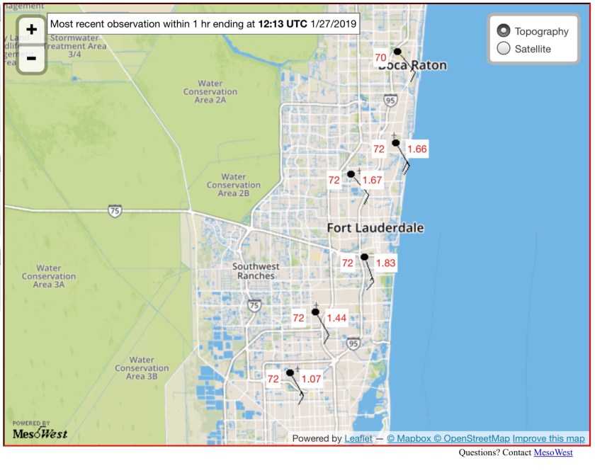
A bit warmer this morning compared to yesterday with a temp of 72°. In the past 24 hours Pompano Beach had 1.62 inches of rain. Other current temps and 24 hour rainfall are below.
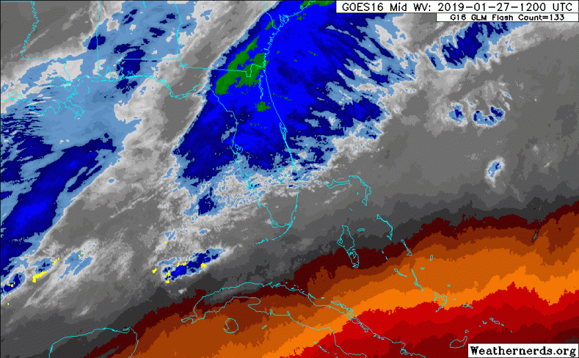
Rain has affected all areas out there this morning with more to come, current radar and water vapor satellite showing the area of activity in blue.

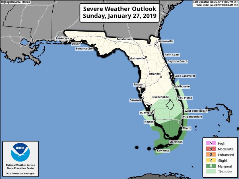
As we go,through today a cold front will approach and move through the area with plenty of shower activity ahead of it. So again today we will see planets of shower activity with a chance of strong to severe thunderstorms this afternoon. Focus for the stronger storms will be south of south of middle Palm Beach county and areas south. This is shown in the latest SPC outlook placing us in a Marginal risk of severe weather.
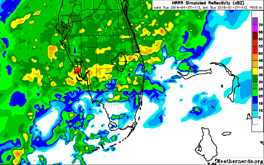
Timing of the strongest storms will be between 4pm and 11pm. Looking at the latest HRRR predictive radar activity does ramp up later in the day.
Main threats will be strong, gusty winds, brief heavy rainfall, and possible isolated waterspouts/tornadoes. Stay weather aware today.
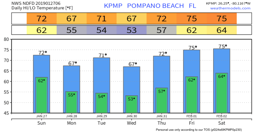
High today will be 74° and cooling down into Monday, next 36 hours look like this.

Next front will be mid-week and should be mostly dry and uneventful. Next seven days do not show any real extremes.
I will post updates on Twitter as needed, enjoy your day!
Discover more from Pompano Weather
Subscribe to get the latest posts sent to your email.
