
NWS has issued a Severe Weather Statement for Palm Beach County until 12:15 PM
Category: Local Weather
Severe Thunderstorm Warning
NWS has issued a Severe Thunderstorm Warning for Palm Beach County until 12:15 PM
Special Weather Statement
NWS has issued a Special Weather Statement for Coastal Palm Beach County & Metro Palm Beach County Counties until 12:15 PM
Saturday – Afternoon Showers Ahead of a Cold Front
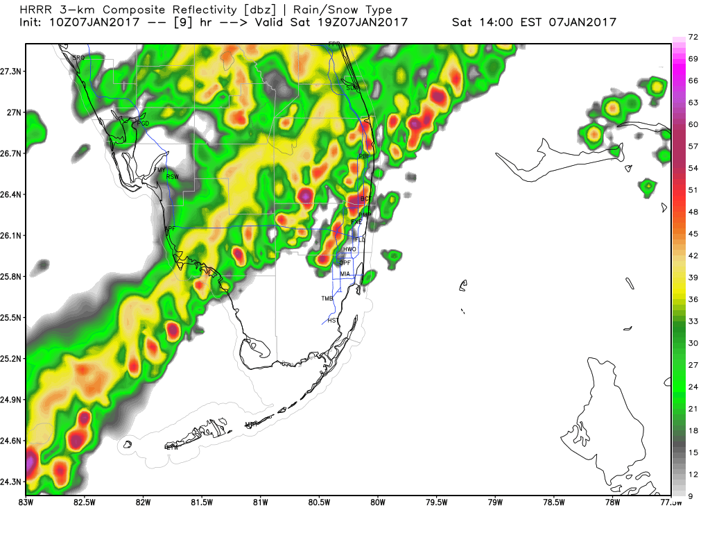
No real change to our expected weather today. Cold front is in the north/central Florida area with an area of showers and thunderstorms.
We will be warm through the morning with a high near 85F. After 12 noon we will have an increase in shower activity and possible thunderstorms through the afternoon. Then clearing and turning much cooler into the overnight hours. HRRR brings the activity in our area around 2pm.
Then a quick cool down after the passage of the front.
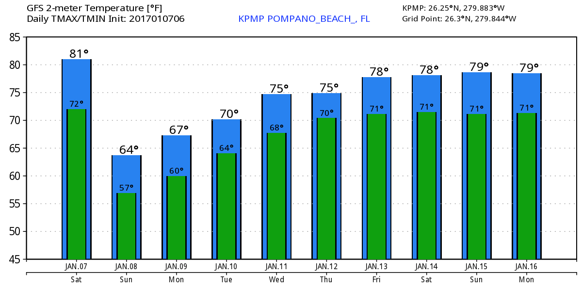
Sunday will be nice with breezy conditions and not as warm with a high of 66F. Here is the latest GFS highs and lows through next weekend:
If outside today keep an eye on the lightning and take shelter if you hear thunder.
Cold Front Sweeps Through on Saturday
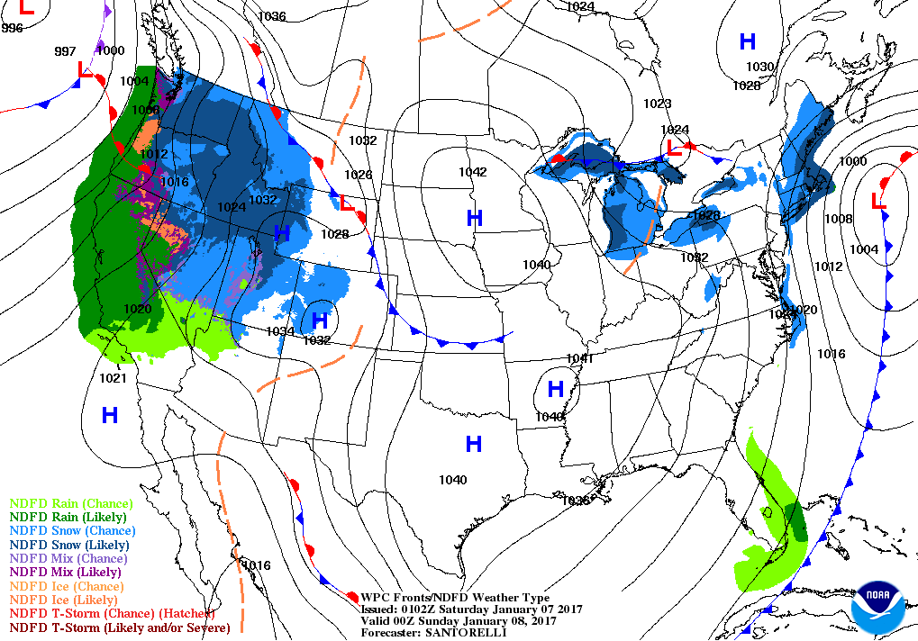
Quick update for the weekend – cooler weather is on its way as a front will sweep through the area late tomorrow afternoon and will be offshore by 7pm. This can be seen in the WPC forecast map for Saturday evening.
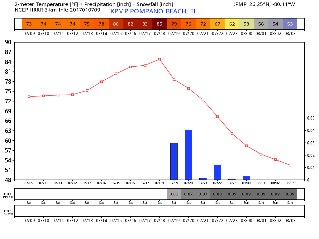
We will have a steep temp change with some showers as the front approaches then passes. Latest HRRR brings the front through early afternoon. The model gives us a high of 84 prior to the rain and in the hour after the frontal passage (FROPA) we have a nine degree drop.
 I will update the timing nad effect in the morning.
A couple notes from today’s weather, visibilities at Pompano Airport were .25 miles between 530 and 535am this morning. Also we reached a high of 80F.
Also our thoughts and prayers for those affected by the FLL violence this afternoon. Weird watching the coverage these evening for a place I know fairly well.
Special Weather Statement
NWS has issued a Special Weather Statement for Coastal Broward County & Coastal Palm Beach County Counties until 09:00 AM
Special Weather Statement
NWS has issued a Special Weather Statement for Coastal Broward County & Metro Broward County Counties until 01:00 PM
Special Weather Statement
NWS has issued a Special Weather Statement for Metro Broward County & Metro Palm Beach County Counties until 09:15 AM
NYE 2016 – Warmer and Mostly Dry
As we end 2016 our cool spell will end as well. Starting the day with the coolest temps in about 10 months of 54F. We will warm up rather quickly with the 70s by about noon and topping off around 76F. Here are the highs from the latest HRRR:

Only the very slightest chance of a shower today and tonight. If you are out tonight we will run about 12-15 degrees warmer with our over night low being 68F.
Thank you for being one of my readers in 2016 and looking forward to more in 2017. Have a safe and happy New Year’s!
Special Weather Statement
NWS has issued a Special Weather Statement for Coastal Broward County, Coastal Palm Beach County, Metro Broward County & Metro Palm Beach County Counties until 07:45 AM
