9/5/22 – Labor Day 2022 Hot and Mostly Dry

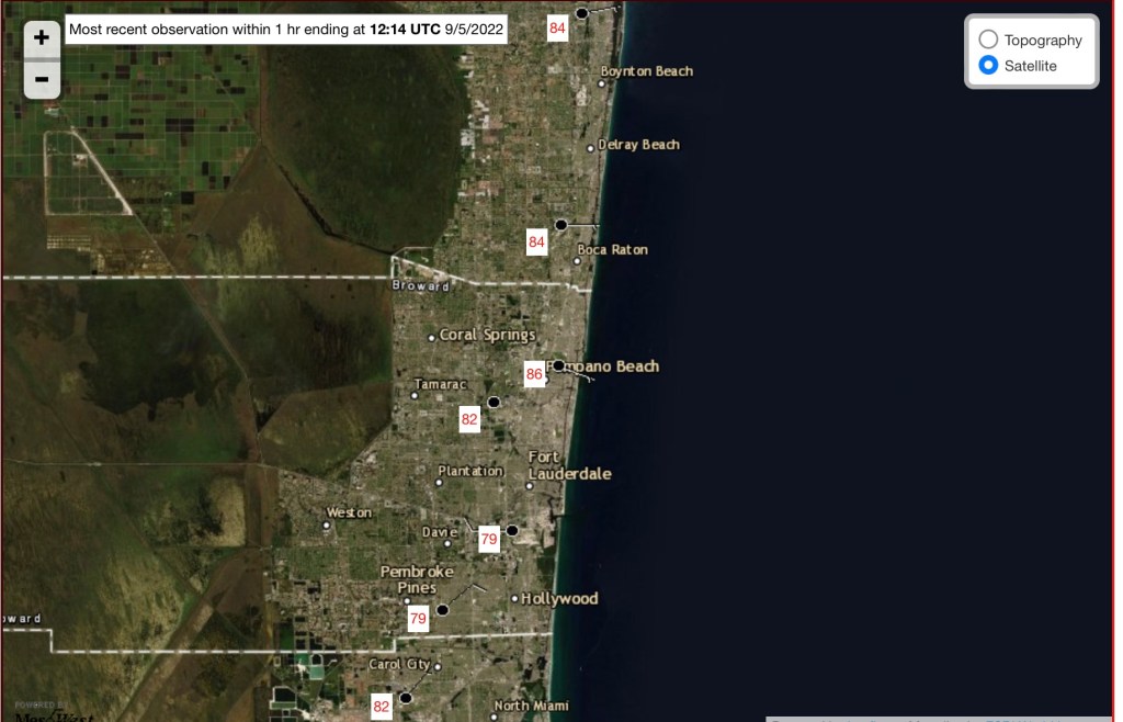
Starting Labor Day Monday with 86° in Pompano as we prepare for a high today of 93°. Yes, still quite summer-like today. Latest temps around the SE coast look like this at 8am.

8am temperatures 9/5/22.

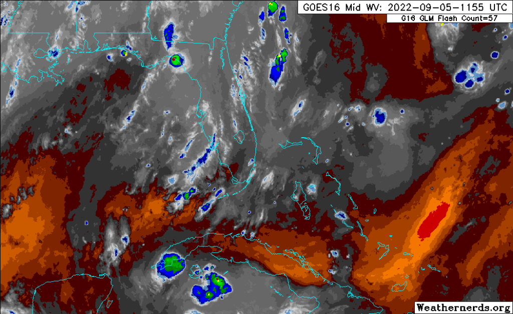
Latest satellite shows some clouds and the dry air we had over us is now well to our south.

Water vapor imagery from 755 am this morning.

Overall today only a chance of a shower and a possible thunderstorm. Shower activity will be mostly in the morning areas and more focuses on the west coast in the afternoon and evening. We will see this pattern for the first part of the week.

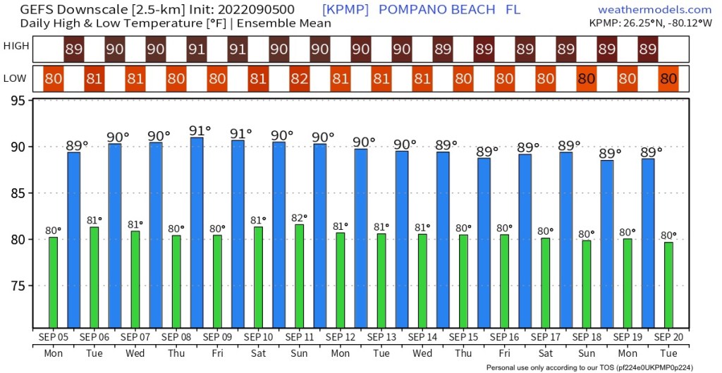
Since we are now in the Fall, meteorologically, we can start looking at the extended forecast models for the first hints of Fall weather. According the latest GEFS, we are not there yet. The next two weeks appear to not break the Summer patter.

Modeled (GEFS) highs and lows through September 20.

Have a safe and enjoyable Labor Day.

Advertisement

Happy Thanksgiving 2020 – Almost Perfect South Fla Weather

Happy Thanksgiving and we have almost a weather-perfect day to be outside with only the slightest chance of an afternoon shower. Just keep that in mind if you are having your meal outside but this will only be a very isolated issue and should be quick.

Otherwise we will have some clouds, a nice breeze, and a high of 80F. This should be the trend we see through the holiday weekend with only the slightest chance of a fast moving shower.

After the weekend we will be watching for the cold front that will really change on weather starting Tuesday, a nice drop in temps coming up.

Enjoy your holiday as I share this Tweet:

https://platform.twitter.com/widgets.js