
Waking up this morning to 85F with a few point of 75F with our easterly flow off the ocean continuing. Radar at this time only shows a few isolated showers mostly over the Atlantic waters.
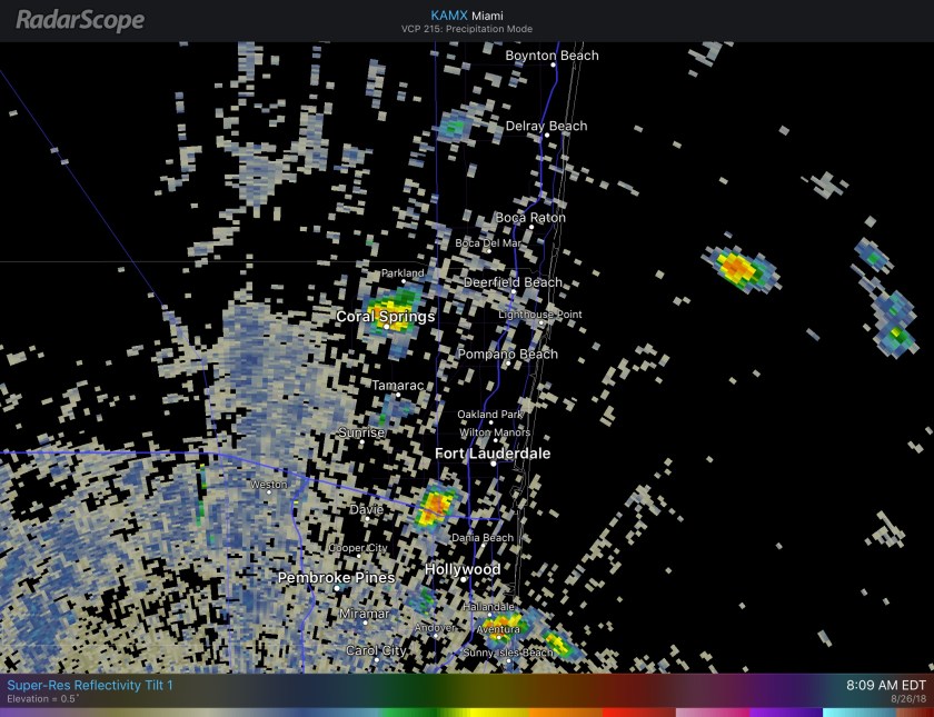
As we go into the afternoon we will see some showers and thunderstorms develop near the coast and move inland. Latest HRRR shows the timing in the noon to 2pm time frame. Not all will get wet.

After the activity moves inland we will still run a chance of rain but not as likely as the early afternoon period and most of the showers will subside by sunset for the east coast region.
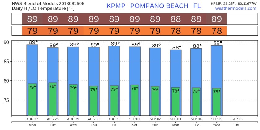
Highs today will be a touch warmer than yesterday at 89F with more sunshine today. In fact we will be somewhat consistent with our highs and lows over the next few days as the easterly flow continues.
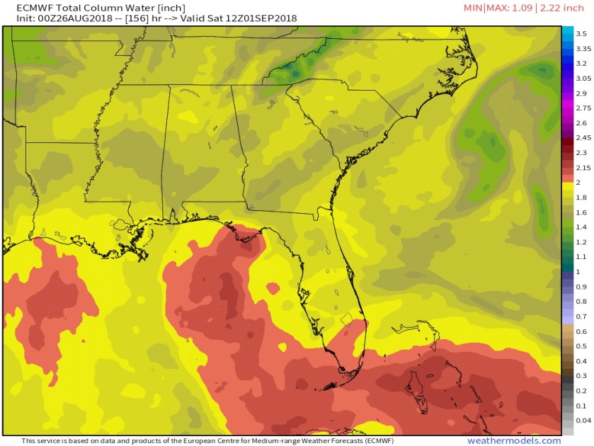
For the week ahead rain can happen most anytime but the main focus will be that late morning and early afternoon period. Into next weekend models depict a tropical wave affecting the area for the Labor Day weekend. Models do not develop it at this time before us and the GFS is dryer while the Euro is more wet. Win concern would be heavier rainfall for south Florida. This is a week out and will be watched but nothing to worry about at this time. This is the Euro for Saturday showing ample moisture over the area (dark orange).
Enjoy your day!
Discover more from Pompano Weather
Subscribe to get the latest posts sent to your email.
