
Just a quick post that for the sixth year in a row we may see a named storm form prior to June 1. Models are indicating that a low may form southeast of Florida and move north over the Bahamas where it could further develop into a tropical storm. The area the NHC has indicated where it may form is in red this weekend.
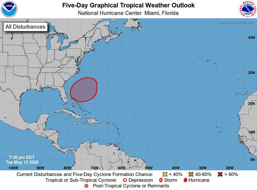
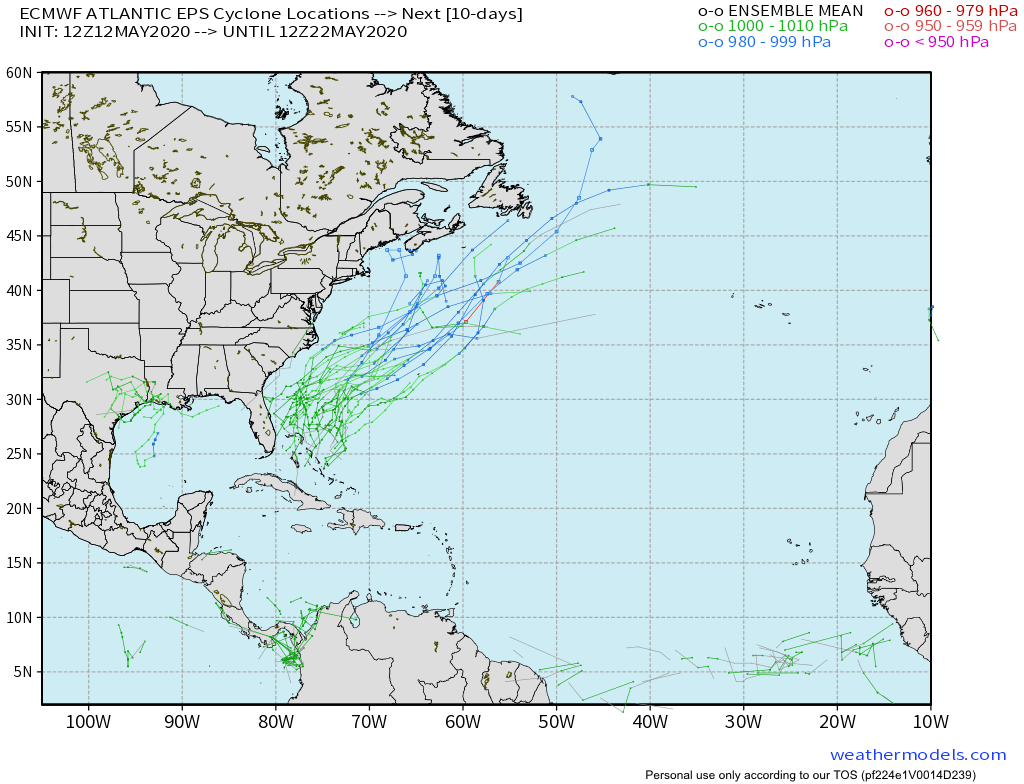
Though we will have a good chance of rain Friday through the weekend we will see no direct impacts besides the rain from this system if it develops. Global models all indicate that the system will move AWAY from Florida. The latest ensemble from the Euro help depict this.
I will have an update later this week on the evolution of this system and our weekend weather.
Discover more from Pompano Weather
Subscribe to get the latest posts sent to your email.
