
This is a test post using QGIS to produce and publish maps.
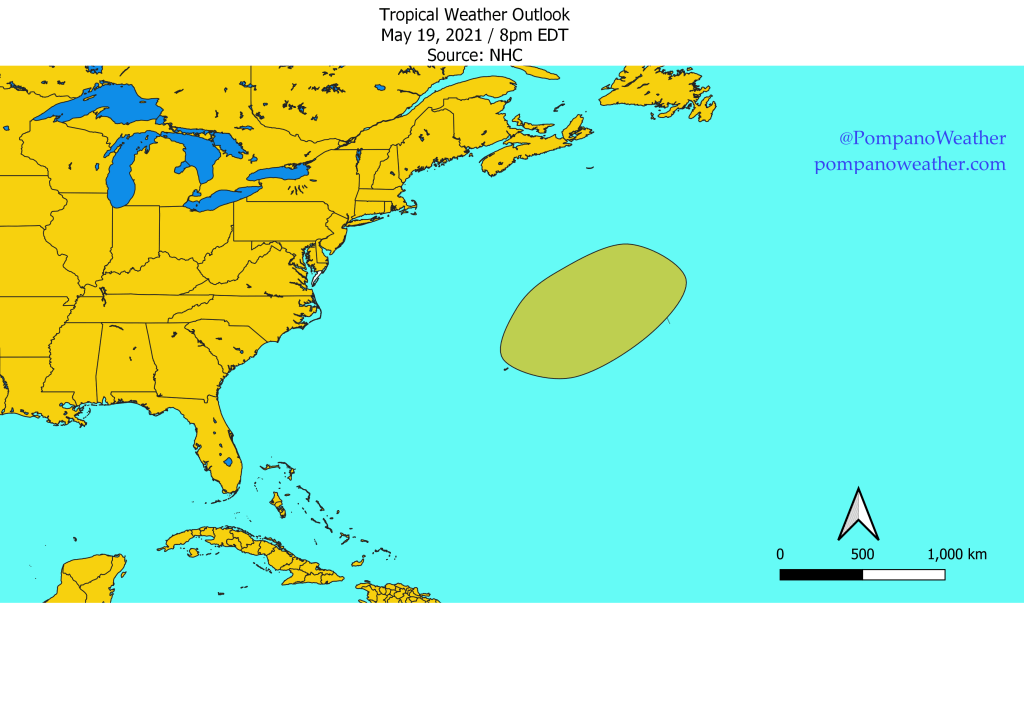
Tropical Weather Outlook
NWS National Hurricane Center Miami FL
800 PM EDT Wed May 19 2021

For the North Atlantic...Caribbean Sea and the Gulf of Mexico:

1. A large area of cloudiness and thunderstorms has developed several
hundred miles east of Bermuda. A non-tropical low pressure system is
expected to form within this broad cloud system a few hundred miles
northeast of Bermuda by tomorrow and produce gale-force winds. The
low is then forecast to move westward and southwestward over warmer
waters on Friday, and will likely become a short-lived subtropical
cyclone late Friday and into the weekend near and to the northeast
of Bermuda.  The system is expected to move toward the north and
northeast into a more hostile environment by late Sunday into
Monday.  For more  information on this developing system, please
see High Seas forecasts issued by the Ocean Prediction Center.
* Formation chance through 48 hours...low...30 percent.
* Formation chance through 5 days...medium...60 percent.
Discover more from Pompano Weather
Subscribe to get the latest posts sent to your email.
