
Hurricane Elsa has weakened a bit since last night but maintains hurricane status with maximum winds of 75mph and a minimum pressure of 999mb. Elsa is moving very quickly towards the WNW at 31mph.
Latest location with the 5am forecast cone are below showing extreme SE Florida just beyond the boarder. This does not mean we are clear, just the center is not likely to track over us. We can expect rain and gusty winds Monday and into Tuesday, though this is still very fluid.
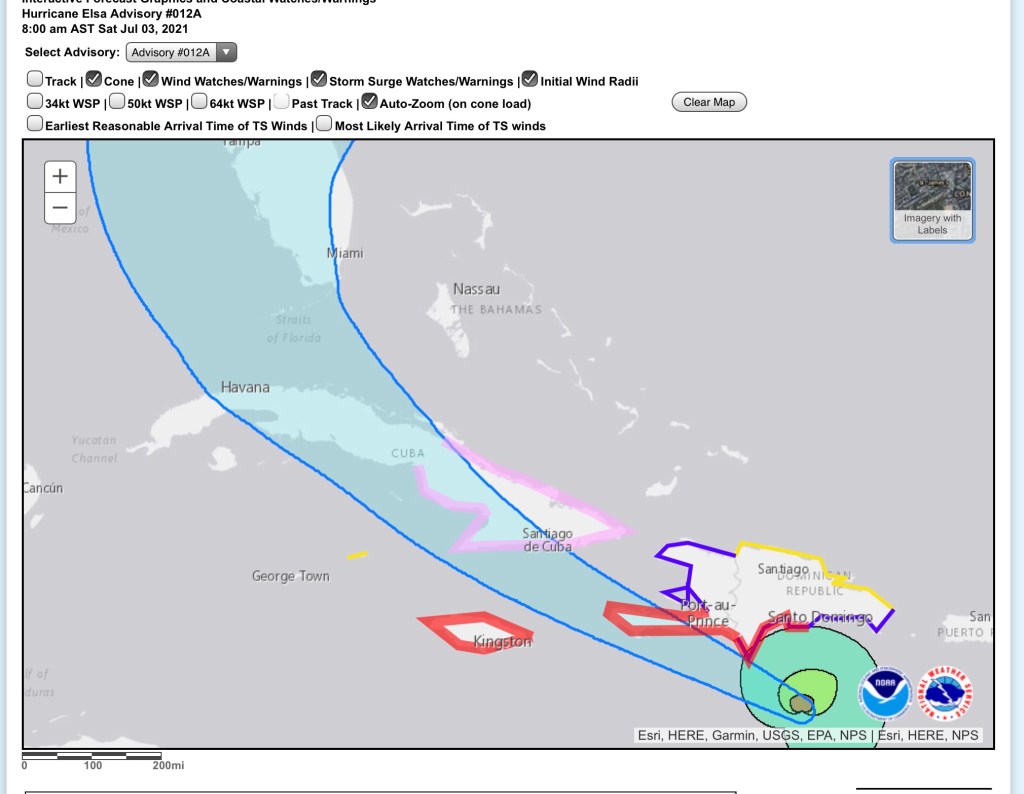
Latest model plots continue to favor west of south Florida.

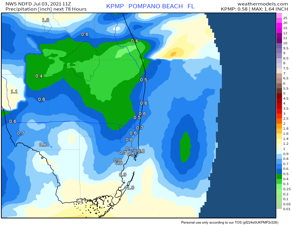
For the weekend, we should see less rain than in the previous couple days. Rainfall amounts are expected to be less than an inch.
I will have an update after the 11am advisory.
Discover more from Pompano Weather
Subscribe to get the latest posts sent to your email.
