
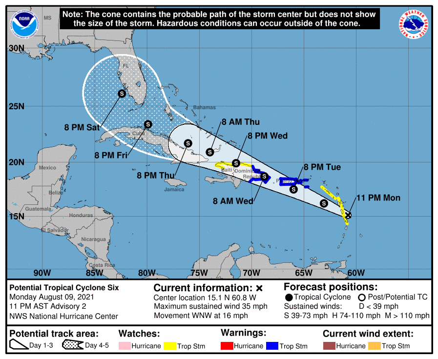
Quick update, watching PTC 6 that was designated earlier this evening. As of 11pm south Florida remains in the forecast cone as the system continues to develop. Currently, most model guidance is in line with the official forecasts keeping what is likely to become Tropical Storm Fred below hurricane strength through five days. Impacts from the storm are likely to affect the area between Friday and Sunday with the primary threat being heavy rain and gusty winds. It is too early to determine the exact extent but as of now the worst case would be five or six inches of rain and wind gusts up to 45 mph.
We will need to continue to monitor this storm through the week. I will have further updates tomorrow.
Discover more from Pompano Weather
Subscribe to get the latest posts sent to your email.
