
As of this morning Fred is very disorganized with a broad rotation as it emerged off the coast of Haiti early this morning. Recon is currently investigating the storm and has yet to find any tropical storm force winds. Fred will continue to be watched as it is now over warm waters to see how/if it evolves while traveling in the direction of Florida.

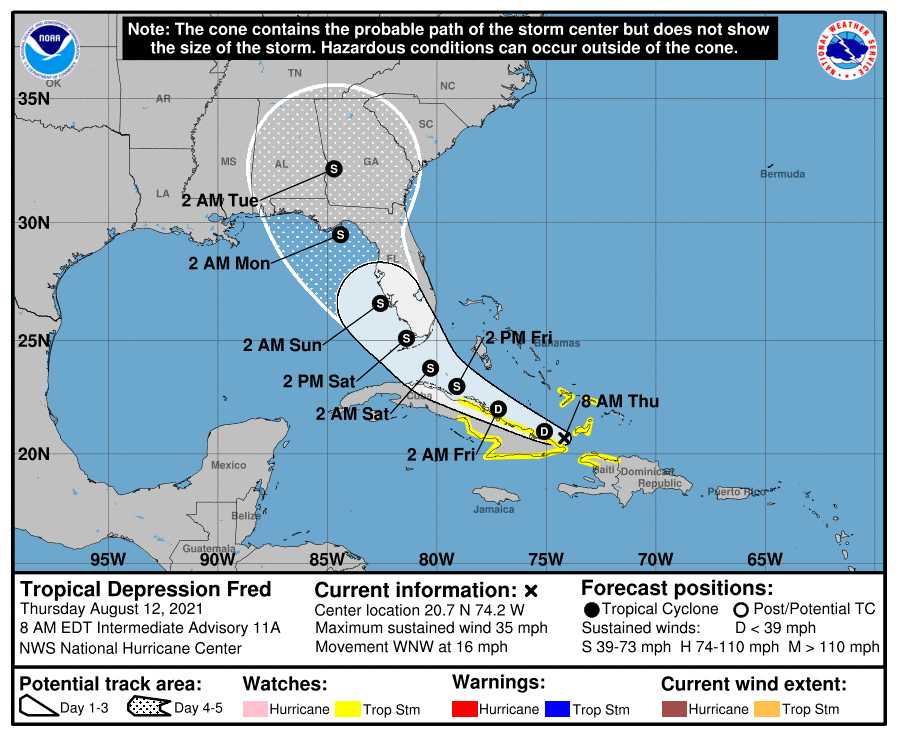
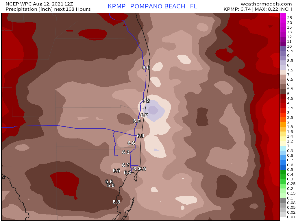
Current forecast has not really changed, and with a disorganized system the overall intensity is not the concern. Rainfall could be plentiful this weekend, the Weather Prediction Center latest forecast calls for areas of five plus inches through this weekend for parts of SE Florida.
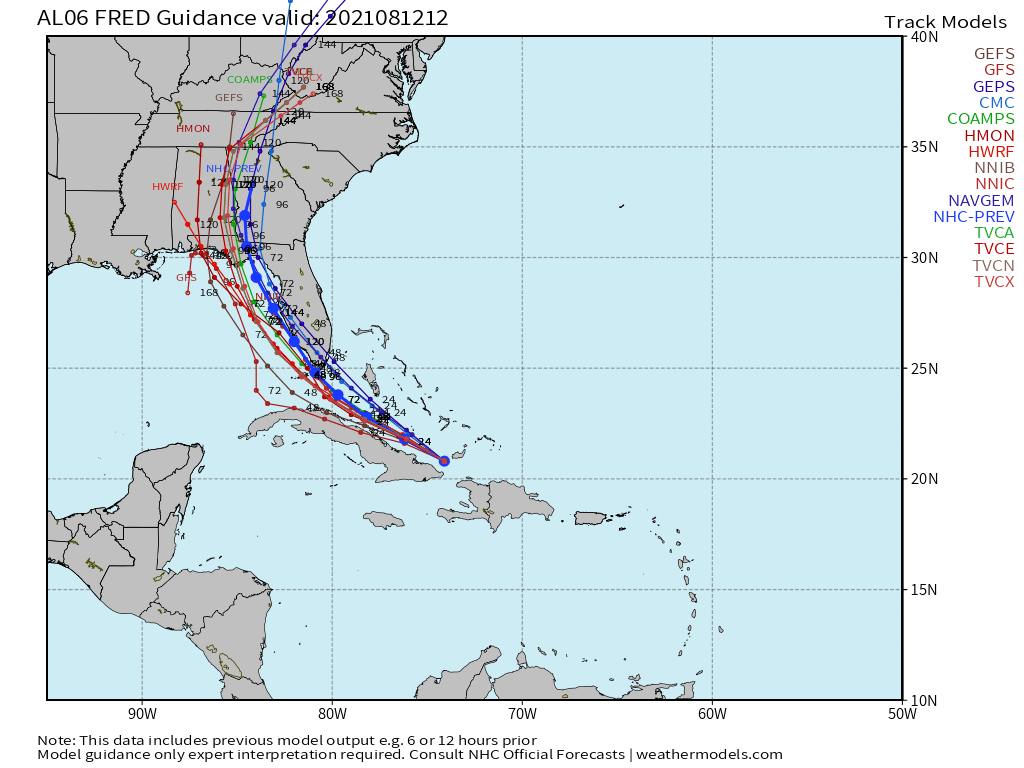
Latest tropical models remain consistent and in line with the current NHC forecast.
Current forecast time line is for shower activity to ramp up on Friday and rain should be plentiful Saturday with some gusty winds. By Sunday shower activity will likely decrease into the afternoon and into the evening.
More updates later today with quick updates on Twitter PompanoWeather
Discover more from Pompano Weather
Subscribe to get the latest posts sent to your email.
