
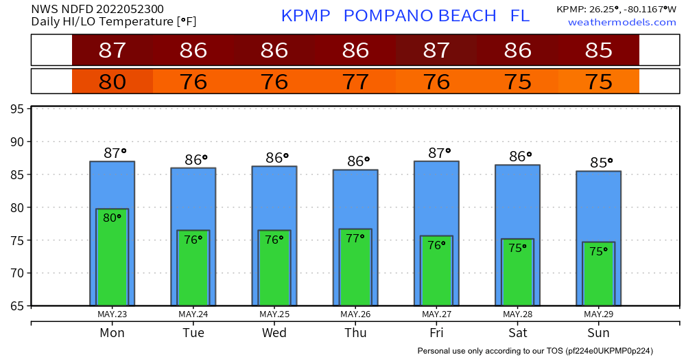
After a very wet and storm end of last week, then a dry, very warm weekend we will see some moderation in the temperature as we go into this new week. Rain chances do not increase until mid week and then do return for the Memorial Day weekend with a trough of low pressure that will be in our area. We will look closer at the weekend later in the week. Here are the forecasted highs and lows for the next seven days.
We also have our first tropical disturbance identified this evening. This will not affect south Florida but just a reminder the season is upon us. This is the time to begin our preparedness.

Discover more from Pompano Weather
Subscribe to get the latest posts sent to your email.
