
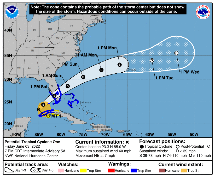
Not much change to the forecast and expectations overnight and into Saturday. The system does not have a closed circulation, hence it is still Potential Tropical Cyclone 1 (PTC1) Here is the latest forecast and the Tropical Storm Warnings in effect.
The system is not well organized with all of the convection east of the broad low pressure center. This is easier seen on water vapor imagery.
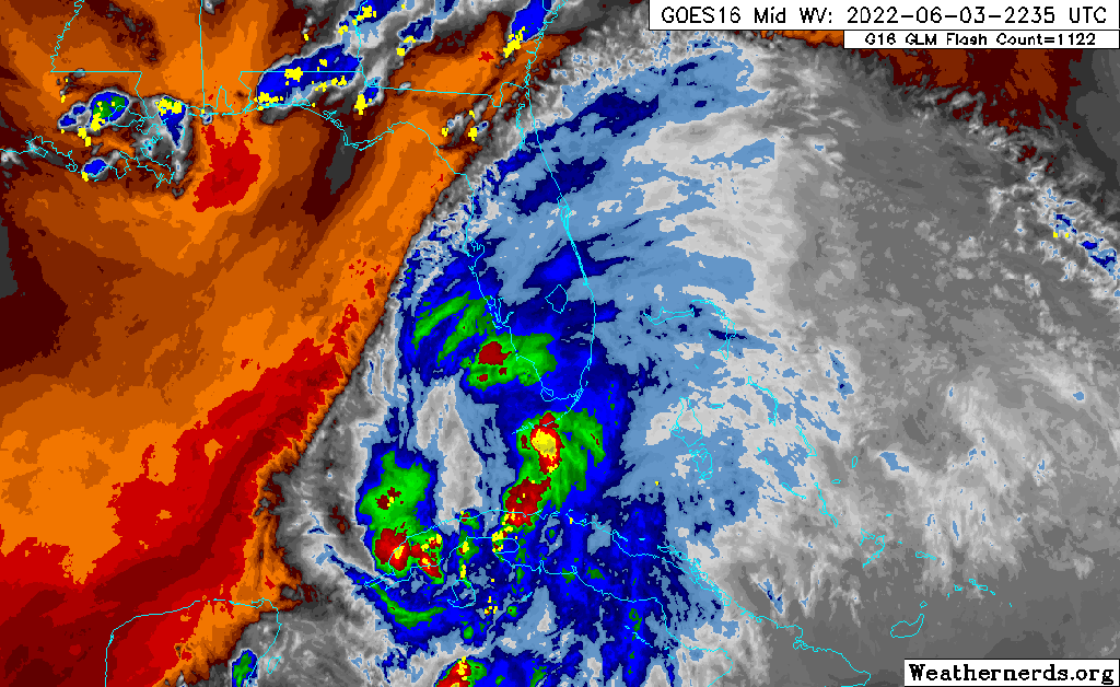
Looking closely at the loop above, it appears the activity is waning somewhat, not a sign of intensification. Rainfall through the weekend is still five plus inches for many areas.

Latest tropical models remain very consistency with taking the center over Lake Okeechobee. With this system, it is not about the system but the area of rain to the east of it.

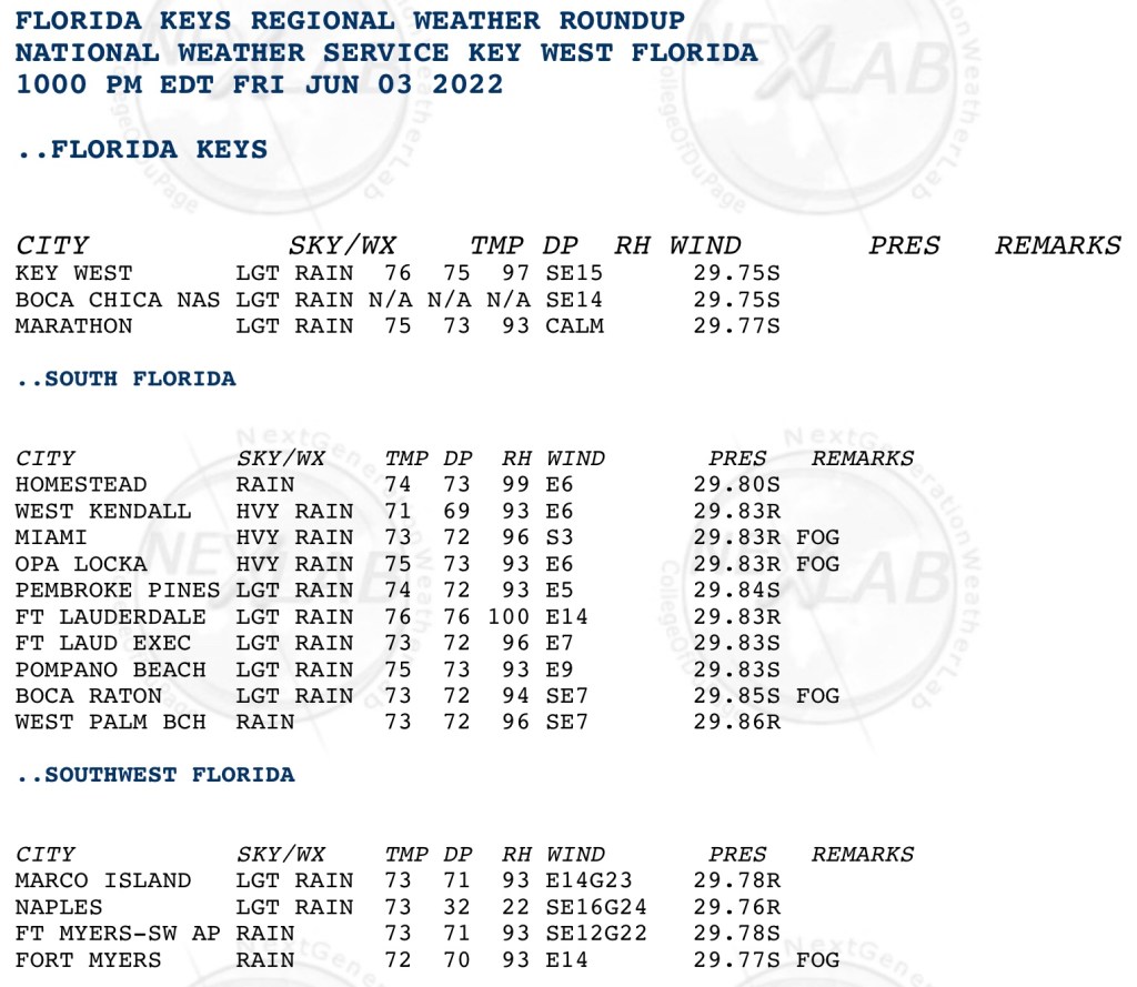
Lastly for now, here are 10pm observations from across south Florida and the Keys. Most sites are reporting rain to heavy rain, but the winds are not significant at this time.
I will have periodic updates on Twitter. Please share any pictures or observations you have as we go through the night and Saturday.
Discover more from Pompano Weather
Subscribe to get the latest posts sent to your email.
