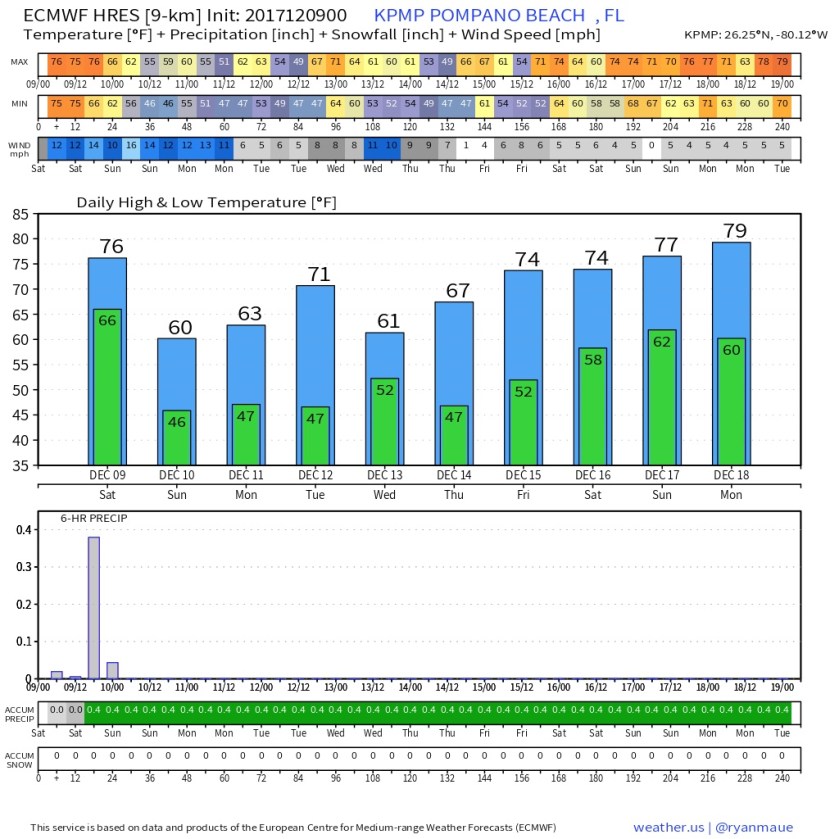
Good morning and at this time yesterday we were are 77F on the way to a high of 80F before the front came through. In Pompano we are at our low of 47F which is a 30 degree drop in 24 hours. Welcome Winter!
No hazardous weather today with cool, clear, blue skies, and breezy conditions heading to a high of 65F. Highs across the area today and difference from normal look like this:
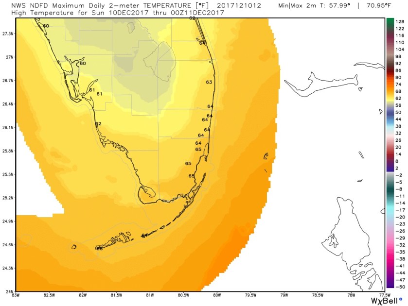
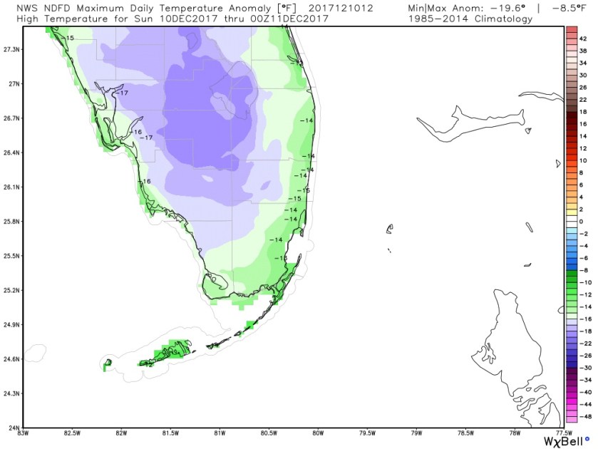
Most areas will be about 15 degrees below normal for our high. Lows tonight will be about the same as today.
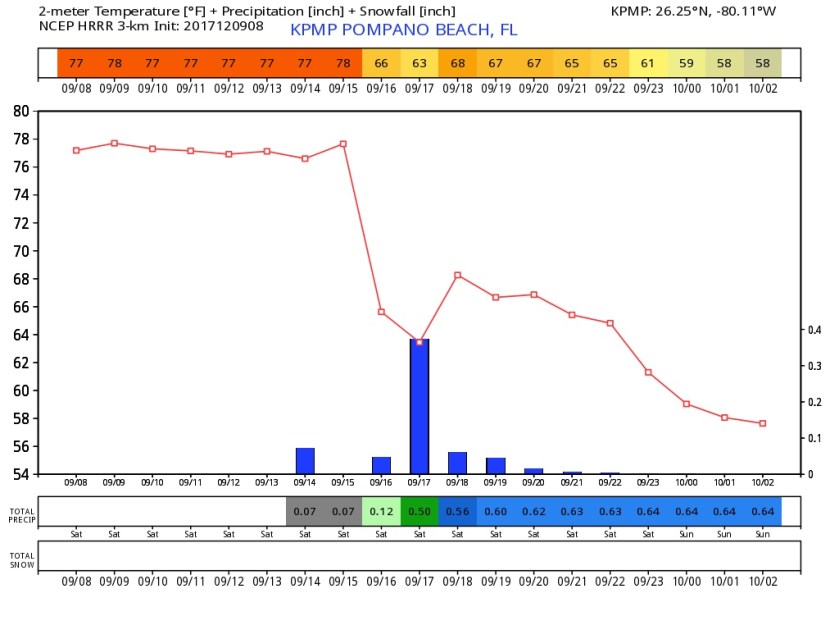
Looking ahead to the week mostly cooler weather with no rain through Friday. We will warm up towards the end of the week and into next weekend. Latest Euro for Pompano reflects this:

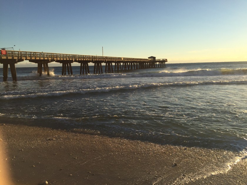
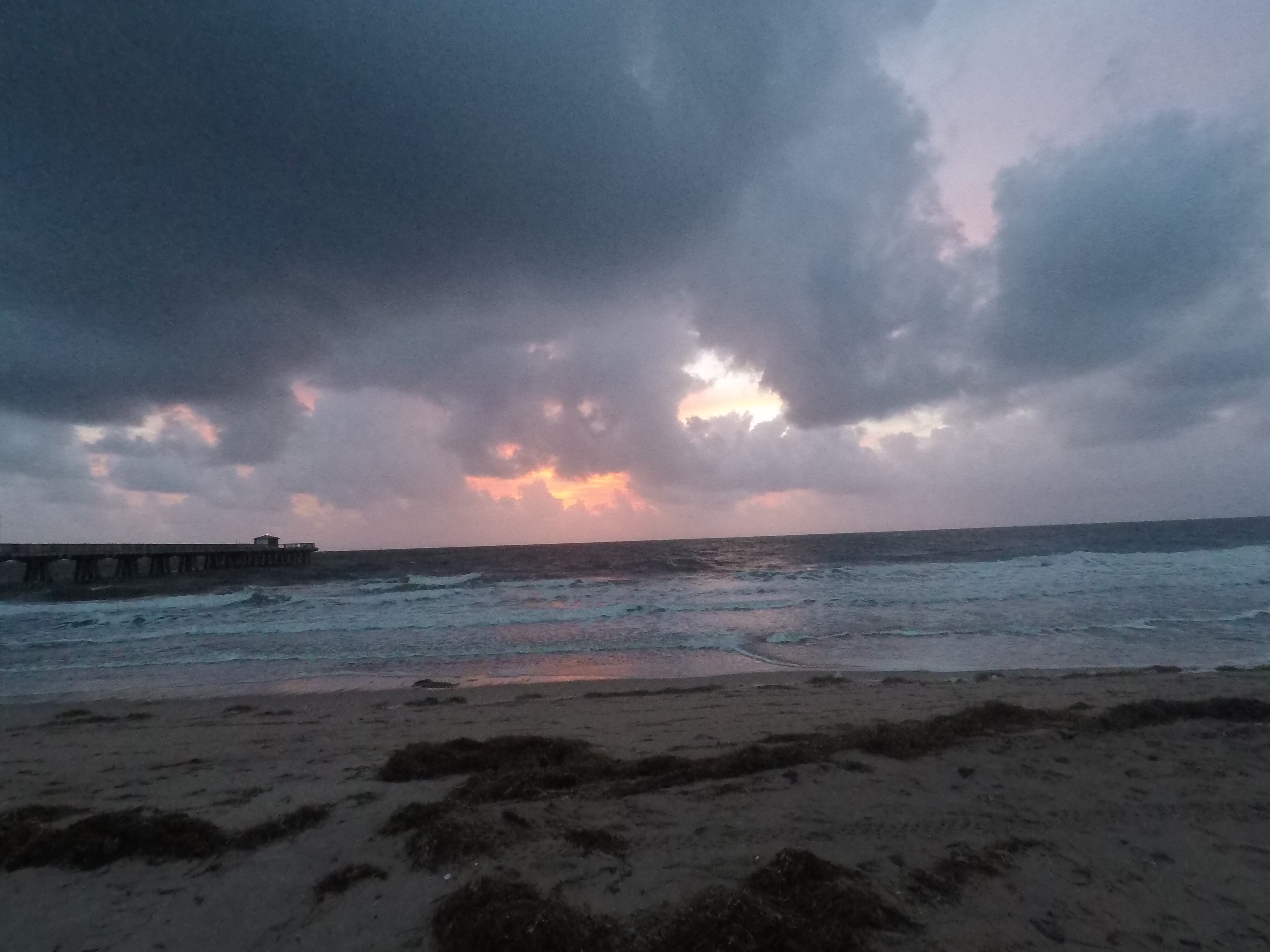
Get out and enjoy a south Florida winter day. Here is Pompano Pier from this morning. Enjoy!