9/18/22 – Work Week Forecast, Fiona Update

We are now in the second half of September already. For the week ahead, we will start with the same pattern we have seen since last week but with a decrease in rain chances by mid-week that will last into the weekend.

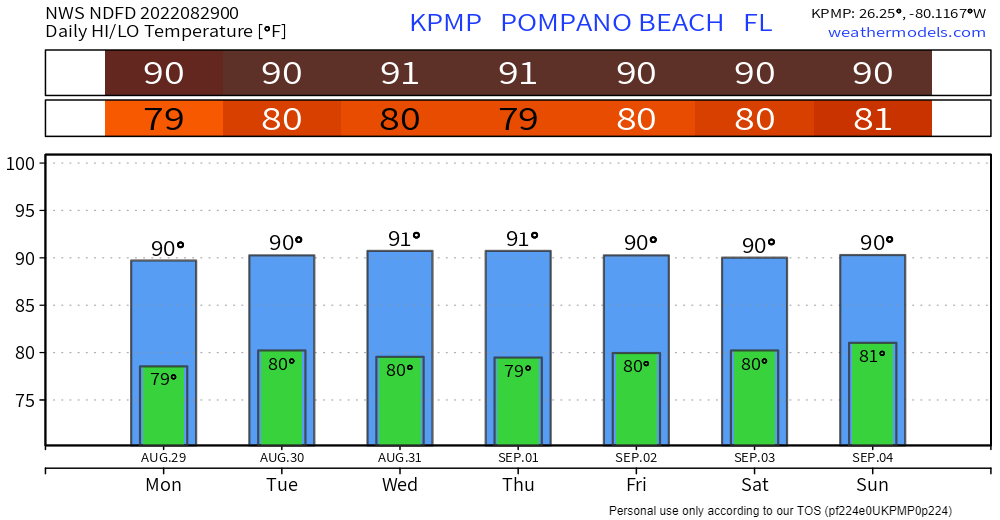
Temperatures This Week

HighsMonTuesWedThurFriSatSun
89898990918988

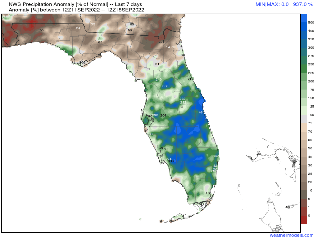
Rainfall this week did add up. All areas of south Florida received more than 100% of average rainfall while most in north Florida were less than average.

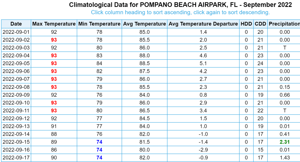
I did want to show the highs in Pompano so far in September. The first 12 days had highs of either 92F or 93F. Here is the climate data so far from https://xmacis.rcc-acis.org/

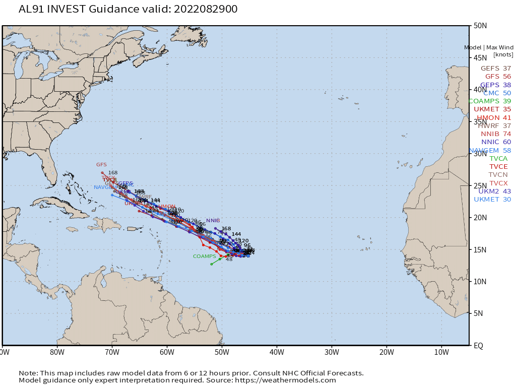
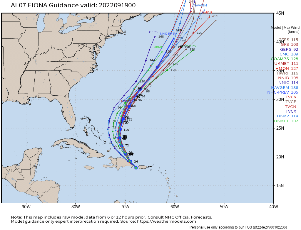
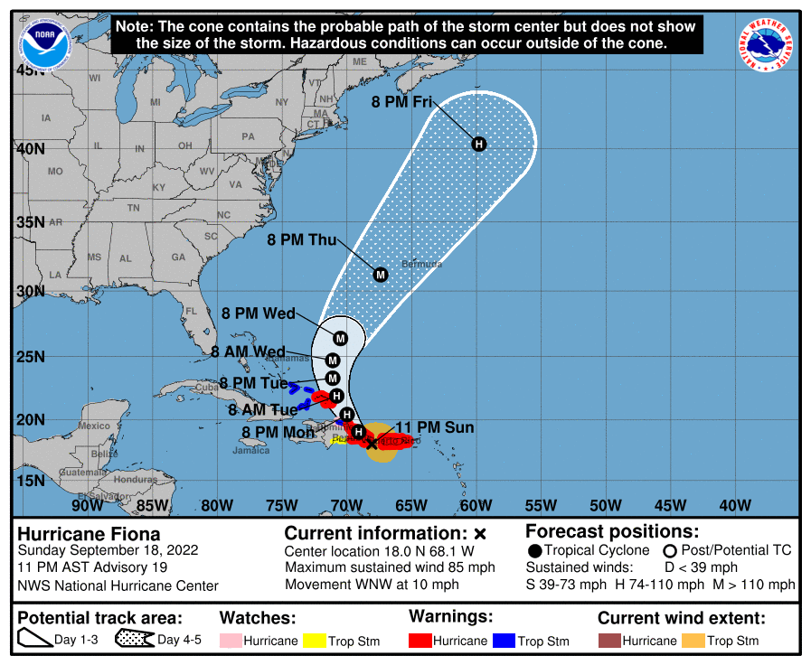
Hurricane Fiona caused major flooding in Puerto Rico today, and reports state that the entire island is currently without power. Fiona is will not directly impact the US, but it will help bring us a nice breeze Wednesday through Thursday. The latest models are in excellent agreement and the latest NHC forecast as of 11pm is below as well.

Models as of 8pm on September 18, 2022.
11pm advisory on September 18, 2022

Have a great Monday.

Advertisement

8/28/22 – School Week/Work Week Forecast

As we head into a holiday weekend, we will see another week where we will see some shower activity in the mornings. Afternoons will continue quite warm with some scattered showers around. Morning temps will be around 80F and the midafternoon temps around 91F.

Latest NWS highs/lows for Pompano this week.

The tropics have started to come alive after a mostly dormant August. This is not typical at all. On average, there are two named storms in the month. The 8pm Tropical Weather Outlooks indicates four areas being monitored; one of these areas (in red) has a high chance of development in the next five days.

8pm Tropical Weather Outlook

There are no immediate concerns for south Florida at this time. Though, all of us should have our storm supplies and plans ready.

The latest models on this system show some modest development as it treks across the Atlantic.

Please follow the site on Twitter @PompanoWeather for local weather updates and tropical news.

8/15/22 – Back to School Forecast (Broward)

And just like that, summer vacation is over. As many of us return to our daily school schedules here is what we can expect Tuesday.

Sunrise will be at 6:53 am with a few clouds and an possible isolated shower. Temperature will be 79°. For the afternoon, a better chance of showers and some thunderstorms, not expecting the coverage we saw today. High tomorrow will be 90°.

For the rest of the week we will see a similar pattern with the only change being a decrease in the afternoon rain chances.

Wishing everyone a successful, on-time first day!

Infrared image showing the remaining clouds from this afternoon’s showers and thunderstorms.

7/10/22 Work Week Forecast: Hot and Mostly Dry to Start Off

Though we are seeing some showers and thunderstorms this Sunday afternoon the week ahead will be quite warm with highs in the lower 90s. Rain chance the first part of the week will be low followed by a better chance of showers Thursday and Friday. Through Wednesday we may see between one-quarter and one-half inch of rain. Central and the panhandle part of the start will see greater amounts.

Rainfall amounts forecasted through Wednesday morning.

For tropical weather we will be watching a trough of low pressure over the southeast US that could generate an area of low pressure in the northern Gulf of Mexico by late week. I am not expecting this to directly affect us in south Florida.

Tropical weather outlook issued at 2pm Sunday.

Stay hydrated and enjoy your week.