After a couple rough days of weather for the mid-west area some “lighter” weather news today. First, the GFS rolled out an upgrade this morning starting with the 12Z run. Want to know the changes? Click here for the details.
ALSO TODAY MOST LOCAL NWS OFFICES STARTED to use mixed case in some of their text products, most notably is the Area Forecast Discussions (AFD). The first discussion from Miami to use this format was the 7:16am forecast discussion update which looked like this:
issued 716 AM EDT WED MAY 11 2016/

AVIATION...Winds have recently decoupled at most sites,
leading to light and variable conditions across the region.
Prevailing easterly flow will be little lighter today, but still
will see east coast sites increasing to 10-15kts behind sea breeze
around 14Z-15Z. Gulf coast breeze develops and pushes inland of
KAPF after 17Z-18Z with winds becoming W-NW. A few light showers
possible on sea breezes, with a few more showers over interior
22Z-01Z with sea breeze collision. Coverage not high enough to
mention VCSH at this time with no TSRA expected. Winds become
light and variable overnight at all sites.

Note: As of 5AM this morning, NWS Area Forecast Discussions will
now be in mixed case.

/ALM
More text products will be added as the year goes on. Still weird to see lower-case in these messages after years of ALL CAPS and minimal punctuation.
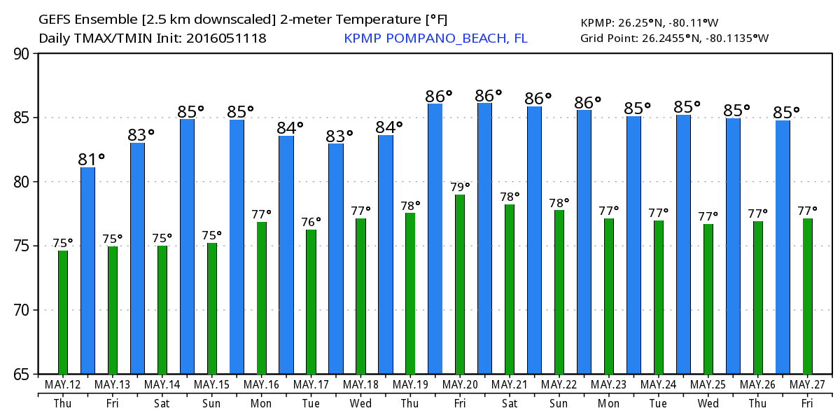
As for the weather itself, we remain warm with slightly above normal highs and lows through the next several days with a chance of showers starting tomorrow.