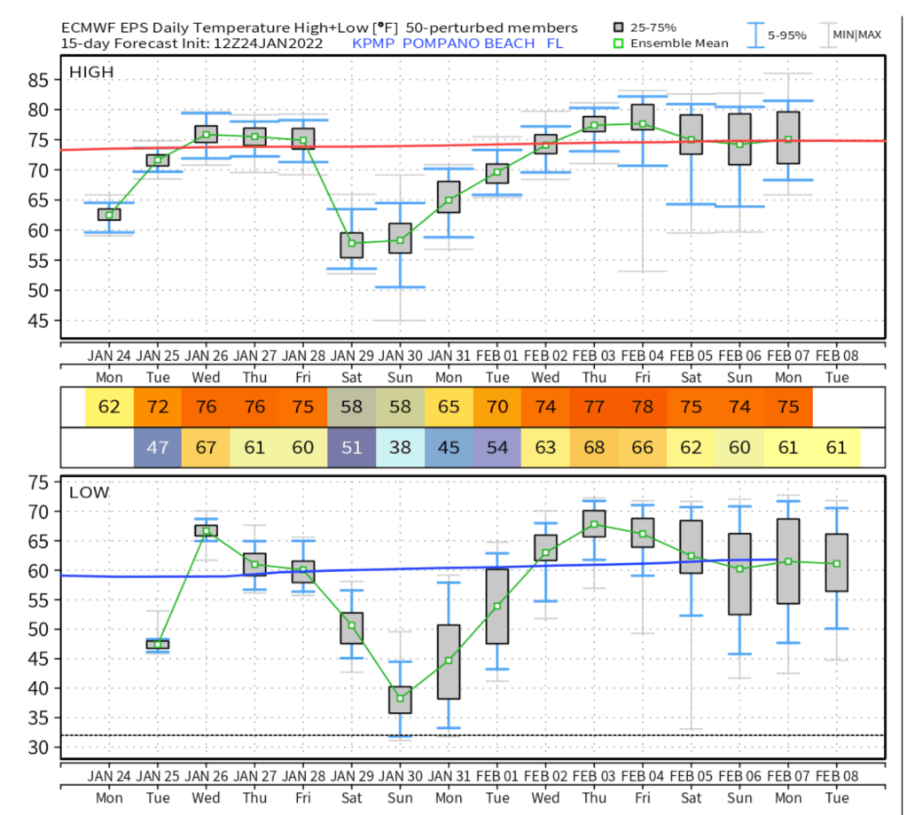
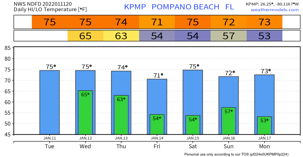
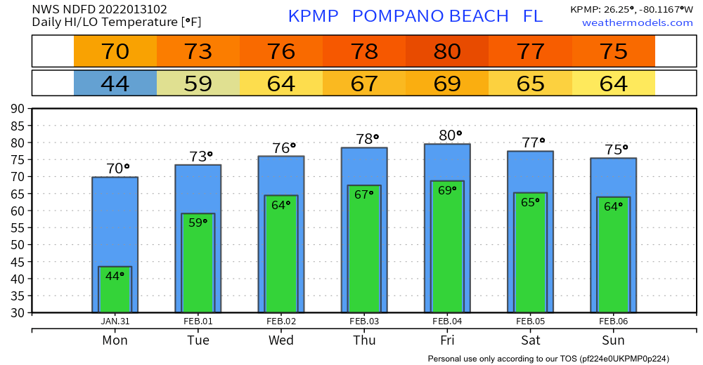
After a very cold weekend we are in for a gradual warmup this week. With lows in the upper 30s to around 40° this morning we will be about 5° warmer Monday morning. From there our gradual warming begins with a high of 70° Monday afternoon.
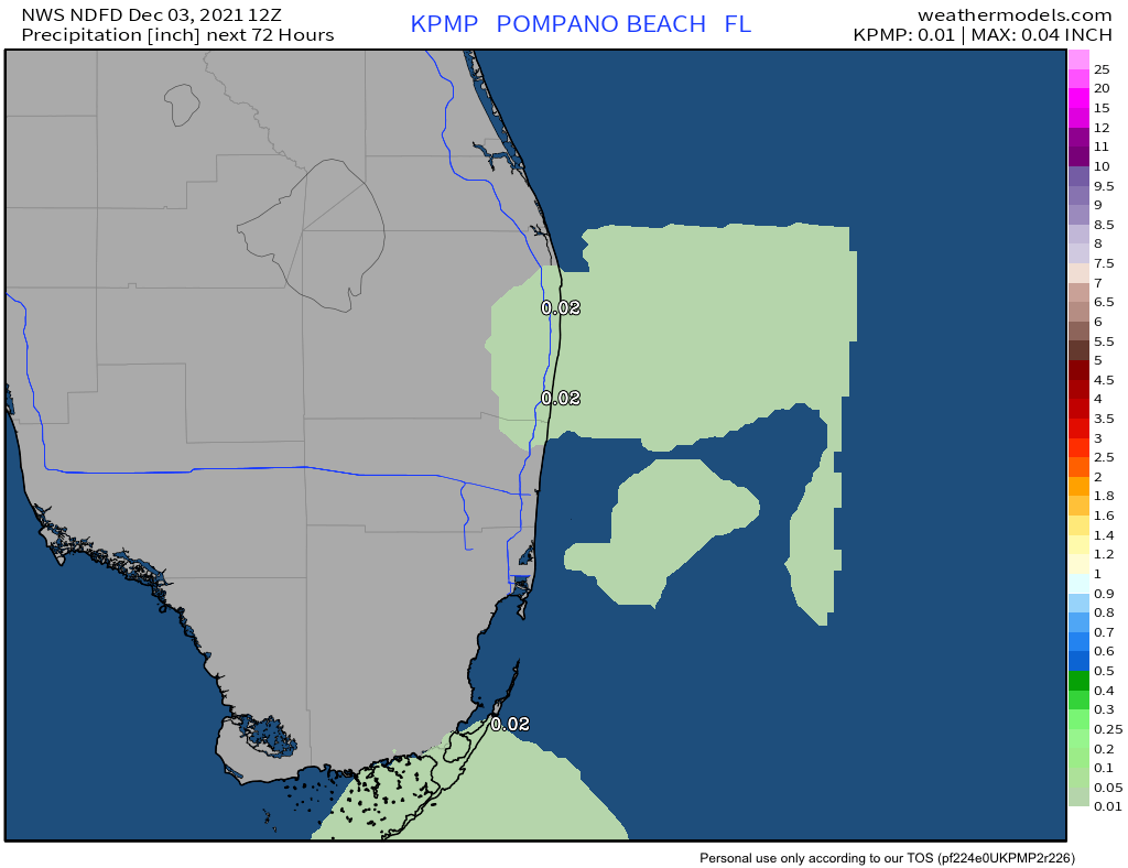
Minimal rain, if any at all this week. No expecting any rain through Tuesday. Starting on Wednesday there could be a couple showers in the area. That risk remains for the rest of the week.
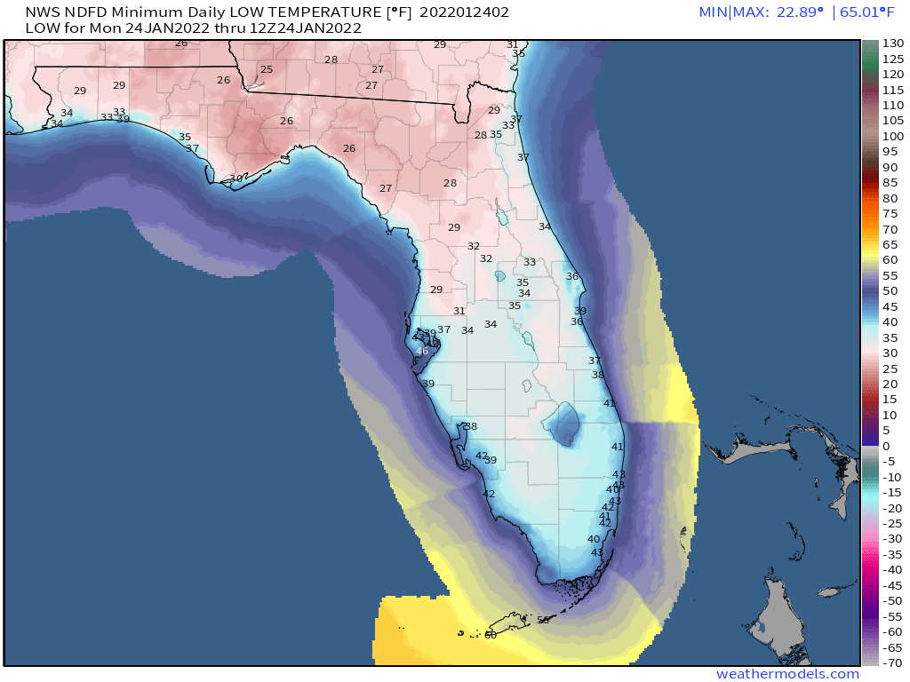
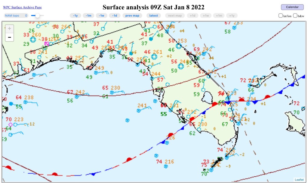
Looking back on today, here are the highs and lows from today (Location/High/Low/Precipitation):
FLL : Fort Lauderdale Intl : 63 / 40 / 0.00
FXE : Fort Lauderdale Exec : 62 / 40 / 0.00
HST : Homestead AFB : 60 / 40 / 0.00
MIA : Miami : 63 / 42 / 0.00
APF : Naples : 61 / 37 / 0.00
OPF : Opa-locka : 62 / 41 / 0.00
HWO : Pembroke Pines : 62 / 39 / 0.00
PMP : Pompano Beach : 62 / 40 / 0.00
TMB : West Kendall-Tamiami : 63 / 39 / 0.00
PBI : West Palm Beach : 61 / 37 / 0.00
Have a great week!