8/29/22 – Decrease in Shower Activity Tomorrow, a Slight Increase in Temps

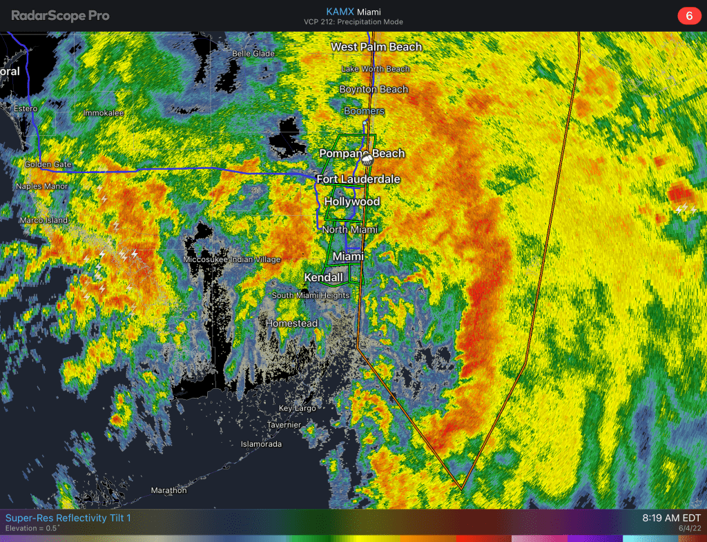
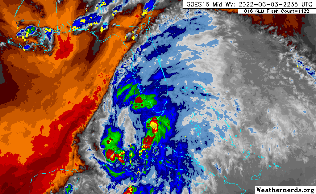
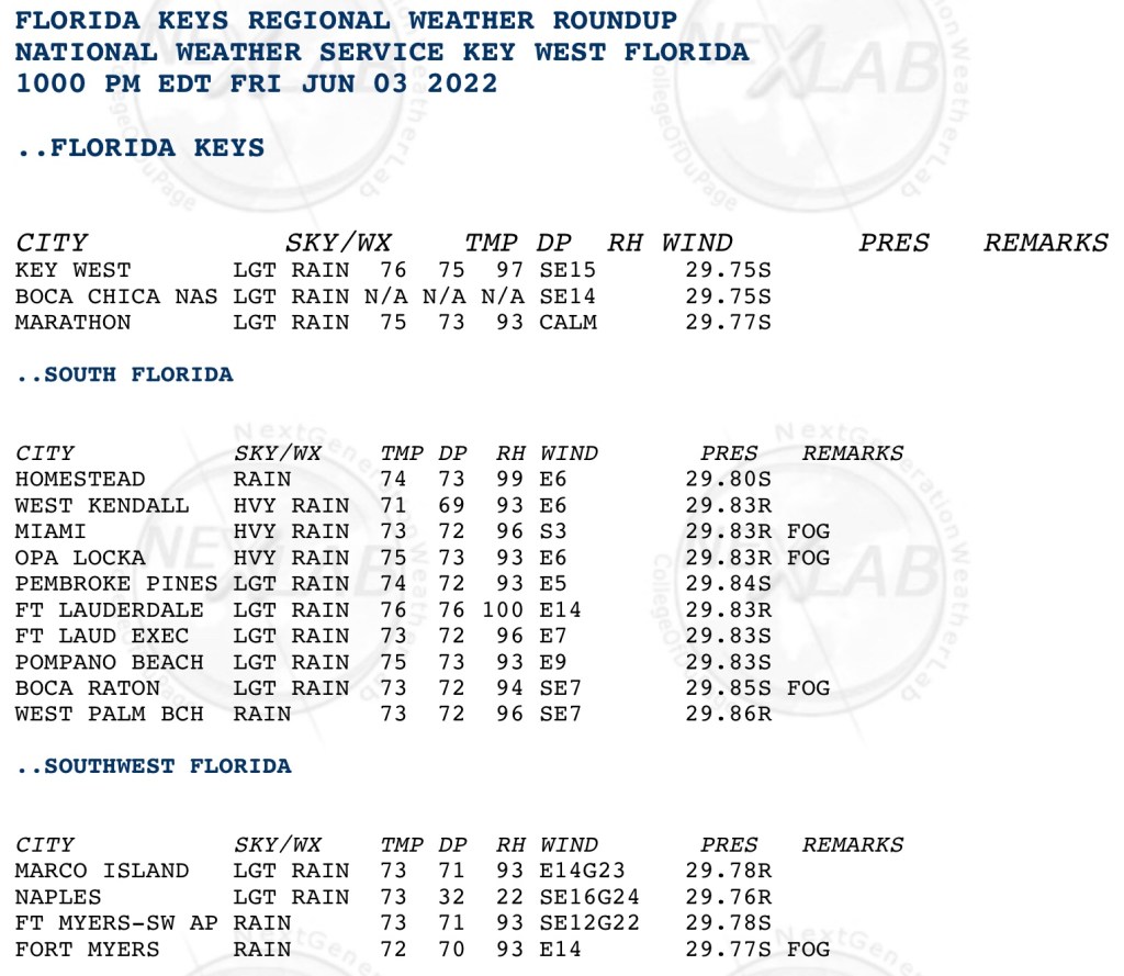
Tomorrow we will begin to see a slight drop in our rain chances while we warm up a couple of degrees. The showers we had this morning did produce some gusty winds including a gust to 44mph at Hillsboro Inlet at 7:03am. This activity also helped cool all the reporting stations in the area below 80°. It was refreshing.

Today’s high/low/rainfall.

For the rest of the week we will see the dip in rain chances tomorrow and then bump back up to what we typically see this time of the year from Wednesday through the holiday weekend. Highs just above 90° and lows around 80°.

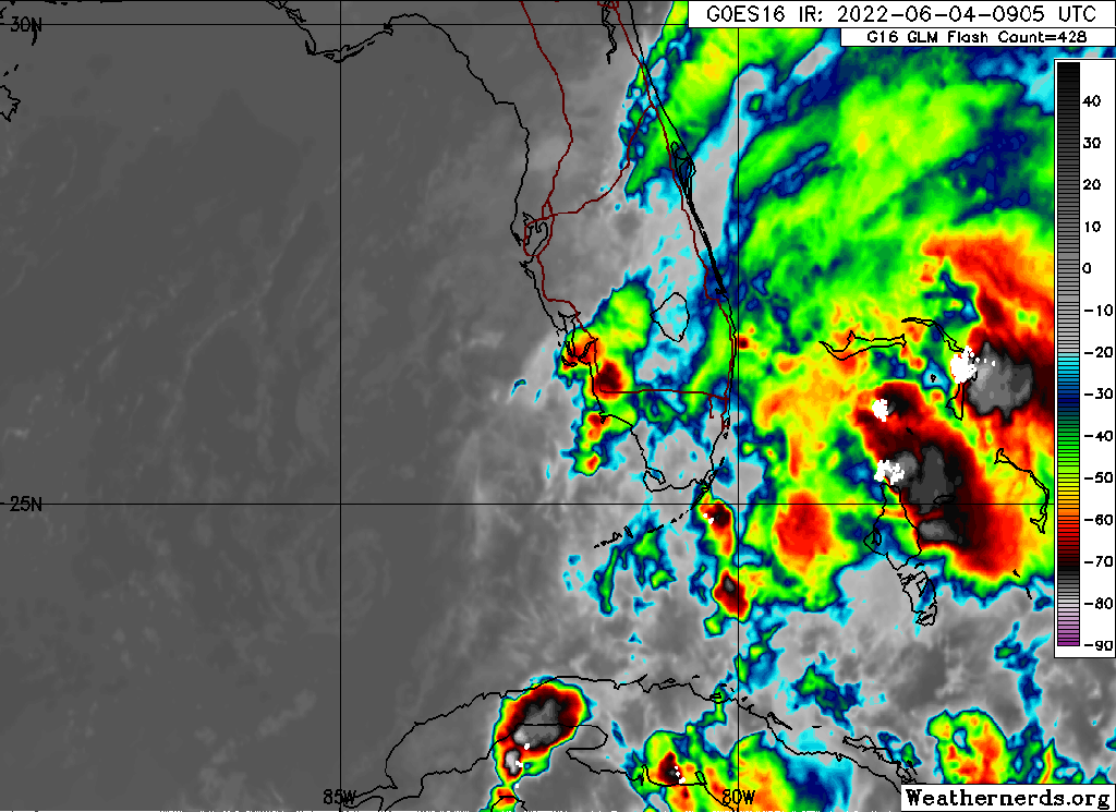
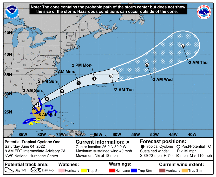
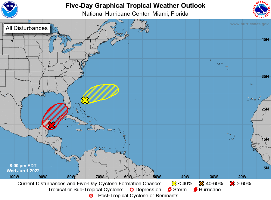
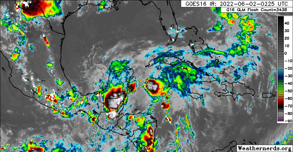
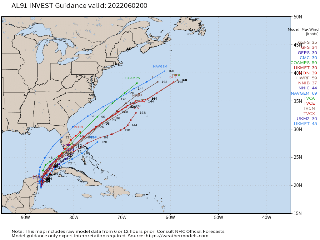
The tropical wave we mentioned yesterday, 91L, now has a high chance of development and we could see a depression form before the end of the week. It is still early to say where and if the storm will develop.

8pm Tropical Weather Outlook with 91L in red.

Further updates tomorrow.

Advertisement

6/4/22 830am – Tropical Storm Warning and Flood Watch Remain in Effect

A night of steady rain which at times was heavy will continue into our Saturday. As PTC1 approaches the southwest Florida coast we will see some of the activity pickup. Rain will subside late this afternoon then into the evening as PTC1 moves off of Florida into the Atlantic.

Miami radar as of 819am. The last round of showers now approaching the west coast of the state.
Satellite loop from the past three hours. Notice lack of activity behind the system.
Latest information on PTC1 as of 8am.

I will have more updates on Twitter today, feel free to share any pictures you have of the storm today.

6/3/22 1015pm – Tropical Storm Warning and Flood Watch

Not much change to the forecast and expectations overnight and into Saturday. The system does not have a closed circulation, hence it is still Potential Tropical Cyclone 1 (PTC1) Here is the latest forecast and the Tropical Storm Warnings in effect.

8pm Advisory for PTC1.

The system is not well organized with all of the convection east of the broad low pressure center. This is easier seen on water vapor imagery.

Water vapor loop on PTC1.

Looking closely at the loop above, it appears the activity is waning somewhat, not a sign of intensification. Rainfall through the weekend is still five plus inches for many areas.

Rainfall forecast through the weekend, most of this will fall between now and Saturday night.

Latest tropical models remain very consistency with taking the center over Lake Okeechobee. With this system, it is not about the system but the area of rain to the east of it.

Lastly for now, here are 10pm observations from across south Florida and the Keys. Most sites are reporting rain to heavy rain, but the winds are not significant at this time.

10pm observations across south Florida.

I will have periodic updates on Twitter. Please share any pictures or observations you have as we go through the night and Saturday.

6/1/22 Hurricane Season Starts with Watching the Gulf

Currently a band of showers and thunderstorms have setup over north Broward. This is a sample of what is to come in the Friday afternoon to Sunday morning time frame.

The National Hurricane Center is monitoring some of the remnants of Hurricane Agetha that came ashore Mexico earlier this week. Currently the area in red has an 80% chance of becoming a tropical system. If it gets a name, it will be Alex.

June 1, 8pm Tropical Weather Outlook
Satellite image at 1025pm EDT.

The future of the system path is fairly certain to come towards Florida then into the Bahama. This will likely produce three to five inches of rain in most areas with locally heavier amounts.

The latest guidance suggest that the further south the system goes the faster the rain will move in and depart. A track closer to the Naples area will produce more rain. Air Force recon will investigate the area starting tomorrow, giving models more data and more reliable output. The 8pm models are below.

June 1, 8pm. Model runs.

Tomorrow should give us more clarity on what to expect this Friday and into the weekend. Please stop by then.