
With the 11am advisory Tropical Storm Elsa is located about 50 miles north of Kingston Jamaica moving WNW at 13mph. Maximum winds are estimated at 60mph.
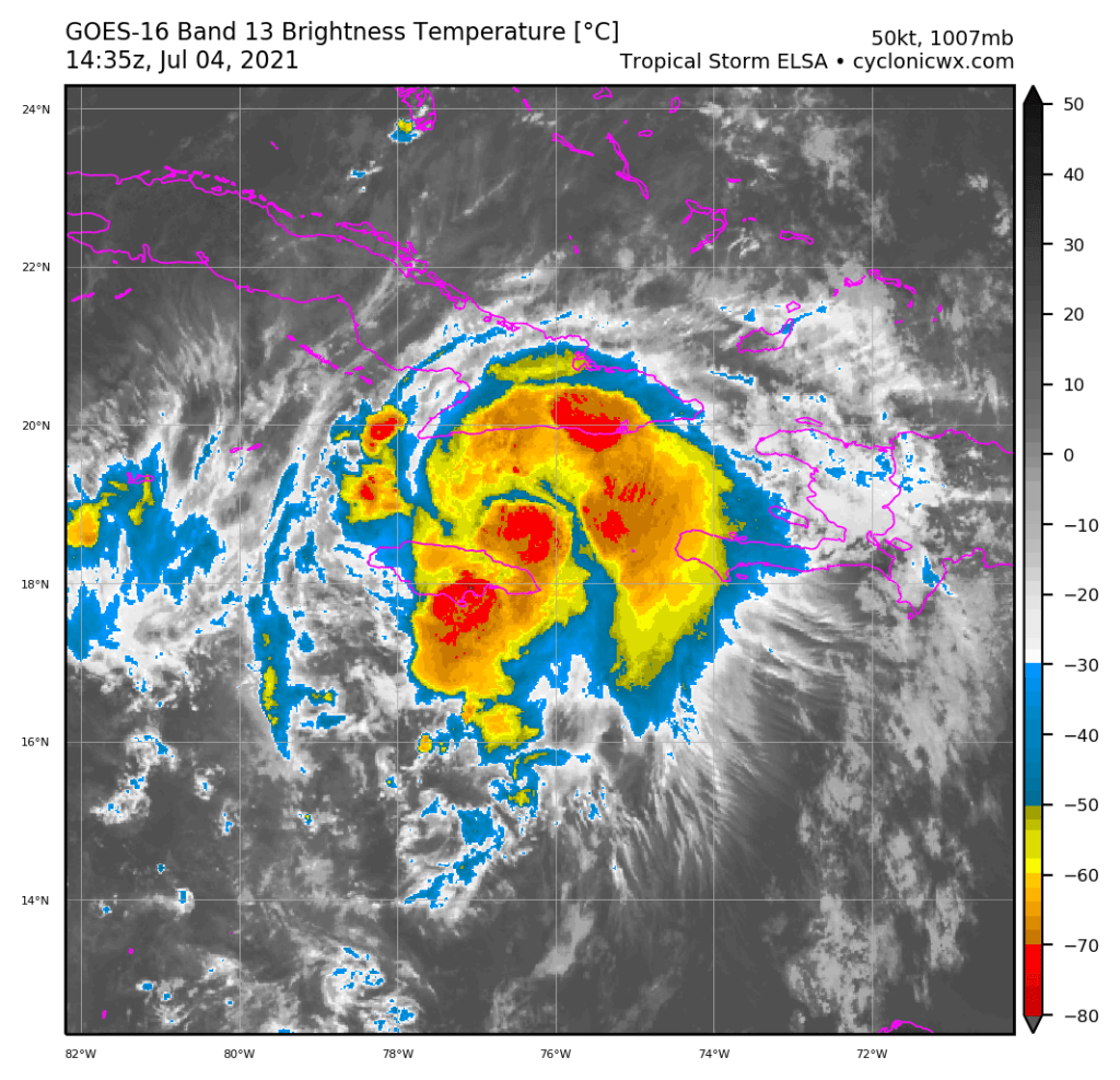
Reconassisnce aircraft has been investigating Elsa this morning and have found it somewhat disorganized with a higher pressure than what is normally observed in storms with this strength. Also the storm is not well aligned with westerly shear separating the low level circulation from the mid and upper levels.

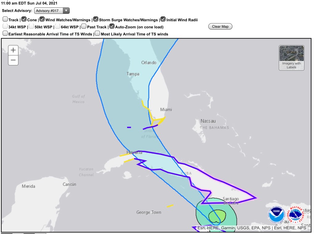
The latest forecast and keeps all of southeast Florida out of the cone but we can still expect effects late Monday going through Tuesday.
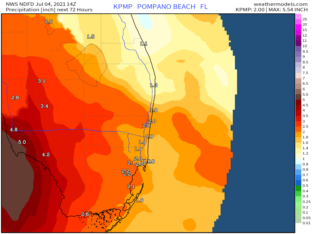
Rainfall of one to four inches will be possible in and around Pompano with gusty winds and a slight possibility if isolated tornadoes. Latest rainfall forecast for the next three days shows all areas expecting more than an inch of rain.
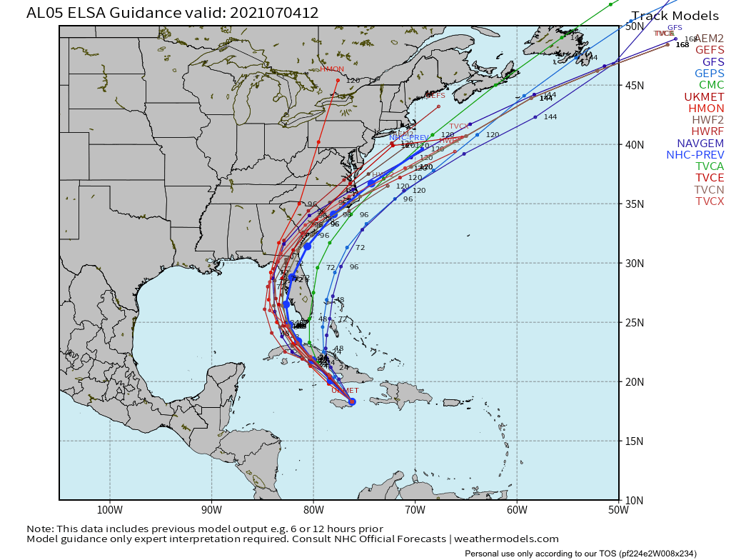
Latest tropical models remain consistent with the track of the storm and line up with the latest official NHC forecast.
More immediately, we can expect hot weather for our Fourth of July with isolated showers possible this afternoon, highs around 92°F with dew points this afternoon around 76°F.
Have a safe holiday, an update will be up early this evening.
Discover more from Pompano Weather
Subscribe to get the latest posts sent to your email.
