
Eyes are on Tropical Depression 9 that was upgraded this morning at 5 AM with most of Florida in the cone. A few items to keep in mind:
- Too early to say that Florida will be affected
- Too early to say what impacts this system will have
- Use today and the weekend to get supplies you do not have and make plans IF the system were to go this way.
- Finally, stay calm. The forecasts will become more refined as we go through the weekend. Always check in with the National Hurricane Center site for official information.

For today and the weekend: today will be mostly dry and typically warm with a high of 90°. Showers and thunderstorms return tomorrow and Sunday with highs of 90° and lows of 79°.
Beyond Sunday our weather will be dependent of the track and intensification of TD9. It is very likely that TD9 will become a Tropical Storm later today or tomorrow.

Models are clustered showing agreement in the flyer track, but this may shift some due to the evolving storm structure and where the actul center forms.

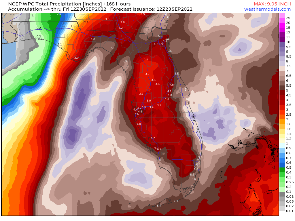
As of now, one thing we will likely see is rain. Regardless of where the center goes, most of Florida will get rain. The latest seven day rainfall forecast indicates plenty of rain for all of south and central Florida.
I will have an update later this evening. Follow on Twitter for updates at @PompanoWeather
Discover more from Pompano Weather
Subscribe to get the latest posts sent to your email.
